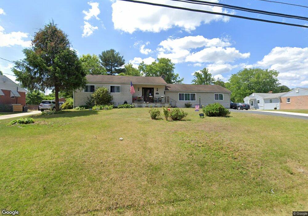
5319 Forge Rd White Marsh, MD 21162
Estimated Value: $353,000 - $447,000
Studio
1
Bath
1,628
Sq Ft
$245/Sq Ft
Est. Value
About This Home
This home is located at 5319 Forge Rd, White Marsh, MD 21162 and is currently estimated at $398,611, approximately $244 per square foot. 5319 Forge Rd is a home located in Baltimore County with nearby schools including Honeygo Elementary School, Perry Hall Middle School, and Perry Hall High School.
Ownership History
Date
Name
Owned For
Owner Type
Purchase Details
Closed on
Jan 29, 2003
Sold by
Humphreys Lee B
Bought by
Dietz Michael A and Dietz Amanda L
Current Estimated Value
Purchase Details
Closed on
Oct 12, 1994
Sold by
Danoff Gerald
Bought by
Humphreys Lee B
Purchase Details
Closed on
Jan 7, 1980
Sold by
Stegman James G
Bought by
Blackhurst Robert H
Create a Home Valuation Report for This Property
The Home Valuation Report is an in-depth analysis detailing your home's value as well as a comparison with similar homes in the area
Home Values in the Area
Average Home Value in this Area
Purchase History
We collect this data history from publicly available records. To have your information removed, we recommend requesting removal directly through your county’s website.
| Date | Buyer | Sale Price | Title Company |
|---|---|---|---|
| Dietz Michael A | $175,000 | -- | |
| Humphreys Lee B | $80,000 | -- | |
| Blackhurst Robert H | $66,500 | -- |
Source: Public Records
Tax History
| Year | Tax Paid | Tax Assessment Tax Assessment Total Assessment is a certain percentage of the fair market value that is determined by local assessors to be the total taxable value of land and additions on the property. | Land | Improvement |
|---|---|---|---|---|
| 2025 | $5,111 | $281,433 | -- | -- |
| 2024 | $5,111 | $266,067 | $0 | $0 |
| 2023 | $2,231 | $250,700 | $87,500 | $163,200 |
| 2022 | $4,281 | $247,767 | $0 | $0 |
| 2021 | $4,526 | $244,833 | $0 | $0 |
| 2020 | $4,526 | $241,900 | $87,500 | $154,400 |
| 2019 | $4,029 | $237,833 | $0 | $0 |
| 2018 | $4,026 | $233,767 | $0 | $0 |
| 2017 | $3,933 | $229,700 | $0 | $0 |
| 2016 | $3,256 | $228,067 | $0 | $0 |
| 2015 | $3,256 | $226,433 | $0 | $0 |
| 2014 | $3,256 | $224,800 | $0 | $0 |
Source: Public Records
Map
Nearby Homes
- 5404 Bush St
- 9710 Gaylord St
- 0 New Forge Rd Unit MDBC2153490
- 5612 Allender Rd
- 11540 Philadelphia Rd Unit 5
- 5113 Robins Perch Ln
- 9814 Kerries Ct
- 5703 Allender Rd
- 9424 Georgia Belle Dr
- 5662 Gunpowder Rd
- 11550 Autumn Terrace Dr
- 9800 Anvil Ct
- 11604 Jerome Ave
- 11715 Jerome Ave
- 5106 Braeburn Way
- 11503 Jerome Ave
- 5822 Dillon John Ct
- 9307 Georgia Belle Dr
- 9310 Glen Vista Rd
- 5113 Tiller Ct
- 5318 Bangert St
- 5400 Bangert St
- 5316 Bangert St
- 5321 Forge Rd
- 5323 Forge Rd
- 5402 Bangert St
- 5319 Bangert St
- 5317 Forge Rd
- 5401 Forge Rd
- 5405 Bangert St
- 5315 Bangert St
- 5312 Bangert St
- 5411 Bangert St
- 5315 Forge Rd
- 5404 Bangert St
- 5403 Forge Rd
- 5324 Forge Rd
- 5310 Bangert St
- 5313 Forge Rd
- 5311 Bangert St
Your Personal Tour Guide
Ask me questions while you tour the home.