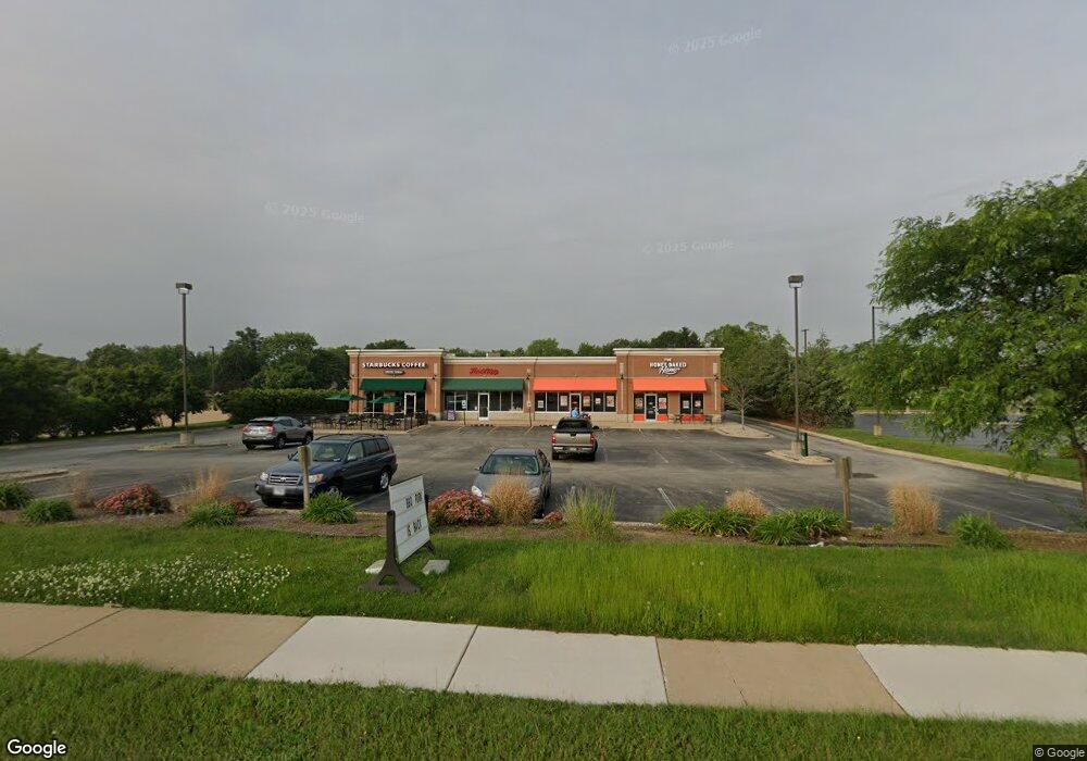
532-538 Main St NW Bourbonnais, IL 60914
Estimated Value: $2,657,091
--
Bed
--
Bath
7,064
Sq Ft
$376/Sq Ft
Est. Value
About This Home
This home is located at 532-538 Main St NW, Bourbonnais, IL 60914 and is currently priced at $2,657,091, approximately $376 per square foot. 532-538 Main St NW is a home located in Kankakee County with nearby schools including Alan B. Shepard Elementary School, Liberty Intermediate School, and Bourbonnais Upper Grade Center.
Ownership History
Date
Name
Owned For
Owner Type
Purchase Details
Closed on
Aug 29, 2024
Sold by
Meyerstein Trust and Meyerstein Arnold H
Bought by
Quiamco Perla Alvarez
Current Estimated Value
Home Financials for this Owner
Home Financials are based on the most recent Mortgage that was taken out on this home.
Original Mortgage
$2,500,000
Interest Rate
6.47%
Mortgage Type
Construction
Purchase Details
Closed on
Apr 5, 2013
Sold by
Reedy David C
Bought by
Rnnb Llc
Create a Home Valuation Report for This Property
The Home Valuation Report is an in-depth analysis detailing your home's value as well as a comparison with similar homes in the area
Home Values in the Area
Average Home Value in this Area
Purchase History
| Date | Buyer | Sale Price | Title Company |
|---|---|---|---|
| Quiamco Perla Alvarez | $2,050,000 | Fidelity National Title | |
| Rnnb Llc | -- | Kankakee Cnty Title & Tr |
Source: Public Records
Mortgage History
| Date | Status | Borrower | Loan Amount |
|---|---|---|---|
| Closed | Quiamco Perla Alvarez | $2,500,000 |
Source: Public Records
Tax History Compared to Growth
Tax History
| Year | Tax Paid | Tax Assessment Tax Assessment Total Assessment is a certain percentage of the fair market value that is determined by local assessors to be the total taxable value of land and additions on the property. | Land | Improvement |
|---|---|---|---|---|
| 2024 | $19,649 | $232,935 | $73,818 | $159,117 |
| 2023 | $19,236 | $232,935 | $73,818 | $159,117 |
| 2022 | $20,049 | $232,935 | $73,818 | $159,117 |
| 2021 | $17,082 | $197,207 | $66,205 | $131,002 |
| 2020 | $17,423 | $197,207 | $66,205 | $131,002 |
| 2019 | $17,611 | $197,207 | $66,205 | $131,002 |
| 2018 | $17,666 | $197,207 | $66,205 | $131,002 |
| 2017 | $17,771 | $197,207 | $66,205 | $131,002 |
| 2016 | $17,754 | $197,207 | $66,205 | $131,002 |
| 2015 | $17,979 | $197,207 | $66,205 | $131,002 |
| 2014 | $14,401 | $164,457 | $66,205 | $98,252 |
| 2013 | -- | $164,457 | $66,205 | $98,252 |
Source: Public Records
Map
Nearby Homes
- 213 Bernard St
- Lot 5/5A Almar Pkwy
- 635 Independence Dr
- 891 Exeter Turn Unit E1
- 850 Exeter Turn
- lot Briarcliff Ln
- 830 W River St
- 5 Inverness Dr
- 271 Toni St
- 813 Canterbury Ln
- 1269 Tower Ct
- 4776 - 0 Illinois 102
- 370 Windermere Way
- 482 S Rivard St
- 631 Concord Place
- 1172 Blaye
- 1365 Braemar Ct
- 7 Bristol Green
- 404 E Grand Dr
- 650 Justin Ct
- 580 Main St NW
- 415 Main St NW
- 647 Woodstock Ln
- 659 Woodstock Ln
- 635 Woodstock Ln
- 671 Woodstock Ln
- 716 Stratford Dr E Unit 718
- 597 Oakrun Dr
- 718 Stratford Dr E
- 683 Woodstock Ln
- 642 Woodstock Ln
- 666 Woodstock Ln
- 597 Oak Run Dr
- 628 Woodstock Ln
- 713 Woodstock Ln
- 744 Stratford Dr E
- 668 Woodstock Ln
- 551 Main St NW
- 421 Brown Blvd
- 455 Main St NW