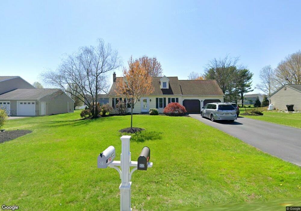
532 Airport Rd New Holland, PA 17557
Estimated Value: $379,000 - $466,000
3
Beds
2
Baths
1,968
Sq Ft
$213/Sq Ft
Est. Value
About This Home
This home is located at 532 Airport Rd, New Holland, PA 17557 and is currently estimated at $419,503, approximately $213 per square foot. 532 Airport Rd is a home located in Lancaster County with nearby schools including Garden Spot Middle School, Garden Spot Senior High School, and Mill Creek Valley Parochial School.
Create a Home Valuation Report for This Property
The Home Valuation Report is an in-depth analysis detailing your home's value as well as a comparison with similar homes in the area
Home Values in the Area
Average Home Value in this Area
Tax History Compared to Growth
Tax History
| Year | Tax Paid | Tax Assessment Tax Assessment Total Assessment is a certain percentage of the fair market value that is determined by local assessors to be the total taxable value of land and additions on the property. | Land | Improvement |
|---|---|---|---|---|
| 2025 | $3,606 | $209,800 | $61,400 | $148,400 |
| 2024 | $3,606 | $209,800 | $61,400 | $148,400 |
| 2023 | $3,552 | $209,800 | $61,400 | $148,400 |
| 2022 | $3,564 | $212,900 | $61,400 | $151,500 |
| 2021 | $3,504 | $212,900 | $61,400 | $151,500 |
| 2020 | $3,504 | $212,900 | $61,400 | $151,500 |
| 2019 | $3,465 | $212,900 | $61,400 | $151,500 |
| 2018 | $5,146 | $212,900 | $61,400 | $151,500 |
| 2017 | $3,398 | $169,700 | $32,800 | $136,900 |
| 2016 | $3,398 | $169,700 | $32,800 | $136,900 |
| 2015 | $846 | $169,700 | $32,800 | $136,900 |
| 2014 | $2,381 | $169,700 | $32,800 | $136,900 |
Source: Public Records
Map
Nearby Homes
- 13 Amber Cir
- 529 Ranck Rd Unit 1
- 529 Ranck Rd Unit 2
- 529 Ranck Rd Unit 3
- 529 Ranck Rd Unit 4
- 529 Ranck Rd Unit 5
- 529 Ranck Rd Unit 9
- 529 Ranck Rd Unit 6
- 529 Ranck Rd Unit 8
- 529 Ranck Rd Unit 10
- 385 Valley View Dr
- 391 E Jackson St
- 406 Brimmer Ave
- 20 N Kinzer Ave
- 148 E Broad St
- 227 Locust St
- 144 W Conestoga St
- 259 Hill Rd
- 80 Diller Ave Unit 9
- 210 Musser Rd