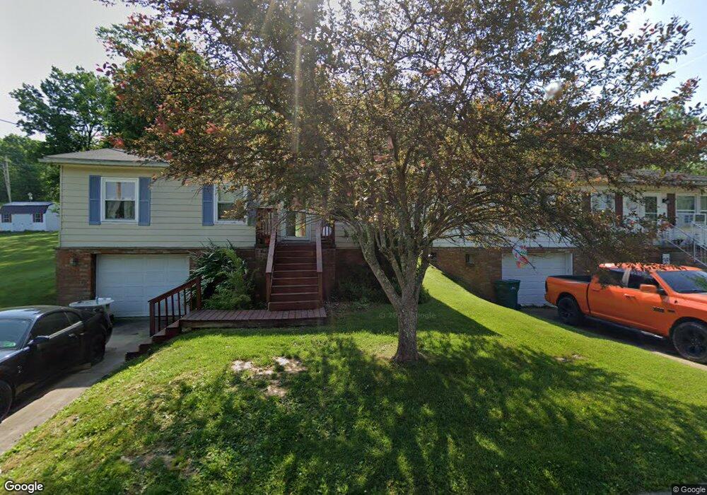
532 Broadway Ave Bridgeport, WV 26330
Estimated Value: $193,000 - $218,000
3
Beds
1
Bath
1,114
Sq Ft
$183/Sq Ft
Est. Value
About This Home
This home is located at 532 Broadway Ave, Bridgeport, WV 26330 and is currently estimated at $203,951, approximately $183 per square foot. 532 Broadway Ave is a home located in Harrison County with nearby schools including Heritage Christian School and Dollie Hilll Christian Academy.
Ownership History
Date
Name
Owned For
Owner Type
Purchase Details
Closed on
May 10, 2018
Sold by
Pitsenbarger Shanon R
Bought by
Ashcraft Ii Jefferson L and Loss Kelsea Nicole
Current Estimated Value
Home Financials for this Owner
Home Financials are based on the most recent Mortgage that was taken out on this home.
Original Mortgage
$5,000
Outstanding Balance
$2,908
Interest Rate
4.4%
Mortgage Type
New Conventional
Estimated Equity
$201,043
Create a Home Valuation Report for This Property
The Home Valuation Report is an in-depth analysis detailing your home's value as well as a comparison with similar homes in the area
Home Values in the Area
Average Home Value in this Area
Purchase History
| Date | Buyer | Sale Price | Title Company |
|---|---|---|---|
| Ashcraft Ii Jefferson L | $138,000 | None Available |
Source: Public Records
Mortgage History
| Date | Status | Borrower | Loan Amount |
|---|---|---|---|
| Open | Ashcraft Ii Jefferson L | $5,000 | |
| Open | Ashcraft Ii Jefferson L | $125,325 |
Source: Public Records
Tax History Compared to Growth
Tax History
| Year | Tax Paid | Tax Assessment Tax Assessment Total Assessment is a certain percentage of the fair market value that is determined by local assessors to be the total taxable value of land and additions on the property. | Land | Improvement |
|---|---|---|---|---|
| 2025 | $1,260 | $82,680 | $21,000 | $61,680 |
| 2024 | $1,260 | $78,660 | $21,000 | $57,660 |
| 2023 | $1,184 | $73,920 | $21,000 | $52,920 |
| 2022 | $1,129 | $73,440 | $21,000 | $52,440 |
| 2021 | $1,117 | $73,320 | $21,000 | $52,320 |
| 2020 | $1,097 | $72,600 | $21,000 | $51,600 |
| 2019 | $1,103 | $72,960 | $21,000 | $51,960 |
| 2018 | $2,119 | $70,320 | $21,000 | $49,320 |
| 2017 | $1,933 | $64,380 | $21,000 | $43,380 |
| 2016 | $1,840 | $61,860 | $18,780 | $43,080 |
| 2015 | $1,813 | $60,000 | $18,000 | $42,000 |
| 2014 | $1,762 | $58,380 | $16,500 | $41,880 |
Source: Public Records
Map
Nearby Homes
- Lot 6 HC Industrial Park
- 103 Willow Oak Dr
- 142 Willow Oak Dr
- 109 Willow Oak Dr
- 144 Willow Oak Dr
- 141 Willow Oak Dr
- 140 Willow Oak Dr
- 101 Willow Oak Dr
- Lot 1 the Vale Rd
- TBD Johnson Ave
- 632 Lawman Ave
- 406 Willis Ave
- 221 Broadway Ave
- 443 Lawman Ave
- 640 Pennsylvania Ave
- 220 Meadow View Dr
- 111 Circle Dr
- 250 Del Dew Dr
- Bristol Plan at Worthington Village
- Jamestown Plan at Worthington Village
- 534 Broadway Ave
- 520 Broadway Ave
- 538 Broadway Ave
- 522 Broadway Ave
- 126 Woodside Ln
- 202 Woodside Ln
- 216 Woodside Ln
- 231 Woodside Ln
- 121 Woodside Ln
- 205 Woodside Ln
- 524 Broadway Ave
- 525 Broadway Ave
- 521 Broadway Ave
- 516 Broadway Ave Unit A
- 511 Broadway Ave
- 516 E Olive St
- 605 Broadway Ave
- 505 Benedum Dr
- 507 Benedum Dr
- 504 Broadway Ave