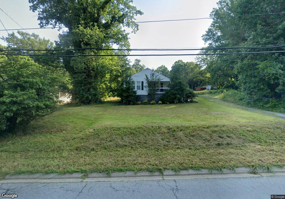
532 Gentry Memorial Hwy Easley, SC 29640
Estimated Value: $152,000 - $208,000
2
Beds
1
Bath
1,078
Sq Ft
$167/Sq Ft
Est. Value
About This Home
This home is located at 532 Gentry Memorial Hwy, Easley, SC 29640 and is currently estimated at $180,357, approximately $167 per square foot. 532 Gentry Memorial Hwy is a home located in Pickens County with nearby schools including McKissick Academy of Science & Technology, Richard H. Gettys Middle School, and Easley High School.
Ownership History
Date
Name
Owned For
Owner Type
Purchase Details
Closed on
Feb 29, 2016
Sold by
Summitt Properties Llc
Bought by
Crenshaw Nancy and Crenshaw Brian
Current Estimated Value
Purchase Details
Closed on
Apr 8, 2008
Sold by
Duncan Jeffrey S and Duncan Kamie W
Bought by
Summitt Properties Llc
Home Financials for this Owner
Home Financials are based on the most recent Mortgage that was taken out on this home.
Original Mortgage
$100,000
Interest Rate
6.08%
Mortgage Type
Purchase Money Mortgage
Purchase Details
Closed on
Dec 28, 2007
Sold by
West Charles T
Bought by
Duncan Jeffery S and Duncan Kamie W
Purchase Details
Closed on
Dec 26, 2007
Sold by
Wise Laura W
Bought by
Duncan Jeffery S and Duncan Kamie W
Purchase Details
Closed on
Dec 22, 2007
Sold by
West Walter D
Bought by
Duncan Jeffery S and Duncan Kamie W
Create a Home Valuation Report for This Property
The Home Valuation Report is an in-depth analysis detailing your home's value as well as a comparison with similar homes in the area
Home Values in the Area
Average Home Value in this Area
Purchase History
| Date | Buyer | Sale Price | Title Company |
|---|---|---|---|
| Crenshaw Nancy | $92,000 | None Available | |
| Summitt Properties Llc | $50,000 | -- | |
| Duncan Jeffery S | $11,103 | Attorney | |
| Duncan Jeffery S | $11,103 | Attorney | |
| Duncan Jeffery S | $11,103 | Attorney | |
| Duncan Jeffery S | $11,103 | Attorney |
Source: Public Records
Mortgage History
| Date | Status | Borrower | Loan Amount |
|---|---|---|---|
| Previous Owner | Summitt Properties Llc | $100,000 |
Source: Public Records
Tax History Compared to Growth
Tax History
| Year | Tax Paid | Tax Assessment Tax Assessment Total Assessment is a certain percentage of the fair market value that is determined by local assessors to be the total taxable value of land and additions on the property. | Land | Improvement |
|---|---|---|---|---|
| 2024 | $1,394 | $5,800 | $720 | $5,080 |
| 2023 | $1,394 | $5,800 | $720 | $5,080 |
| 2022 | $1,399 | $5,800 | $720 | $5,080 |
| 2021 | $1,363 | $5,800 | $720 | $5,080 |
| 2020 | $1,301 | $5,800 | $720 | $5,080 |
| 2019 | $1,309 | $5,800 | $720 | $5,080 |
| 2018 | $1,300 | $5,520 | $720 | $4,800 |
| 2017 | $1,289 | $5,520 | $720 | $4,800 |
| 2015 | $950 | $3,960 | $0 | $0 |
| 2008 | -- | $3,080 | $660 | $2,420 |
Source: Public Records
Map
Nearby Homes
- 315 Gentry Memorial Hwy
- 206 Hidden Trail Hidden Trail
- LOT 3 Old Craig Land Dr
- LOT 2 Old Craig Land Dr
- LOT 1 Dr
- 107 Breanna Ct
- 301 Bannister St
- 145 Margaret St
- 409 Mulberry Rd
- 102 Highland Rd
- 113 Ryan St
- 100 Carlissa Ct
- 00 Mountain Top Trail
- 112 Wilbur St
- 108 Maryland Ave
- 110 Wilbur St
- 107 Cobb St
- 306 Rice Rd
- 110 Nottingham Ln
- 105 Linden Hall Ln
- 534 Gentry Memorial Hwy
- 538 Gentry Memorial Hwy
- 113 Waynes Dr
- 114 Arrowridge Dr
- 540 Gentry Memorial Hwy
- 112 Arrowridge Dr
- 121 Waynes Dr
- 121 & 113 Waynes
- 539 Gentry Memorial Hwy
- 112 Mauldin Rd
- 120 Mauldin Rd
- 107 Mauldin Rd
- 103 Arrowridge Dr
- 124 Mauldin Rd
- 111 Mauldin Rd
- 106 Arrowridge Dr
- 128 Mauldin Rd
- 215 Ridgeland Cir
- 426 Gentry Memorial Hwy
- 619 Gentry Memorial Hwy