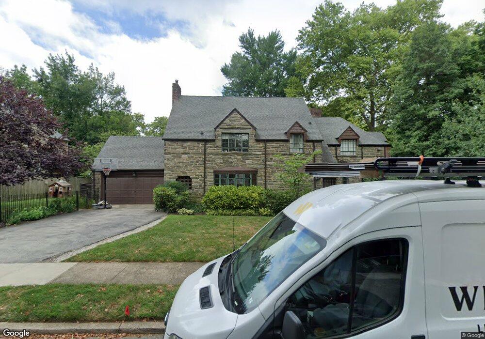
532 Howe Rd Merion Station, PA 19066
Estimated Value: $1,331,000 - $1,408,000
4
Beds
4
Baths
3,953
Sq Ft
$347/Sq Ft
Est. Value
About This Home
This home is located at 532 Howe Rd, Merion Station, PA 19066 and is currently estimated at $1,370,409, approximately $346 per square foot. 532 Howe Rd is a home located in Montgomery County with nearby schools including Cynwyd School, Bala-Cynwyd Middle School, and Lower Merion High School.
Ownership History
Date
Name
Owned For
Owner Type
Purchase Details
Closed on
Aug 9, 2021
Sold by
Oconnor James J and Oconnor Mary Marcia
Bought by
Lester Benjamin R and Lester Amy Roslow
Current Estimated Value
Home Financials for this Owner
Home Financials are based on the most recent Mortgage that was taken out on this home.
Original Mortgage
$864,000
Outstanding Balance
$784,460
Interest Rate
2.8%
Mortgage Type
New Conventional
Estimated Equity
$585,949
Purchase Details
Closed on
Jan 1, 1958
Bought by
Oconnor James J and Oconnor Mary M
Create a Home Valuation Report for This Property
The Home Valuation Report is an in-depth analysis detailing your home's value as well as a comparison with similar homes in the area
Home Values in the Area
Average Home Value in this Area
Purchase History
| Date | Buyer | Sale Price | Title Company |
|---|---|---|---|
| Lester Benjamin R | $960,000 | None Available | |
| Oconnor James J | -- | -- |
Source: Public Records
Mortgage History
| Date | Status | Borrower | Loan Amount |
|---|---|---|---|
| Open | Lester Benjamin R | $864,000 |
Source: Public Records
Tax History Compared to Growth
Tax History
| Year | Tax Paid | Tax Assessment Tax Assessment Total Assessment is a certain percentage of the fair market value that is determined by local assessors to be the total taxable value of land and additions on the property. | Land | Improvement |
|---|---|---|---|---|
| 2025 | $18,286 | $437,840 | -- | -- |
| 2024 | $18,286 | $437,840 | -- | -- |
| 2023 | $16,122 | $402,840 | $153,290 | $249,550 |
| 2022 | $15,823 | $402,840 | $153,290 | $249,550 |
| 2021 | $15,463 | $402,840 | $153,290 | $249,550 |
| 2020 | $15,085 | $402,840 | $153,290 | $249,550 |
| 2019 | $14,819 | $402,840 | $153,290 | $249,550 |
| 2018 | $14,819 | $402,840 | $153,290 | $249,550 |
| 2017 | $14,275 | $402,840 | $153,290 | $249,550 |
| 2016 | $14,117 | $402,840 | $153,290 | $249,550 |
| 2015 | $13,163 | $402,840 | $153,290 | $249,550 |
| 2014 | $13,163 | $402,840 | $153,290 | $249,550 |
Source: Public Records
Map
Nearby Homes
- 650 Revere Rd
- 508 Lafayette Rd
- 51 Academy Rd
- 534 Ott Rd
- 623 Broad Acres Rd
- 19 Rock Hill Rd Unit 7-D
- 275 Brookway Rd
- 717 Stradone Rd
- 346 Winding Way
- 603 Old Gulph Rd
- 345 Valley Rd
- 404 Merwyn Rd
- 101 Montgomery Ave Unit A-5
- 216 N Narberth Ave
- 1140 Greentree Ln
- 42 Madison Ave Unit 272
- 116 E Princeton Rd
- 354 Trevor Ln
- 211 Bryn Mawr Ave
- 135 Cornell Rd