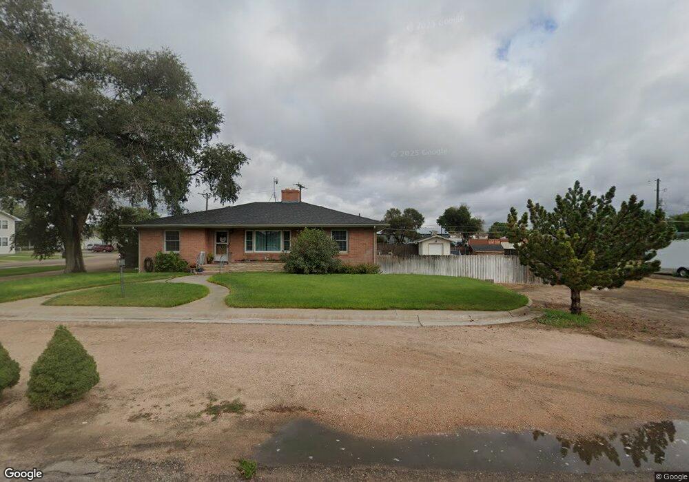
532 Kochia Way Sterling, CO 80751
Estimated Value: $335,000 - $388,936
3
Beds
3
Baths
3,252
Sq Ft
$114/Sq Ft
Est. Value
About This Home
This home is located at 532 Kochia Way, Sterling, CO 80751 and is currently estimated at $370,984, approximately $114 per square foot. 532 Kochia Way is a home located in Logan County with nearby schools including Ayres Elementary School, Campbell Elementary School, and Sterling Middle School.
Ownership History
Date
Name
Owned For
Owner Type
Purchase Details
Closed on
Apr 14, 2011
Sold by
Hamil James R
Bought by
Fuller Michael and Fuller Julie
Current Estimated Value
Home Financials for this Owner
Home Financials are based on the most recent Mortgage that was taken out on this home.
Original Mortgage
$185,183
Outstanding Balance
$128,474
Interest Rate
4.92%
Mortgage Type
FHA
Estimated Equity
$242,510
Purchase Details
Closed on
Feb 10, 2011
Sold by
Hamil Robert Aaron
Bought by
Hamil James R
Purchase Details
Closed on
Oct 20, 2008
Sold by
Hamil James R
Bought by
Hamil Robert Aaron
Purchase Details
Closed on
Oct 27, 2005
Sold by
Hamil James
Bought by
Hamil James R
Home Financials for this Owner
Home Financials are based on the most recent Mortgage that was taken out on this home.
Original Mortgage
$425,000
Interest Rate
5.9%
Mortgage Type
Purchase Money Mortgage
Create a Home Valuation Report for This Property
The Home Valuation Report is an in-depth analysis detailing your home's value as well as a comparison with similar homes in the area
Home Values in the Area
Average Home Value in this Area
Purchase History
| Date | Buyer | Sale Price | Title Company |
|---|---|---|---|
| Fuller Michael | $190,000 | None Available | |
| Hamil James R | -- | None Available | |
| Hamil Robert Aaron | -- | None Available | |
| Hamil James R | -- | None Available | |
| Hamil James R | -- | None Available |
Source: Public Records
Mortgage History
| Date | Status | Borrower | Loan Amount |
|---|---|---|---|
| Open | Fuller Michael | $185,183 | |
| Previous Owner | Hamil James R | $425,000 |
Source: Public Records
Tax History Compared to Growth
Tax History
| Year | Tax Paid | Tax Assessment Tax Assessment Total Assessment is a certain percentage of the fair market value that is determined by local assessors to be the total taxable value of land and additions on the property. | Land | Improvement |
|---|---|---|---|---|
| 2024 | $1,730 | $26,380 | $0 | $0 |
| 2023 | $1,730 | $26,380 | $0 | $0 |
| 2022 | $2,884 | $20,910 | $2,900 | $18,010 |
| 2021 | $2,554 | $21,520 | $2,990 | $18,530 |
| 2020 | $2,597 | $38,560 | $2,990 | $35,570 |
| 2019 | $1,630 | $38,560 | $2,990 | $35,570 |
| 2018 | $2,291 | $16,670 | $2,610 | $14,060 |
| 2017 | $1,389 | $81,010 | $12,670 | $68,340 |
| 2015 | $1,316 | $70,410 | $9,450 | $60,960 |
| 2014 | $1,316 | $66,680 | $8,090 | $58,590 |
| 2013 | $1,316 | $66,680 | $8,090 | $58,590 |
Source: Public Records
Map
Nearby Homes
- 507 Jonquil Rd
- 427 Jonquil St
- 603 W Lark Ln
- 1803 Robin Rd
- 1815 Robin Rd
- 1704 Robin Rd
- 1422 S 5th Ave
- 1409 S 6th Ave
- 804 Nicole Rd
- 1410 S 8th Ave
- 817 Mindy Cir Unit A
- 1325 S 4th Ave
- 1417 S 9th Ave
- 819 Glenora St
- 805 Fairhurst St
- 19140 Chambers Dr
- 920 Glenora St
- 909 Fairhurst St
- 714 Delmar St
- 517 Columbine St