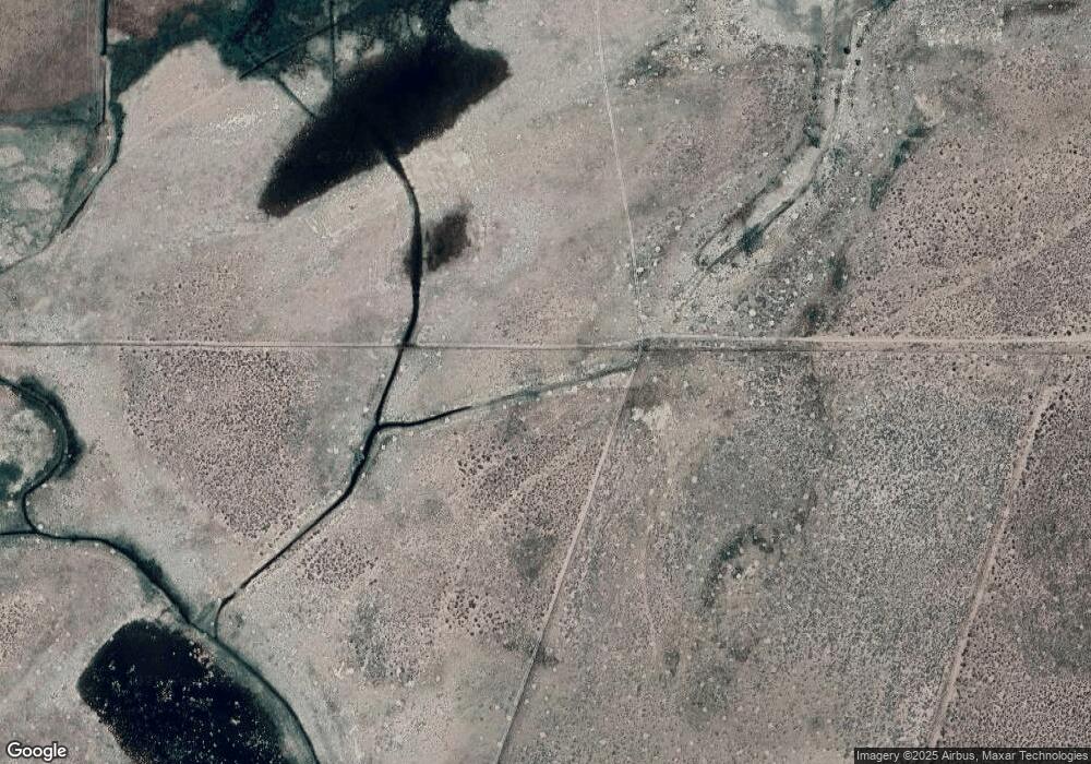
532 Lower Colony Rd Unit N2 Wellington, NV 89444
Estimated Value: $693,000 - $4,248,000
2
Beds
2
Baths
1,308
Sq Ft
$1,889/Sq Ft
Est. Value
About This Home
This home is located at 532 Lower Colony Rd Unit N2, Wellington, NV 89444 and is currently estimated at $2,470,500, approximately $1,888 per square foot. 532 Lower Colony Rd Unit N2 is a home located in Lyon County with nearby schools including Smith Valley Schools.
Ownership History
Date
Name
Owned For
Owner Type
Purchase Details
Closed on
Dec 26, 2012
Sold by
Bacon Mary Lee Parker and Bacon Edward Ford
Bought by
Valley Ranching Nevada Llc
Current Estimated Value
Purchase Details
Closed on
Sep 8, 2012
Sold by
Parker Bacon Mary Lee and Bacon Edward Ford
Bought by
Parker Bacon Mary Lee and Bacon Edward Ford
Purchase Details
Closed on
Aug 2, 2011
Sold by
Bacon Mary Lee and Bacon Milton E
Bought by
Bacon Mary Lee and The Milton E Bacon Jr 1992 Trust
Create a Home Valuation Report for This Property
The Home Valuation Report is an in-depth analysis detailing your home's value as well as a comparison with similar homes in the area
Home Values in the Area
Average Home Value in this Area
Purchase History
| Date | Buyer | Sale Price | Title Company |
|---|---|---|---|
| Valley Ranching Nevada Llc | $2,145,900 | None Available | |
| Parker Bacon Mary Lee | -- | None Available | |
| Bacon Mary Lee | -- | None Available |
Source: Public Records
Tax History Compared to Growth
Tax History
| Year | Tax Paid | Tax Assessment Tax Assessment Total Assessment is a certain percentage of the fair market value that is determined by local assessors to be the total taxable value of land and additions on the property. | Land | Improvement |
|---|---|---|---|---|
| 2025 | $34,964 | $218,077 | $163,615 | $54,463 |
| 2024 | $34,076 | $222,921 | $168,192 | $54,728 |
| 2023 | $34,076 | $194,325 | $144,173 | $50,152 |
| 2022 | $23,293 | $157,571 | $112,090 | $45,481 |
| 2021 | $22,031 | $155,912 | $112,090 | $43,822 |
| 2020 | $21,119 | $153,894 | $112,094 | $41,800 |
| 2019 | $20,857 | $152,660 | $112,470 | $40,190 |
| 2018 | $20,332 | $156,879 | $8,485 | $148,394 |
| 2017 | $19,206 | $161,940 | $8,792 | $153,148 |
| 2016 | $17,234 | $136,970 | $100,318 | $36,652 |
| 2015 | $15,827 | $126,222 | $90,097 | $36,125 |
| 2014 | $15,839 | $118,717 | $87,751 | $30,966 |
Source: Public Records
Map
Nearby Homes
- 17 Grand View Ln
- 9 Hawk View Rd
- 16 Hawk View Dr
- 544 Upper Colony Rd
- 535 Upper Colony Rd
- 50 Miller Ridge Rd
- 456 Upper Colony Rd
- 182 Artist View Rd
- 5 Pinon Dr
- 247 Artist View Rd
- 191 Artist View Rd
- 465 Upper Colony Rd
- 10 Walters Ln
- 49 Pinon Dr
- 67 Pinon Dr
- 55 Mesa Dr
- 42 Wedertz Ln
- 88 Smith Gage Rd
- 25 Jessica Dr
- 175 Jessen Rd
- 49 Pleasant View Dr
- 000 Burke Dr
- 42 Pleasant View Ln Unit 10 SEPARATE PARCELS
- 42 Pleasant View Ln Unit 7 Parcels total
- 42 Pleasant View Dr
- 50 Grand View Ln
- 44 Grand View Ln
- 44 Grand View Ln Unit 10
- TBD Day Ln
- 0 Day Ln
- 01040108 Day Ln
- 18 Pleasant View Dr
- 49 Grand View Ln
- 12 Pleasant View Dr
- 38 Grand View Ln
- 6 Pleasant View Dr
- 510 Day Ln
- 43 Grand View Ln
- 475 Day Ln
- 439 Day Ln
