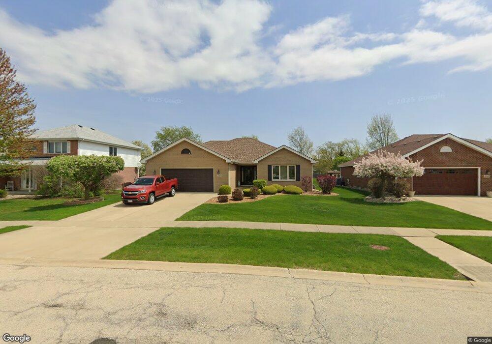
532 Marilyn Dr New Lenox, IL 60451
Estimated Value: $461,441 - $505,000
3
Beds
3
Baths
2,200
Sq Ft
$222/Sq Ft
Est. Value
About This Home
This home is located at 532 Marilyn Dr, New Lenox, IL 60451 and is currently estimated at $489,360, approximately $222 per square foot. 532 Marilyn Dr is a home located in Will County with nearby schools including Bentley Elementary School, Arnold J Tyler School, and Alex M Martino Jr High School.
Ownership History
Date
Name
Owned For
Owner Type
Purchase Details
Closed on
Dec 1, 2017
Sold by
Eskridge Bialka Margaret C and Thomas Lisa M
Bought by
Koenig Pamela J
Current Estimated Value
Purchase Details
Closed on
Nov 25, 2013
Sold by
First Midwest Bank
Bought by
James E Eskridge Revocable Trust
Purchase Details
Closed on
Aug 27, 2002
Sold by
Eskridge Carol A
Bought by
First Midwest Bank and Trust #7134
Purchase Details
Closed on
Aug 26, 2002
Sold by
Eagle Ridge Corp
Bought by
Eskridge Carol A
Create a Home Valuation Report for This Property
The Home Valuation Report is an in-depth analysis detailing your home's value as well as a comparison with similar homes in the area
Home Values in the Area
Average Home Value in this Area
Purchase History
| Date | Buyer | Sale Price | Title Company |
|---|---|---|---|
| Koenig Pamela J | $325,000 | None Available | |
| James E Eskridge Revocable Trust | -- | None Available | |
| First Midwest Bank | -- | -- | |
| Eskridge Carol A | $240,000 | -- |
Source: Public Records
Tax History Compared to Growth
Tax History
| Year | Tax Paid | Tax Assessment Tax Assessment Total Assessment is a certain percentage of the fair market value that is determined by local assessors to be the total taxable value of land and additions on the property. | Land | Improvement |
|---|---|---|---|---|
| 2024 | $6,548 | $135,698 | $36,393 | $99,305 |
| 2023 | $6,548 | $123,699 | $33,175 | $90,524 |
| 2022 | $7,415 | $113,956 | $30,562 | $83,394 |
| 2021 | $7,510 | $107,172 | $28,743 | $78,429 |
| 2020 | $7,583 | $103,348 | $27,717 | $75,631 |
| 2019 | $7,806 | $100,144 | $26,858 | $73,286 |
| 2018 | $7,609 | $96,692 | $25,932 | $70,760 |
| 2017 | $7,615 | $93,912 | $25,186 | $68,726 |
| 2016 | $7,427 | $91,399 | $24,512 | $66,887 |
| 2015 | $6,721 | $88,522 | $23,740 | $64,782 |
| 2014 | $6,721 | $87,429 | $23,447 | $63,982 |
| 2013 | $6,721 | $88,607 | $23,763 | $64,844 |
Source: Public Records
Map
Nearby Homes
- 513 Somerset Ln
- 449 Somerset Ln Unit 1
- 1017 E Lincoln Hwy
- 709 Garadice Dr
- 125 N Anderson Rd
- 203 Tonell Ave
- 214 Somerset Ct
- 235 Roberts Rd
- 920 Barnside Rd
- 1212 Georgias Way
- 1535 Glenbrooke Ln
- 1193 Georgias Way
- 1139 Georgias Way
- 1125 Georgias Way
- 1351 E Lincoln Hwy
- 1245 Georgias Way
- 328 E Lincoln Hwy
- 701 Bishops Gate
- 641 Lisson Grove
- 808 Stonegate Rd
- 516 Marilyn Dr
- 548 Marilyn Dr
- 564 Marilyn Dr
- 929 Krystal Ln
- 922 Krystal Ln
- 228 S Spencer Rd
- 580 Marilyn Dr
- 945 Cheyenne Ln
- 914 Krystal Ln
- 921 Krystal Ln
- 224 Spencer Rd
- 805 Regent St
- 596 Marilyn Dr
- 804 Chelsea St
- 929 Cheyenne Ln
- 906 Krystal Ln Unit 5
- 917 Krystal Ln
- 600 Marilyn Dr
- 804 Regent St
- 913 Cheyenne Ln