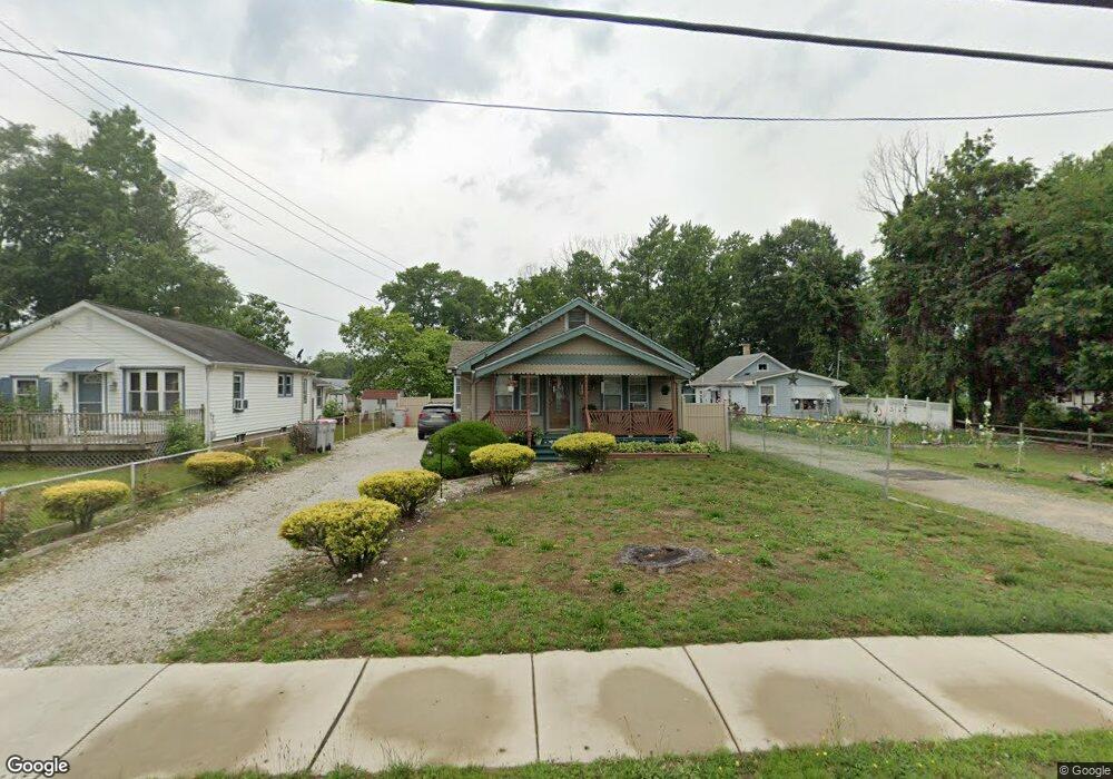
532 N West Ave Vineland, NJ 08360
Estimated Value: $196,240 - $291,000
--
Bed
--
Bath
1,266
Sq Ft
$199/Sq Ft
Est. Value
About This Home
This home is located at 532 N West Ave, Vineland, NJ 08360 and is currently estimated at $251,810, approximately $198 per square foot. 532 N West Ave is a home located in Cumberland County with nearby schools including Max Leuchter Elementary School, T.W. Wallace Middle School, and Vineland Senior High School.
Ownership History
Date
Name
Owned For
Owner Type
Purchase Details
Closed on
May 15, 2003
Sold by
Pihs Mark A
Bought by
Laboy Felipe
Current Estimated Value
Home Financials for this Owner
Home Financials are based on the most recent Mortgage that was taken out on this home.
Original Mortgage
$45,505
Outstanding Balance
$19,878
Interest Rate
5.86%
Estimated Equity
$231,932
Purchase Details
Closed on
Aug 29, 2002
Sold by
Kimble Glass Co
Bought by
Laboy Felipe and Lozang Adam
Purchase Details
Closed on
Jan 26, 1996
Sold by
Household Finance Corp Iii
Bought by
Laboy Felipe
Home Financials for this Owner
Home Financials are based on the most recent Mortgage that was taken out on this home.
Original Mortgage
$53,834
Interest Rate
7%
Mortgage Type
FHA
Purchase Details
Closed on
Aug 25, 1995
Sold by
Forcinito James A
Bought by
Household Finance Corp Iii
Create a Home Valuation Report for This Property
The Home Valuation Report is an in-depth analysis detailing your home's value as well as a comparison with similar homes in the area
Home Values in the Area
Average Home Value in this Area
Purchase History
| Date | Buyer | Sale Price | Title Company |
|---|---|---|---|
| Laboy Felipe | $47,900 | -- | |
| Laboy Felipe | $12,000 | -- | |
| Laboy Felipe | $53,900 | Beacon Title | |
| Household Finance Corp Iii | -- | -- |
Source: Public Records
Mortgage History
| Date | Status | Borrower | Loan Amount |
|---|---|---|---|
| Open | Laboy Felipe | $45,505 | |
| Previous Owner | Laboy Felipe | $53,834 | |
| Closed | Household Finance Corp Iii | -- |
Source: Public Records
Tax History Compared to Growth
Tax History
| Year | Tax Paid | Tax Assessment Tax Assessment Total Assessment is a certain percentage of the fair market value that is determined by local assessors to be the total taxable value of land and additions on the property. | Land | Improvement |
|---|---|---|---|---|
| 2025 | $3,834 | $120,400 | $31,100 | $89,300 |
| 2024 | $3,834 | $120,400 | $31,100 | $89,300 |
| 2023 | $3,808 | $120,400 | $31,100 | $89,300 |
| 2022 | $3,695 | $120,400 | $31,100 | $89,300 |
| 2021 | $3,628 | $120,400 | $31,100 | $89,300 |
| 2020 | $3,524 | $120,400 | $31,100 | $89,300 |
| 2019 | $3,476 | $120,400 | $31,100 | $89,300 |
| 2018 | $3,384 | $120,400 | $31,100 | $89,300 |
| 2017 | $3,215 | $120,400 | $31,100 | $89,300 |
| 2016 | $3,102 | $120,400 | $31,100 | $89,300 |
| 2015 | $2,987 | $120,400 | $31,100 | $89,300 |
| 2014 | $2,825 | $120,400 | $31,100 | $89,300 |
Source: Public Records
Map
Nearby Homes
- 550 Northwest Ave
- 108 W Park Ave
- 663 Wayne Ave
- 0 W Landis Ave
- 1252 W Oak Rd
- 1489 N Delsea Dr
- 400 N 7th St
- 636 E Pear St
- 218 W Montrose St
- 329 W Grape St
- 404 Montrose St
- 1429 W Oak Rd
- 511 E Grape St
- 1500 Venus Dr
- 1267 Northeast Blvd
- 1298 W Cornell St
- 818 E Pear St
- 409 N East Ave
- 411 N East Ave
- 1143 N East Ave
- 530 N West Ave
- 534 N West Ave
- 528 N West Ave
- 538 N West Ave
- 78 Bortle Ave
- 539 N West Ave
- 537 N West Ave
- 545 N West Ave
- 74 Bortle Ave
- 79 Avon Place
- 526 N West Ave
- 540 N West Ave
- 533 N West Ave
- 533 N West Ave Unit 2
- 104 Bortle Ave
- 70 Bortle Ave
- 103 Fenimore St
- 75 Avon Place
- 105 Bortle Ave
- 529 N West Ave