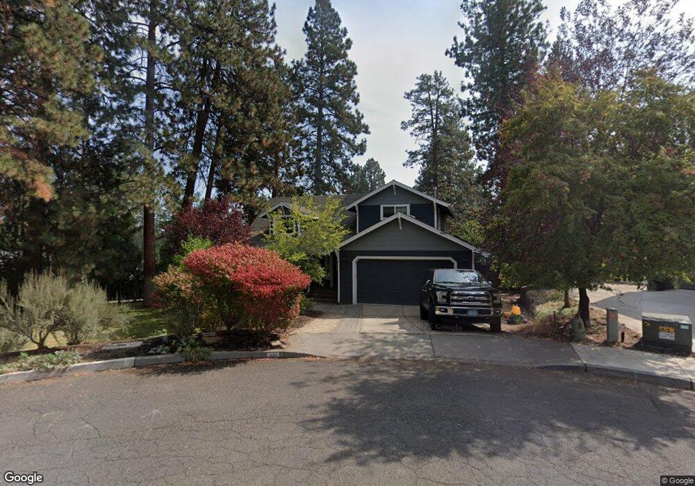
532 NW Sean Ct Bend, OR 97701
Summit West NeighborhoodEstimated Value: $944,000 - $1,078,471
3
Beds
3
Baths
1,868
Sq Ft
$545/Sq Ft
Est. Value
About This Home
This home is located at 532 NW Sean Ct, Bend, OR 97701 and is currently estimated at $1,018,118, approximately $545 per square foot. 532 NW Sean Ct is a home located in Deschutes County with nearby schools including High Lakes Elementary School, Pacific Crest Middle School, and Summit High School.
Ownership History
Date
Name
Owned For
Owner Type
Purchase Details
Closed on
Oct 17, 2013
Sold by
Grediagin Ann
Bought by
Fredland Richard and Fredland Noelle
Current Estimated Value
Home Financials for this Owner
Home Financials are based on the most recent Mortgage that was taken out on this home.
Original Mortgage
$291,000
Interest Rate
4.53%
Mortgage Type
Seller Take Back
Purchase Details
Closed on
Jun 9, 2010
Sold by
Grediagin Ann
Bought by
Grediagin Ann and Ann Grediagin Revocable Living Trust
Purchase Details
Closed on
Mar 18, 2005
Sold by
Gordon David A and Gordon Karan J
Bought by
Grediagin Ann
Home Financials for this Owner
Home Financials are based on the most recent Mortgage that was taken out on this home.
Original Mortgage
$223,300
Interest Rate
5.61%
Mortgage Type
Unknown
Create a Home Valuation Report for This Property
The Home Valuation Report is an in-depth analysis detailing your home's value as well as a comparison with similar homes in the area
Home Values in the Area
Average Home Value in this Area
Purchase History
| Date | Buyer | Sale Price | Title Company |
|---|---|---|---|
| Fredland Richard | $361,000 | First American Title | |
| Grediagin Ann | -- | None Available | |
| Grediagin Ann | $319,000 | Western Title & Escrow Co |
Source: Public Records
Mortgage History
| Date | Status | Borrower | Loan Amount |
|---|---|---|---|
| Closed | Fredland Richard | $291,000 | |
| Previous Owner | Grediagin Ann | $223,300 |
Source: Public Records
Tax History Compared to Growth
Tax History
| Year | Tax Paid | Tax Assessment Tax Assessment Total Assessment is a certain percentage of the fair market value that is determined by local assessors to be the total taxable value of land and additions on the property. | Land | Improvement |
|---|---|---|---|---|
| 2025 | $6,389 | $378,120 | -- | -- |
| 2024 | $6,147 | $367,110 | -- | -- |
| 2023 | $5,698 | $356,420 | $0 | $0 |
| 2022 | $5,316 | $335,970 | $0 | $0 |
| 2021 | $5,324 | $326,190 | $0 | $0 |
| 2020 | $5,051 | $326,190 | $0 | $0 |
| 2019 | $4,911 | $316,690 | $0 | $0 |
| 2018 | $4,772 | $307,470 | $0 | $0 |
| 2017 | $4,632 | $298,520 | $0 | $0 |
| 2016 | $4,417 | $289,830 | $0 | $0 |
| 2015 | $4,295 | $281,390 | $0 | $0 |
| 2014 | $4,168 | $273,200 | $0 | $0 |
Source: Public Records
Map
Nearby Homes
- 2379 NW Drouillard Ave
- 1772 SW Troon Ave
- 1829 SW Turnberry Place
- 1505 NW Jacksonville Ave
- 1828 SW Troon Ave
- 1785 SW Troon Ave
- 505 NW Flagline Dr
- 1872 NW Hill Point Dr
- 1710 SW Knoll Ave
- 1122 NW Stannium Rd
- 15 SW Quail Butte Place
- 1603 NW Milwaukee Ave
- 19490 Green Lakes Loop
- 319 NW Flagline Dr
- 2409 NW Quinn Creek Loop
- 1026 NW Baltimore Ave
- 113 NW Outlook Vista Dr
- 0 Fazio Ln Unit Lot 273 220187171
- 305 NW Columbia St
- 1597 NW Portland Ave
- 510 NW Sean Ct
- 574 NW Sean Ct
- 1688 NW Elgin Ave
- 535 NW Sean Ct
- 1680 NW Elgin Ave
- 596 NW Sean Ct
- 571 NW Sean Ct
- 1677 NW Fresno Ave
- 1699 NW Elgin Ave
- 593 NW Sean Ct
- 1669 NW Fresno Ave
- 618 NW Sean Ct
- 1687 NW Elgin Ave
- 576 NW Lindsay Ct
- 1664 NW Elgin Ave
- 455 NW 17th St
- 554 NW Lindsay Ct
- 1661 NW Fresno Ave
- 1698 NW Davenport Ave