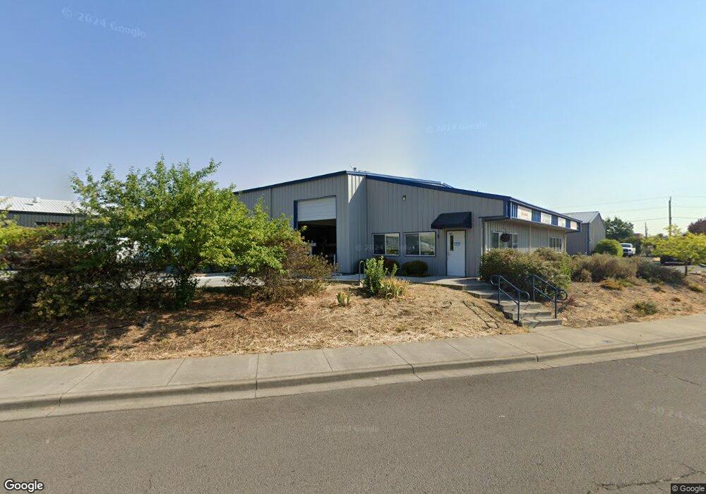
532 Parsons Dr Unit 102 Medford, OR 97501
Northwest Medford NeighborhoodEstimated Value: $1,270,730
--
Bed
--
Bath
11,480
Sq Ft
$111/Sq Ft
Est. Value
About This Home
This home is located at 532 Parsons Dr Unit 102, Medford, OR 97501 and is currently estimated at $1,270,730, approximately $110 per square foot. 532 Parsons Dr Unit 102 is a home located in Jackson County with nearby schools including Oak Grove Elementary School, McLoughlin Middle School, and North Medford High School.
Ownership History
Date
Name
Owned For
Owner Type
Purchase Details
Closed on
Jun 29, 2018
Sold by
Blech Andreas and Blech Carole
Bought by
Dmtw Properties Llc
Current Estimated Value
Home Financials for this Owner
Home Financials are based on the most recent Mortgage that was taken out on this home.
Original Mortgage
$765,000
Outstanding Balance
$625,666
Interest Rate
4.6%
Mortgage Type
Commercial
Estimated Equity
$645,064
Purchase Details
Closed on
Aug 16, 2010
Sold by
Landers Richard L and Landers Sheryl A
Bought by
Blech Andreas and Blech Carole
Create a Home Valuation Report for This Property
The Home Valuation Report is an in-depth analysis detailing your home's value as well as a comparison with similar homes in the area
Home Values in the Area
Average Home Value in this Area
Purchase History
| Date | Buyer | Sale Price | Title Company |
|---|---|---|---|
| Dmtw Properties Llc | $850,000 | First American Title | |
| Blech Andreas | $675,000 | First American |
Source: Public Records
Mortgage History
| Date | Status | Borrower | Loan Amount |
|---|---|---|---|
| Open | Dmtw Properties Llc | $765,000 |
Source: Public Records
Tax History Compared to Growth
Tax History
| Year | Tax Paid | Tax Assessment Tax Assessment Total Assessment is a certain percentage of the fair market value that is determined by local assessors to be the total taxable value of land and additions on the property. | Land | Improvement |
|---|---|---|---|---|
| 2025 | $11,738 | $809,390 | $137,940 | $671,450 |
| 2024 | $11,738 | $785,820 | $133,920 | $651,900 |
| 2023 | $11,378 | $762,940 | $130,020 | $632,920 |
| 2022 | $11,101 | $762,940 | $130,020 | $632,920 |
| 2021 | $10,814 | $740,720 | $126,230 | $614,490 |
| 2020 | $10,585 | $719,150 | $122,550 | $596,600 |
| 2019 | $10,335 | $677,880 | $115,510 | $562,370 |
| 2018 | $10,070 | $626,730 | $232,470 | $394,260 |
| 2017 | $9,560 | $626,730 | $232,470 | $394,260 |
| 2016 | $9,020 | $564,720 | $209,470 | $355,250 |
| 2015 | $9,597 | $606,910 | $225,120 | $381,790 |
| 2014 | $9,339 | $583,790 | $216,540 | $367,250 |
Source: Public Records
Map
Nearby Homes
- 660 Margaret Rose
- 0 Rossanley Dr Unit D 220175528
- 873 Mindy Sue
- 925 Carol Rae
- 1129 Pinecroft Ave
- 639 Darla Mae
- 825 Carol Rae
- 720 Hedy Jayne
- 705 Tawn Cheree
- 722 Dahl Place Unit 17
- 760 Nicholas Lee Dr
- 2435 Stearns Way
- 317 W Clark St
- 738 N Ross Ln
- 833 W Jackson St
- 804 Humphrey St
- 672 Heber Ln
- 709 W Jackson St
- 1916 Elm Ave
- 517 Kenwood Ave
- 506 Parsons Dr
- 1505 Sage Rd Unit A
- 1505 Sage Rd
- 542 Parsons Dr
- 502 Parsons Dr
- 1501 Sage A Rd
- 1501 Sage Rd Unit A
- 562 Parsons Dr Unit 104
- 562 Parsons Dr Unit 113
- 562 Parsons Dr Unit 103
- 562 Parsons Dr
- 562 Parsons Dr Unit 114
- 562 Parsons Dr Unit 112
- 562 Parsons Dr Unit 101
- 562 Parsons Dr Unit 110
- 562 Parsons Dr Unit 115
- 562 Parsons Dr Unit 102
- 562 Parsons Dr Unit 105
- 562 Parsons Dr Unit 106
- 562 Parsons Dr Unit 113/114