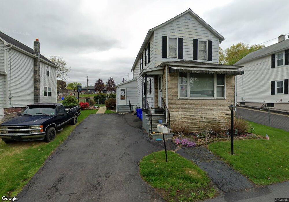
532 Railroad St Duryea, PA 18642
Estimated Value: $96,000 - $186,000
3
Beds
1
Bath
1,246
Sq Ft
$112/Sq Ft
Est. Value
About This Home
This home is located at 532 Railroad St, Duryea, PA 18642 and is currently estimated at $139,867, approximately $112 per square foot. 532 Railroad St is a home located in Luzerne County with nearby schools including Pittston City Intermediate Center, Pittston Area Middle School, and Pittston Area Senior High School.
Ownership History
Date
Name
Owned For
Owner Type
Purchase Details
Closed on
Aug 1, 2017
Sold by
Hartlow Robert C and Bartlow Jean M
Bought by
Swingle Alaena M
Current Estimated Value
Home Financials for this Owner
Home Financials are based on the most recent Mortgage that was taken out on this home.
Original Mortgage
$41,828
Outstanding Balance
$35,172
Interest Rate
4.25%
Mortgage Type
FHA
Estimated Equity
$104,695
Purchase Details
Closed on
Jun 13, 2014
Sold by
Bartlow Robert C and Bartlow Jean M
Bought by
Bartlow Robert C and Bartlow Jean M
Create a Home Valuation Report for This Property
The Home Valuation Report is an in-depth analysis detailing your home's value as well as a comparison with similar homes in the area
Home Values in the Area
Average Home Value in this Area
Purchase History
| Date | Buyer | Sale Price | Title Company |
|---|---|---|---|
| Swingle Alaena M | $42,600 | None Available | |
| Bartlow Robert C | -- | None Available |
Source: Public Records
Mortgage History
| Date | Status | Borrower | Loan Amount |
|---|---|---|---|
| Open | Swingle Alaena M | $41,828 |
Source: Public Records
Tax History Compared to Growth
Tax History
| Year | Tax Paid | Tax Assessment Tax Assessment Total Assessment is a certain percentage of the fair market value that is determined by local assessors to be the total taxable value of land and additions on the property. | Land | Improvement |
|---|---|---|---|---|
| 2025 | $1,152 | $45,000 | $22,800 | $22,200 |
| 2024 | $1,152 | $45,000 | $22,800 | $22,200 |
| 2023 | $1,129 | $45,000 | $22,800 | $22,200 |
| 2022 | $1,107 | $45,000 | $22,800 | $22,200 |
| 2021 | $1,107 | $45,000 | $22,800 | $22,200 |
| 2020 | $1,082 | $45,000 | $22,800 | $22,200 |
| 2019 | $1,060 | $45,000 | $22,800 | $22,200 |
| 2018 | $1,836 | $79,600 | $22,800 | $56,800 |
| 2017 | $1,795 | $79,600 | $22,800 | $56,800 |
| 2016 | -- | $79,600 | $22,800 | $56,800 |
| 2015 | $1,411 | $79,600 | $22,800 | $56,800 |
| 2014 | $1,411 | $79,600 | $22,800 | $56,800 |
Source: Public Records
Map
Nearby Homes
- 0 Corner of Grove and Jones St
- 528 Railroad St
- 538 Railroad St
- 524 Railroad St
- 540 Railroad St
- 520 Railroad St
- 544 Railroad St
- 441 Grove St
- 501 Donnelly St
- 0 Jones St Unit GSB182558
- 0 Jones St
- 500 Donnelly St
- 446 Meyers St
- 415 Jones St
- 422 Meyers St
- 505 Donnelly St
- 504 Donnelly St
- 504 Meyers St
- 455 Foote Ave
- 453 Foote Ave