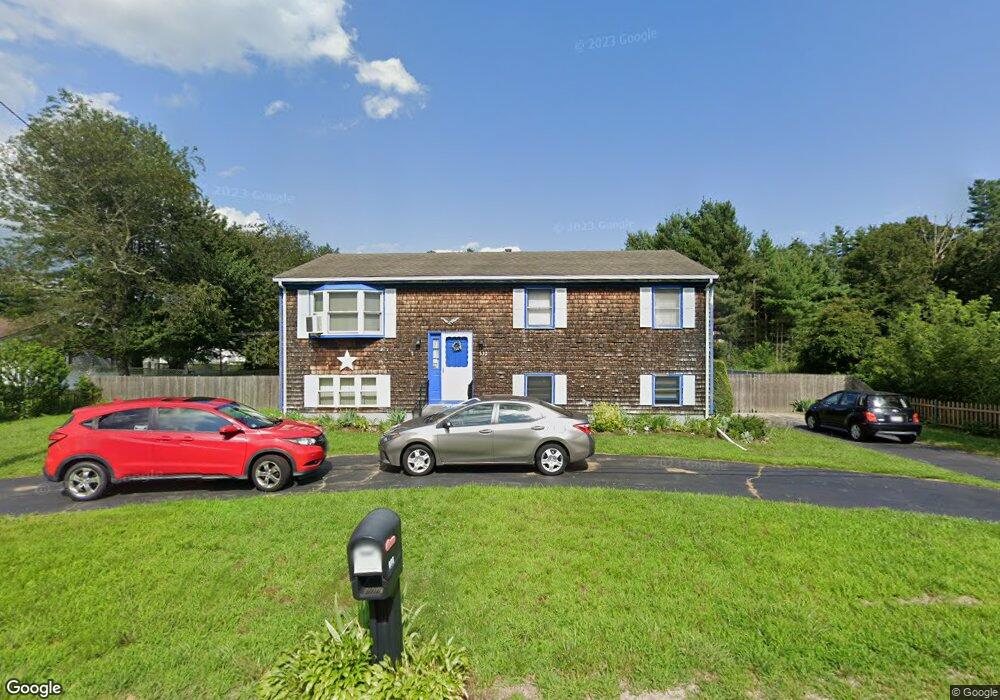
532 Sanford Rd Westport, MA 02790
North Westport NeighborhoodEstimated Value: $339,000 - $476,191
3
Beds
--
Bath
1,144
Sq Ft
$366/Sq Ft
Est. Value
About This Home
This home is located at 532 Sanford Rd, Westport, MA 02790 and is currently estimated at $419,048, approximately $366 per square foot. 532 Sanford Rd is a home located in Bristol County with nearby schools including Alice A. Macomber Primary School, Westport Elementary School, and Westport Middle-High School.
Ownership History
Date
Name
Owned For
Owner Type
Purchase Details
Closed on
Oct 29, 2008
Sold by
Rudis Marie V
Bought by
Mayo Kathleen A and Stlaurent Pauline A
Current Estimated Value
Create a Home Valuation Report for This Property
The Home Valuation Report is an in-depth analysis detailing your home's value as well as a comparison with similar homes in the area
Home Values in the Area
Average Home Value in this Area
Purchase History
| Date | Buyer | Sale Price | Title Company |
|---|---|---|---|
| Mayo Kathleen A | -- | -- | |
| Rudis Marie V | -- | -- |
Source: Public Records
Mortgage History
| Date | Status | Borrower | Loan Amount |
|---|---|---|---|
| Previous Owner | Rudis Marie V | $30,000 | |
| Previous Owner | Rudis Marie V | $32,200 | |
| Previous Owner | Rudis Marie V | $11,000 |
Source: Public Records
Tax History Compared to Growth
Tax History
| Year | Tax Paid | Tax Assessment Tax Assessment Total Assessment is a certain percentage of the fair market value that is determined by local assessors to be the total taxable value of land and additions on the property. | Land | Improvement |
|---|---|---|---|---|
| 2025 | $3,160 | $424,100 | $173,200 | $250,900 |
| 2024 | $3,108 | $402,100 | $153,800 | $248,300 |
| 2023 | $2,947 | $361,200 | $140,100 | $221,100 |
| 2022 | $2,932 | $345,700 | $140,100 | $205,600 |
| 2021 | $2,770 | $321,400 | $115,800 | $205,600 |
| 2020 | $2,670 | $316,700 | $111,100 | $205,600 |
| 2019 | $2,559 | $309,400 | $111,100 | $198,300 |
| 2018 | $2,470 | $302,300 | $112,200 | $190,100 |
| 2017 | $2,326 | $291,900 | $108,600 | $183,300 |
| 2016 | $2,171 | $274,400 | $105,000 | $169,400 |
| 2015 | $2,105 | $265,400 | $107,400 | $158,000 |
Source: Public Records
Map
Nearby Homes