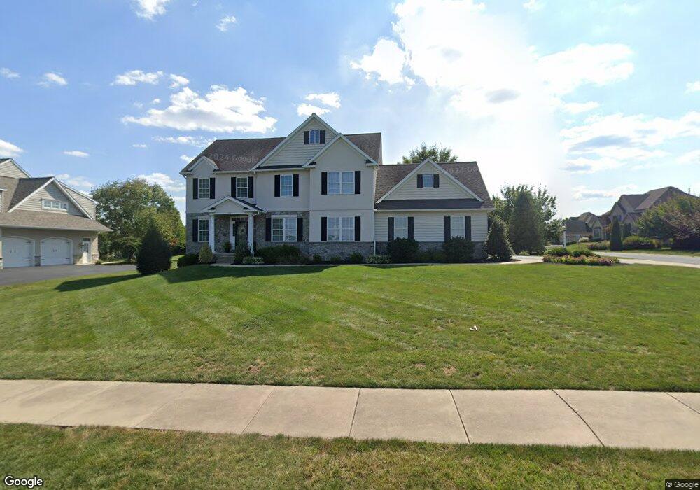
532 Snyder Rd Lititz, PA 17543
Kissel Hill NeighborhoodEstimated Value: $961,000 - $1,015,018
5
Beds
5
Baths
3,605
Sq Ft
$273/Sq Ft
Est. Value
About This Home
This home is located at 532 Snyder Rd, Lititz, PA 17543 and is currently estimated at $984,339, approximately $273 per square foot. 532 Snyder Rd is a home located in Lancaster County with nearby schools including Reidenbaugh Elementary School, Landis Run Intermediate School, and Manheim Township Middle School.
Ownership History
Date
Name
Owned For
Owner Type
Purchase Details
Closed on
Dec 27, 2007
Sold by
Wolf Robert A and Wolf Ellen M
Bought by
Carroll Martin T and Carroll Anita L
Current Estimated Value
Home Financials for this Owner
Home Financials are based on the most recent Mortgage that was taken out on this home.
Original Mortgage
$400,000
Outstanding Balance
$241,910
Interest Rate
5.37%
Mortgage Type
Purchase Money Mortgage
Estimated Equity
$742,429
Purchase Details
Closed on
Sep 15, 2006
Sold by
Hogan John A and Herr Daryl D
Bought by
Wolf Robert A and Wolf Ellen M
Purchase Details
Closed on
Jan 20, 2006
Sold by
Perate Neil F and Perate Tracy L
Bought by
Hogan John A and Herr Daryl D
Purchase Details
Closed on
Dec 21, 2005
Sold by
Sherman & Walton Inc
Bought by
Perate Neil F and Perate Tracy L
Create a Home Valuation Report for This Property
The Home Valuation Report is an in-depth analysis detailing your home's value as well as a comparison with similar homes in the area
Home Values in the Area
Average Home Value in this Area
Purchase History
| Date | Buyer | Sale Price | Title Company |
|---|---|---|---|
| Carroll Martin T | $560,000 | None Available | |
| Wolf Robert A | $145,000 | None Available | |
| Hogan John A | $289,465 | None Available | |
| Perate Neil F | $195,510 | None Available |
Source: Public Records
Mortgage History
| Date | Status | Borrower | Loan Amount |
|---|---|---|---|
| Open | Carroll Martin T | $400,000 |
Source: Public Records
Tax History
| Year | Tax Paid | Tax Assessment Tax Assessment Total Assessment is a certain percentage of the fair market value that is determined by local assessors to be the total taxable value of land and additions on the property. | Land | Improvement |
|---|---|---|---|---|
| 2025 | $12,532 | $579,200 | $113,700 | $465,500 |
| 2024 | $12,532 | $579,200 | $113,700 | $465,500 |
| 2023 | $12,205 | $579,200 | $113,700 | $465,500 |
| 2022 | $11,544 | $557,200 | $113,700 | $443,500 |
| 2021 | $11,286 | $557,200 | $113,700 | $443,500 |
| 2020 | $11,286 | $557,200 | $113,700 | $443,500 |
| 2019 | $11,177 | $557,200 | $113,700 | $443,500 |
| 2018 | $8,313 | $557,200 | $113,700 | $443,500 |
| 2017 | $12,107 | $475,800 | $106,200 | $369,600 |
| 2016 | $12,107 | $475,800 | $106,200 | $369,600 |
| 2015 | $3,043 | $475,800 | $106,200 | $369,600 |
| 2014 | $8,761 | $475,800 | $106,200 | $369,600 |
Source: Public Records
Map
Nearby Homes
- 1221 Brighton Ave
- 617 Dorset St
- 649 Dorset St
- 504 Cheltenham Ct
- 1021 Suffolk Dr
- 505 Northampton Dr Unit 2
- 131 Milton Cir
- 512 Northampton Dr Unit 43
- 421 Southampton Dr
- 168 Olde Field Dr
- 297 Sarsen Dr
- 30 Farmview Ln
- 66 Farmview Ln
- 634 Northfield Rd
- 701 Woodfield Dr
- 660 Woodfield Dr
- 602 Willow Green
- LOT 12 Bent Creek Dr
- 78 Oakhill Dr
- LOT 34 Honey Farm Rd
- 524 Snyder Rd
- 357 Wheatfield Dr
- 511 Bedford Place
- 516 Snyder Rd
- 507 Bedford Place
- 361 Wheatfield Dr
- 608 Snyder Rd
- 365 Wheatfield Dr
- 1109 Brighton Ave
- 1105 Brighton Ave
- 503 Bedford Place
- 1113 Brighton Ave
- 1101 Brighton Ave
- 1117 Brighton Ave
- 510 Bedford Place
- 369 Wheatfield Dr
- 1121 Brighton Ave
- 506 Bedford Place
- 1125 Brighton Ave
- 502 Bedford Place
Your Personal Tour Guide
Ask me questions while you tour the home.