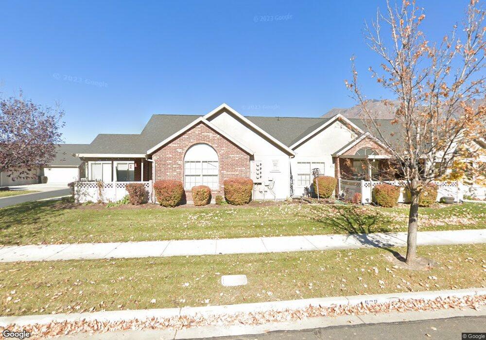
532 W 300 S Unit D Springville, UT 84663
Westfields North NeighborhoodEstimated Value: $427,000 - $522,000
2
Beds
2
Baths
1,594
Sq Ft
$294/Sq Ft
Est. Value
About This Home
This home is located at 532 W 300 S Unit D, Springville, UT 84663 and is currently estimated at $468,933, approximately $294 per square foot. 532 W 300 S Unit D is a home located in Utah County with nearby schools including Westside Elementary School, Springville Junior High School, and Springville High School.
Ownership History
Date
Name
Owned For
Owner Type
Purchase Details
Closed on
Jul 22, 2024
Sold by
Asay Alan
Bought by
Hazel Karen
Current Estimated Value
Home Financials for this Owner
Home Financials are based on the most recent Mortgage that was taken out on this home.
Original Mortgage
$709,500
Outstanding Balance
$575,339
Interest Rate
7.5%
Mortgage Type
Reverse Mortgage Home Equity Conversion Mortgage
Estimated Equity
-$106,406
Purchase Details
Closed on
Jul 12, 2022
Sold by
Jesse And Janice Asay Trust
Bought by
Asay Man
Home Financials for this Owner
Home Financials are based on the most recent Mortgage that was taken out on this home.
Original Mortgage
$275,000
Interest Rate
5.09%
Mortgage Type
New Conventional
Purchase Details
Closed on
Jul 16, 2015
Sold by
Asay Jesse W and Asay Janice E
Bought by
The Jesse And Janice Asay Trust and Asay Janice Elolen Foster
Create a Home Valuation Report for This Property
The Home Valuation Report is an in-depth analysis detailing your home's value as well as a comparison with similar homes in the area
Home Values in the Area
Average Home Value in this Area
Purchase History
| Date | Buyer | Sale Price | Title Company |
|---|---|---|---|
| Hazel Karen | -- | Cottonwood Title | |
| Asay Man | -- | None Listed On Document | |
| The Jesse And Janice Asay Trust | -- | None Available |
Source: Public Records
Mortgage History
| Date | Status | Borrower | Loan Amount |
|---|---|---|---|
| Open | Hazel Karen | $709,500 | |
| Closed | Hazel Karen | $709,500 | |
| Previous Owner | Asay Man | $275,000 |
Source: Public Records
Tax History Compared to Growth
Tax History
| Year | Tax Paid | Tax Assessment Tax Assessment Total Assessment is a certain percentage of the fair market value that is determined by local assessors to be the total taxable value of land and additions on the property. | Land | Improvement |
|---|---|---|---|---|
| 2025 | $2,359 | $243,650 | $49,200 | $393,800 |
| 2024 | $2,359 | $234,135 | $0 | $0 |
| 2023 | $2,292 | $229,625 | $0 | $0 |
| 2022 | $2,457 | $241,670 | $0 | $0 |
| 2021 | $2,113 | $323,100 | $38,800 | $284,300 |
| 2020 | $2,055 | $304,800 | $36,600 | $268,200 |
| 2019 | $1,846 | $278,300 | $30,800 | $247,500 |
| 2018 | $1,760 | $253,000 | $30,800 | $222,200 |
| 2017 | $1,749 | $133,375 | $0 | $0 |
| 2016 | $1,684 | $125,840 | $0 | $0 |
| 2015 | $1,588 | $121,000 | $0 | $0 |
| 2014 | $1,287 | $97,185 | $0 | $0 |
Source: Public Records
Map
Nearby Homes
- 224 S 550 W Unit B-2
- 293 S 450 W Unit B
- 550 S 400 W
- 33 N 650 W
- 12 N 450 W
- 717 S Harrison Dr Unit 29
- 749 S Harrison Dr Unit 38
- 776 S Harrison Dr Unit 78
- 742 S Harrison Dr Unit 13
- 743 S Harrison Dr W Unit 36
- 751 S Harrison Dr Unit 28
- 735 S Harrison Dr Unit 26
- 785 S Harrison Dr Unit 51
- 731 S Harrison Dr Unit 25
- 717 S Harrison Dr
- 729 S Harrison Dr
- 745 S Harrison Dr W Unit 37
- 1166 W 200 S
- 1197 W 150 S
- 156 N 600 W
- 518 W 300 S
- 518 W 300 S Unit 42C
- 518 W 300 S Unit B
- 532 W 300 S Unit 39D
- 532 W 300 S
- 532 W 300 S
- 544 W 300 S Unit 35D
- 544 W 300 S Unit 34C
- 544 W 300 S Unit 33B
- 518 W 300 S
- 532 W 300 S Unit 40A
- 544 W 300 S Unit A
- 518 W 300 S Unit D
- 532 W 300 S Unit A
- 544 W 300 S Unit D
- 537 W 200 S
- 531 W 200 S
- 543 W 200 S
- 533 W 300 S Unit 27D
- 533 W 300 S