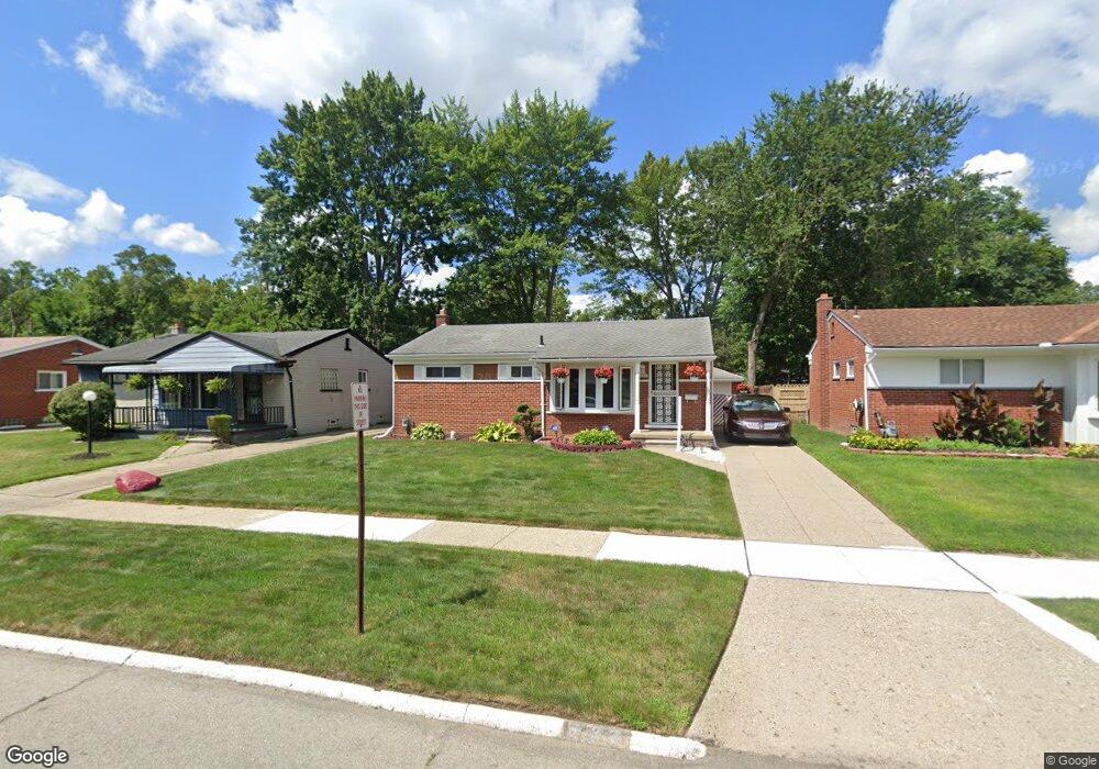
532 Western St Inkster, MI 48141
Estimated Value: $123,683 - $211,000
--
Bed
--
Bath
967
Sq Ft
$158/Sq Ft
Est. Value
About This Home
This home is located at 532 Western St, Inkster, MI 48141 and is currently estimated at $153,171, approximately $158 per square foot. 532 Western St is a home located in Wayne County with nearby schools including David Hicks School, Marshall Upper Elementary School, and John Glenn High School.
Ownership History
Date
Name
Owned For
Owner Type
Purchase Details
Closed on
Aug 6, 2019
Sold by
Teel Rubin C
Bought by
Teel Rubin C and Teel Antoine D
Current Estimated Value
Purchase Details
Closed on
Oct 15, 2018
Sold by
Teel Rubin C
Bought by
Teel Ruben C and Teel Antoine D
Purchase Details
Closed on
Dec 11, 2007
Sold by
Goldfarb Bonding Agency Llc
Bought by
Teel Rubin C
Purchase Details
Closed on
Oct 3, 2006
Sold by
Teel Rubin C and Teel Ernestine
Bought by
Goldfarb Bonding Agency Llc
Purchase Details
Closed on
Mar 19, 2004
Sold by
Teel Rubin C and Teel Arlene
Bought by
Teel Rubin C
Home Financials for this Owner
Home Financials are based on the most recent Mortgage that was taken out on this home.
Original Mortgage
$73,000
Interest Rate
5.65%
Mortgage Type
Purchase Money Mortgage
Create a Home Valuation Report for This Property
The Home Valuation Report is an in-depth analysis detailing your home's value as well as a comparison with similar homes in the area
Home Values in the Area
Average Home Value in this Area
Purchase History
| Date | Buyer | Sale Price | Title Company |
|---|---|---|---|
| Teel Rubin C | -- | None Available | |
| Teel Ruben C | -- | None Available | |
| Teel Rubin C | -- | Philip F Greco Title Company | |
| Goldfarb Bonding Agency Llc | -- | Title Company | |
| Teel Rubin C | $36,000 | -- |
Source: Public Records
Mortgage History
| Date | Status | Borrower | Loan Amount |
|---|---|---|---|
| Previous Owner | Teel Rubin C | $73,000 |
Source: Public Records
Tax History Compared to Growth
Tax History
| Year | Tax Paid | Tax Assessment Tax Assessment Total Assessment is a certain percentage of the fair market value that is determined by local assessors to be the total taxable value of land and additions on the property. | Land | Improvement |
|---|---|---|---|---|
| 2025 | $1,266 | $62,000 | $0 | $0 |
| 2024 | $1,266 | $51,900 | $0 | $0 |
| 2023 | $1,265 | $41,200 | $0 | $0 |
| 2022 | $1,557 | $33,300 | $0 | $0 |
| 2021 | $1,647 | $30,000 | $0 | $0 |
| 2020 | $1,607 | $25,400 | $0 | $0 |
| 2019 | $1,602 | $21,200 | $0 | $0 |
| 2018 | $1,147 | $20,000 | $0 | $0 |
| 2017 | $637 | $19,800 | $0 | $0 |
| 2016 | $1,586 | $19,900 | $0 | $0 |
| 2015 | $2,110 | $21,100 | $0 | $0 |
| 2013 | $2,850 | $28,500 | $0 | $0 |
| 2012 | $1,483 | $34,600 | $3,200 | $31,400 |
Source: Public Records
Map
Nearby Homes
- 29760 Birchwood St
- 29643 Steinhauer St
- 29522 Grandview St
- 29942 Avondale St
- 724 Clair St
- 30030 Glenwood St
- 30129 Glenwood St
- 29118 Avondale St
- 30414 Cherry Hill Rd
- 329 Shotka St
- 28999 Beechnut St
- 29477 Hazelwood St
- 28930 Birchwood St
- 30822 Steinhauer St
- 30817 Birchwood Ave
- 1435 Jeffrey Ln
- 577 Brandt St
- 30806 Fernwood St
- 29142 Parkwood St
- 29487 Florence St
- 522 Western St
- 542 Western St
- 552 Western St
- 512 Western St
- 531 Betty Lane Dr
- 521 Betty Lane Dr
- 541 Betty Lane Dr
- 562 Western St
- 29733 Hiveley St
- 551 Betty Lane Dr
- 511 Betty Lane Dr
- 29748 Steinhauer St
- 561 Betty Lane Dr
- 600 Western St
- 29719 Hiveley St
- 29736 Steinhauer St
- 571 Betty Lane Dr
- 610 Western St
- 29744 Hiveley St
- 29724 Steinhauer St