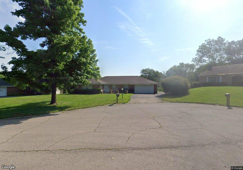
5320 Cedar Trail Dayton, OH 45415
Estimated Value: $247,898 - $271,000
3
Beds
2
Baths
2,250
Sq Ft
$115/Sq Ft
Est. Value
About This Home
This home is located at 5320 Cedar Trail, Dayton, OH 45415 and is currently estimated at $258,475, approximately $114 per square foot. 5320 Cedar Trail is a home located in Montgomery County with nearby schools including Valerie Elementary School, Imagine Schools - Woodbury Academy, and Horizon Science Academy-Dayton Elementary School.
Ownership History
Date
Name
Owned For
Owner Type
Purchase Details
Closed on
Oct 21, 2008
Sold by
Osterday Margaret H
Bought by
Selmon Annie
Current Estimated Value
Home Financials for this Owner
Home Financials are based on the most recent Mortgage that was taken out on this home.
Original Mortgage
$121,189
Outstanding Balance
$78,668
Interest Rate
5.94%
Mortgage Type
FHA
Estimated Equity
$179,807
Create a Home Valuation Report for This Property
The Home Valuation Report is an in-depth analysis detailing your home's value as well as a comparison with similar homes in the area
Home Values in the Area
Average Home Value in this Area
Purchase History
| Date | Buyer | Sale Price | Title Company |
|---|---|---|---|
| Selmon Annie | $122,900 | Attorney |
Source: Public Records
Mortgage History
| Date | Status | Borrower | Loan Amount |
|---|---|---|---|
| Open | Selmon Annie | $121,189 |
Source: Public Records
Tax History Compared to Growth
Tax History
| Year | Tax Paid | Tax Assessment Tax Assessment Total Assessment is a certain percentage of the fair market value that is determined by local assessors to be the total taxable value of land and additions on the property. | Land | Improvement |
|---|---|---|---|---|
| 2024 | $4,761 | $65,940 | $14,180 | $51,760 |
| 2023 | $4,761 | $65,940 | $14,180 | $51,760 |
| 2022 | $4,001 | $40,700 | $8,750 | $31,950 |
| 2021 | $3,986 | $40,700 | $8,750 | $31,950 |
| 2020 | $3,200 | $32,710 | $8,750 | $23,960 |
| 2019 | $4,332 | $39,790 | $8,750 | $31,040 |
| 2018 | $4,337 | $39,790 | $8,750 | $31,040 |
| 2017 | $4,511 | $39,790 | $8,750 | $31,040 |
| 2016 | $4,655 | $40,110 | $8,750 | $31,360 |
| 2015 | $4,105 | $40,110 | $8,750 | $31,360 |
| 2014 | $4,105 | $40,110 | $8,750 | $31,360 |
| 2012 | -- | $39,870 | $9,800 | $30,070 |
Source: Public Records
Map
Nearby Homes
- 159 Burgess Ave
- 5025 Basore Rd
- 71 Westbrook Rd
- 4743 Shaunee Creek Dr Unit 21
- 4763 Shaunee Creek Dr Unit 31
- 5326 Greencroft Dr Unit 5324
- 7725 Harrington Ave
- 4553 Lansmore Dr Unit 37
- 1555 1557 Shiloh Springs Rd Unit 1555 1557
- 5653 Philadelphia Dr
- 4431 Wolf Rd
- 4130 Fleetwood Dr
- 7815 N Main St Unit 14
- 4507 Lansmore Dr Unit 83
- 5400 Bromwick Dr
- 5146 Weddington Dr
- 0 Tall Hickory Trail
- 0 Elgin Roof Rd
- 0 Springway Dr Unit 927025
- 4400 Berquist Dr
- 5300 Cedar Trail
- 5313 Deer Path Ln
- 5330 Cedar Trail
- 5301 Deer Path Ln
- 5325 Deer Path Ln
- 5331 Cedar Trail
- 5315 Cedar Trail
- 5321 Cedar Trail
- 280 Winding Ridge Dr
- 5339 Deer Path Ln
- 5300 Deer Path Ln
- 5314 Deer Path Ln
- 261 Winding Ridge Dr
- 5320 Birchbend Ct
- 149 Winding Ridge Dr
- 290 Winding Ridge Dr
- 281 Winding Ridge Dr
- 5330 Birchbend Ct
- 5328 Deer Path Ln
- 136 Winding Ridge Dr