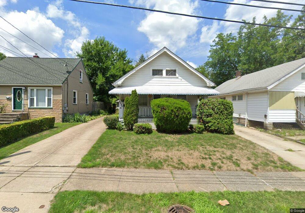
5320 Kohout St Maple Heights, OH 44137
Estimated Value: $97,000 - $122,000
2
Beds
1
Bath
836
Sq Ft
$135/Sq Ft
Est. Value
About This Home
This home is located at 5320 Kohout St, Maple Heights, OH 44137 and is currently estimated at $112,859, approximately $134 per square foot. 5320 Kohout St is a home located in Cuyahoga County with nearby schools including Abraham Lincoln Elementary School, Rockside/ J.F. Kennedy School, and Barack Obama School.
Ownership History
Date
Name
Owned For
Owner Type
Purchase Details
Closed on
Nov 11, 2023
Sold by
Kohout Susan M
Bought by
Susan Kohout Revocable Trust and Kohout
Current Estimated Value
Purchase Details
Closed on
Jan 5, 1990
Sold by
Kohout Susan M
Bought by
Kohout Susan M
Purchase Details
Closed on
Mar 1, 1988
Sold by
Tenbrook K L and Kopta J L
Bought by
Tenbrook James J
Purchase Details
Closed on
Jan 1, 1975
Bought by
Tenbrook K L and Tenbrook Kopta J
Create a Home Valuation Report for This Property
The Home Valuation Report is an in-depth analysis detailing your home's value as well as a comparison with similar homes in the area
Home Values in the Area
Average Home Value in this Area
Purchase History
| Date | Buyer | Sale Price | Title Company |
|---|---|---|---|
| Susan Kohout Revocable Trust | -- | None Listed On Document | |
| Kohout Susan M | -- | -- | |
| Kohout Susan M | $31,500 | -- | |
| Tenbrook Kevin M --Adm | -- | -- | |
| Tenbrook Kevin M -Adm | -- | -- | |
| Tenbrook Kevin M | -- | -- | |
| Tenbrook James J | -- | -- | |
| Evelyn Kopta Etate Of | $21,800 | -- | |
| Evelyn Kopta | -- | -- | |
| Evelyn Kopta (Est Of ).. | -- | -- | |
| Tenbrook K L | -- | -- |
Source: Public Records
Tax History Compared to Growth
Tax History
| Year | Tax Paid | Tax Assessment Tax Assessment Total Assessment is a certain percentage of the fair market value that is determined by local assessors to be the total taxable value of land and additions on the property. | Land | Improvement |
|---|---|---|---|---|
| 2024 | $3,419 | $38,220 | $6,650 | $31,570 |
| 2023 | $2,399 | $22,510 | $3,500 | $19,010 |
| 2022 | $2,390 | $22,510 | $3,500 | $19,010 |
| 2021 | $2,548 | $22,510 | $3,500 | $19,010 |
| 2020 | $2,176 | $17,050 | $2,660 | $14,390 |
| 2019 | $2,164 | $48,700 | $7,600 | $41,100 |
| 2018 | $2,124 | $17,050 | $2,660 | $14,390 |
| 2017 | $2,259 | $17,650 | $3,400 | $14,250 |
| 2016 | $2,186 | $17,650 | $3,400 | $14,250 |
| 2015 | $2,075 | $17,650 | $3,400 | $14,250 |
| 2014 | $2,075 | $18,200 | $3,500 | $14,700 |
Source: Public Records
Map
Nearby Homes
- 5310 Kohout St
- 14567 Pease Rd
- 15095 Granger Rd
- 5312 E 141st St
- 5100 Greenhurst Dr
- 5499 E 141st St
- 14405 Corridon Ave
- 15012 Corridon Ave
- 13601 Granger Rd
- 5362 Roland Dr
- 13417 Granger Rd
- 15505 Benhoff Dr
- 14504 Kennerdown Ave
- 14205 Kennerdown Ave
- 5247 Henry St
- 14901 Krems Ave
- 15012 Krems Ave
- 13601 Eastwood Blvd
- 5372 E 131st St
- 5392 E 131st St
- 5316 Kohout St
- 5324 Kohout St
- 5314 Kohout St
- 5328 Kohout St
- 5306 Kohout St
- 5321 Kohout St
- 5317 Kohout St
- 5325 Kohout St
- 5313 Kohout St
- 5331 Kohout St
- 5302 Kohout St
- 5311 Kohout St
- 5335 Kohout St
- 14617 Granger Rd
- 14623 Granger Rd
- 14615 Granger Rd
- 5298 Kohout St
- 5305 Kohout St
- 5303 Kohout St
- 5303 Kohout St Unit 19