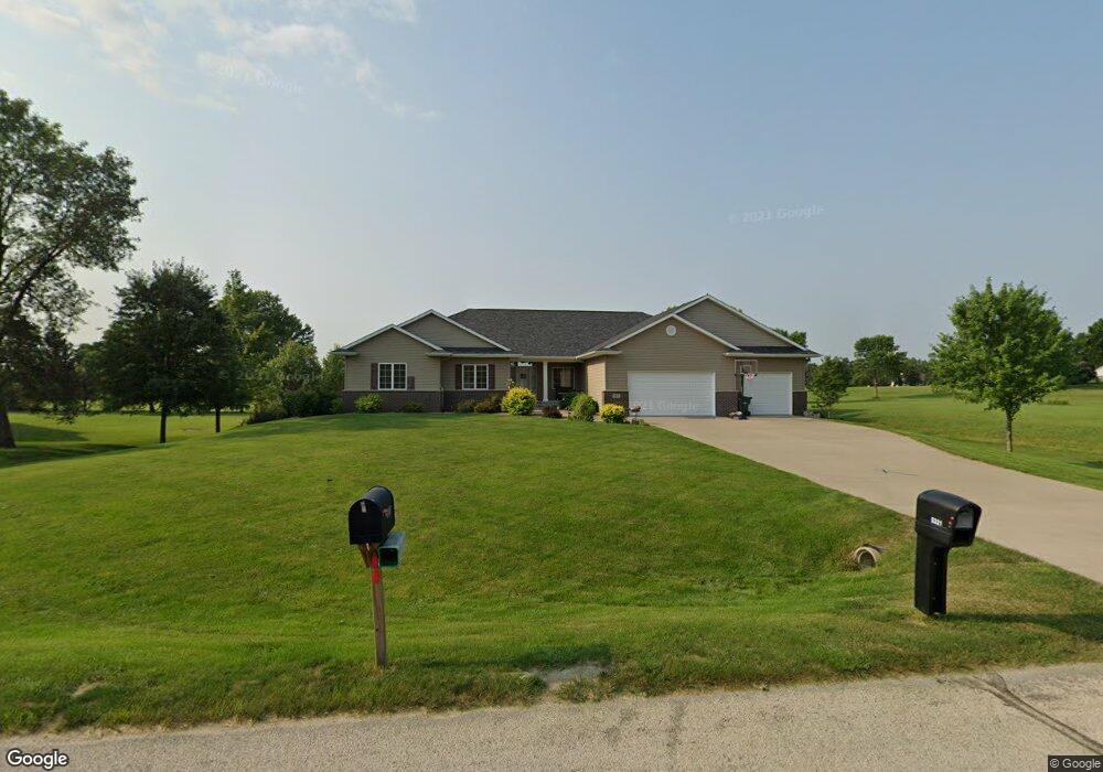
5321 Michael Dr Cedar Rapids, IA 52411
Estimated Value: $569,000 - $594,000
About This Home
This home is located at 5321 Michael Dr, Cedar Rapids, IA 52411 and is currently estimated at $581,168, approximately $252 per square foot. 5321 Michael Dr is a home located in Linn County with nearby schools including Viola Gibson Elementary School, Harding Middle School, and John F. Kennedy High School.
Ownership History
We collect this data history from publicly available records. To have your information removed, we recommend requesting removal directly through your county’s website.
Purchase Details
Home Financials for this Owner
Home Financials are based on the most recent Mortgage that was taken out on this home.Purchase Details
Purchase Details
Purchase Details
Purchase History
We collect this data history from publicly available records. To have your information removed, we recommend requesting removal directly through your county’s website.
| Date | Buyer | Sale Price | Title Company |
|---|---|---|---|
| $425,000 | None Available | ||
| -- | None Available | ||
| -- | None Available | ||
| $69,500 | None Available |
Mortgage History
We collect this data history from publicly available records. To have your information removed, we recommend requesting removal directly through your county’s website.
| Date | Status | Borrower | Loan Amount |
|---|---|---|---|
| Open | $340,000 |
Tax History
We collect this data history from publicly available records. To have your information removed, we recommend requesting removal directly through your county’s website.
| Year | Tax Paid | Tax Assessment Tax Assessment Total Assessment is a certain percentage of the fair market value that is determined by local assessors to be the total taxable value of land and additions on the property. | Land | Improvement |
|---|---|---|---|---|
| 2025 | $8,480 | $548,400 | $75,100 | $473,300 |
| 2024 | $8,800 | $558,400 | $75,100 | $483,300 |
| 2023 | $8,800 | $489,600 | $75,100 | $414,500 |
| 2022 | $8,642 | $426,100 | $60,100 | $366,000 |
| 2021 | $9,336 | $426,100 | $60,100 | $366,000 |
| 2020 | $9,336 | $431,700 | $50,100 | $381,600 |
| 2019 | $8,962 | $424,300 | $50,100 | $374,200 |
| 2018 | $8,710 | $424,300 | $50,100 | $374,200 |
| 2017 | $8,710 | $413,500 | $50,100 | $363,400 |
| 2016 | $8,447 | $397,400 | $50,100 | $347,300 |
| 2015 | $8,473 | $398,223 | $40,040 | $358,183 |
| 2014 | $8,288 | $398,223 | $40,040 | $358,183 |
| 2013 | $8,106 | $398,223 | $40,040 | $358,183 |
Map
- 2511 Grey Wolf
- 355 Wolf Valley Rd
- 4638 Blossom View Ct NE
- 6001 Ridgewood Meadows Ln NE
- 4614 Adams Ct NE
- 5924 Gibson Dr NE
- 6118 Rapids Ridge Rd NE
- 2097 Emmons St
- 5520 Antler Dr
- 6718 Lauder Ln
- 4021 Maple Ridge Ct NE
- 3061 Dell Ridge Ln
- 6720 Caldwell Ln
- 4140 Elkhorn Dr
- 105 17th Avenue Ct
- 4510 Prairie Stone Dr NE
- 4408 Prairie Stone Dr NE
- 4620 Prairie Stone Dr NE
- 2786 Anne Dr
- Lot 2B Buffalo Ridge Dr
- 5321 Michael Dr NE
- 5401 Michael Dr NE
- 5311 Michael Dr NE
- 5301 Michael Dr
- 5320 Michael Dr NE
- 5320 Michael Dr
- 5310 Michael Dr
- 5400 Michael Dr
- 5400 Michael Dr NE
- 5501 Michael Dr
- 5501 Michael Dr NE
- 5300 Michael Dr
- 5511 Michael Dr
- 3120 Grey Wolf
- 3140 Grey Wolf
- 3100 Grey Wolf
- 3160 Grey Wolf
- 3180 Grey Wolf
- 3080 Grey Wolf
- 5661 Michael Dr
Ask me questions while you tour the home.