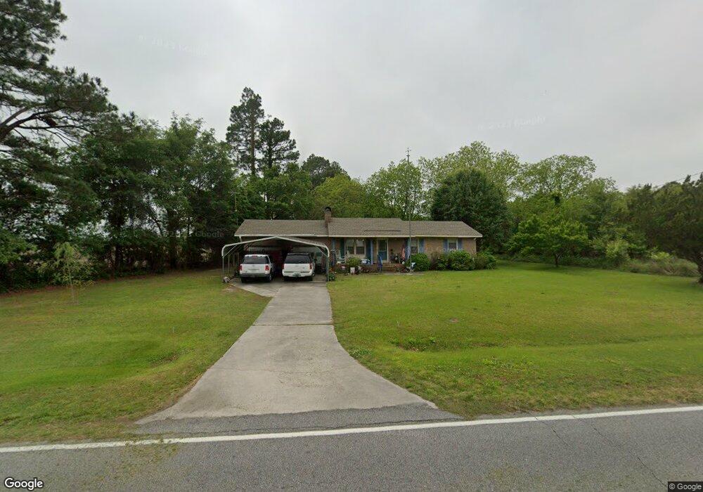
5323 Pauls Path Rd La Grange, NC 28551
Estimated Value: $149,000 - $294,000
3
Beds
1
Bath
1,042
Sq Ft
$195/Sq Ft
Est. Value
About This Home
This home is located at 5323 Pauls Path Rd, La Grange, NC 28551 and is currently estimated at $203,385, approximately $195 per square foot. 5323 Pauls Path Rd is a home located in Lenoir County with nearby schools including La Grange Elementary School, E.B. Frink Middle School, and North Lenoir High School.
Ownership History
Date
Name
Owned For
Owner Type
Purchase Details
Closed on
May 21, 2008
Sold by
Anderson Stephen Wilbert and Anderson Phyllis S
Bought by
Anderson Stephen Wilbert and Anderson Phyllis S
Current Estimated Value
Home Financials for this Owner
Home Financials are based on the most recent Mortgage that was taken out on this home.
Original Mortgage
$89,000
Outstanding Balance
$42,203
Interest Rate
6%
Mortgage Type
New Conventional
Estimated Equity
$161,182
Purchase Details
Closed on
Jul 15, 2005
Sold by
Shepler George A
Bought by
Anderson Stephen Wilbert and Sykes Jerry
Home Financials for this Owner
Home Financials are based on the most recent Mortgage that was taken out on this home.
Original Mortgage
$89,000
Interest Rate
5.25%
Mortgage Type
Adjustable Rate Mortgage/ARM
Create a Home Valuation Report for This Property
The Home Valuation Report is an in-depth analysis detailing your home's value as well as a comparison with similar homes in the area
Home Values in the Area
Average Home Value in this Area
Purchase History
| Date | Buyer | Sale Price | Title Company |
|---|---|---|---|
| Anderson Stephen Wilbert | -- | None Available | |
| Anderson Stephen Wilbert | $90,000 | None Available |
Source: Public Records
Mortgage History
| Date | Status | Borrower | Loan Amount |
|---|---|---|---|
| Open | Anderson Stephen Wilbert | $89,000 | |
| Previous Owner | Anderson Stephen Wilbert | $89,000 |
Source: Public Records
Tax History Compared to Growth
Tax History
| Year | Tax Paid | Tax Assessment Tax Assessment Total Assessment is a certain percentage of the fair market value that is determined by local assessors to be the total taxable value of land and additions on the property. | Land | Improvement |
|---|---|---|---|---|
| 2025 | $590 | $113,161 | $15,582 | $97,579 |
| 2024 | $873 | $84,675 | $11,880 | $72,795 |
| 2023 | $839 | $84,675 | $11,880 | $72,795 |
| 2022 | $839 | $84,675 | $11,880 | $72,795 |
| 2021 | $839 | $84,675 | $11,880 | $72,795 |
| 2020 | $839 | $84,675 | $11,880 | $72,795 |
| 2019 | $839 | $84,675 | $11,880 | $72,795 |
| 2018 | $827 | $84,675 | $11,880 | $72,795 |
| 2017 | $825 | $84,675 | $11,880 | $72,795 |
| 2014 | $905 | $93,860 | $11,880 | $81,980 |
| 2013 | -- | $93,860 | $11,880 | $81,980 |
| 2011 | -- | $93,860 | $11,880 | $81,980 |
Source: Public Records
Map
Nearby Homes
- 5130 Aldridge Store Rd
- 3796 Pecan Grove Cir
- 4310 Colie Rd
- 5024 Gladys Owens St
- 3821 Lindsey Ln
- 3777 Waters Mill Rd
- 3803 Huntcliff Dr
- 3766 Huntcliff Dr
- 3730 Huntcliff Dr
- 3740 Huntcliff Dr
- 3725 Huntcliff Dr
- 113 Institute
- 109 Institute
- 107 Institute
- 603 N Caswell St
- 606 N Caswell St
- Monroe Plan at Walnut Hills - Liberty Series
- Adams Plan at Walnut Hills - Liberty Series
- 3696 Drew Farmer Rd
- 5335 Pauls Path Rd
- 5337 Pauls Path Rd
- 5349 Pauls Path Rd
- 5293 Pauls Path Rd
- 5350 Pauls Path Rd
- 5361 Pauls Path Rd
- 5360 Pauls Path Rd
- 4055 Brothers Rd
- 4019 Brothers Rd
- 4037 Brothers Rd
- 4105 Brothers Rd
- 4027 Brothers Rd
- 5239 Pauls Path Rd
- 4070 Brothers Rd
- 4123 Brothers Rd
- 4084 Brothers Rd
- 4106 Brothers Rd
- 5415 Pauls Path Rd
- 5224 Pauls Path Rd
- 3998 Brothers Rd