Estimated Value: $232,000 - $244,000
3
Beds
2
Baths
1,344
Sq Ft
$178/Sq Ft
Est. Value
About This Home
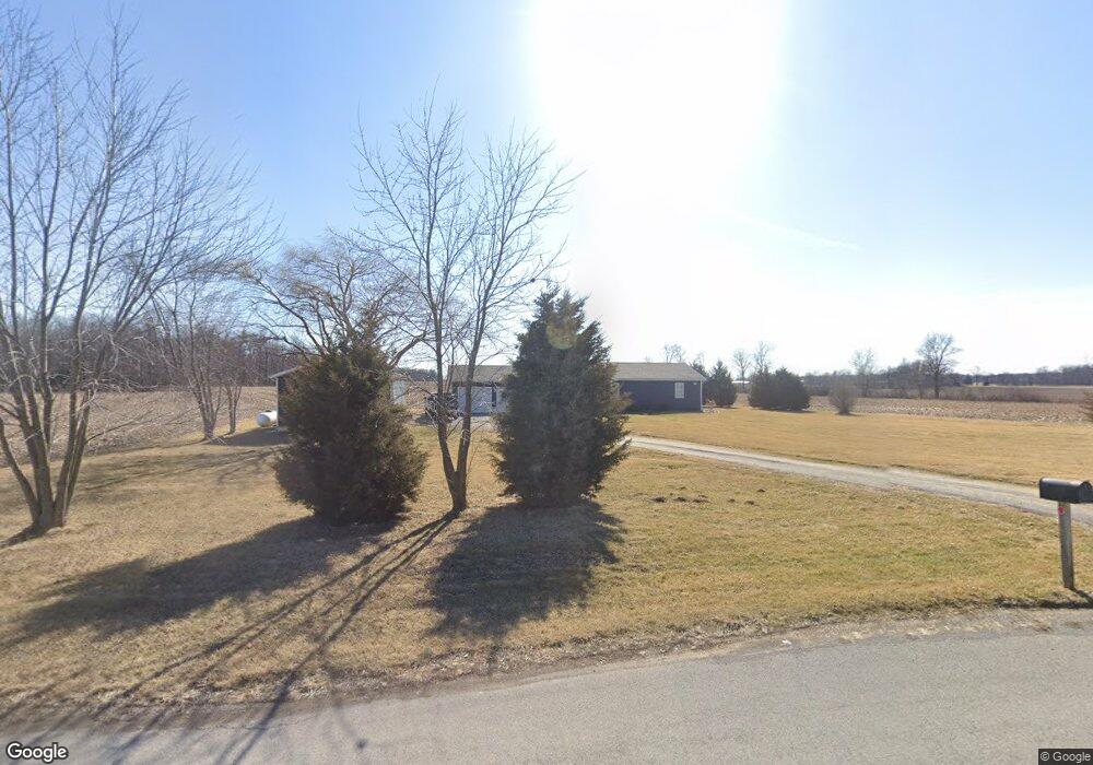
This home is located at 5324 State Route 309, Ada, OH 45810 and is currently estimated at $239,339, approximately $178 per square foot. 5324 State Route 309 is a home located in Hardin County with nearby schools including Upper Scioto Valley Elementary School, Upper Scioto Valley Middle School, and Upper Scioto Valley High School.
Ownership History
Date
Name
Owned For
Owner Type
Purchase Details
Closed on
Mar 20, 2025
Sold by
Kearns Jason R
Bought by
Ashbrook Paul E and Ashbrook Bernadette M
Current Estimated Value
Home Financials for this Owner
Home Financials are based on the most recent Mortgage that was taken out on this home.
Original Mortgage
$175,000
Outstanding Balance
$171,359
Interest Rate
6.05%
Mortgage Type
Credit Line Revolving
Estimated Equity
$67,980
Purchase Details
Closed on
Sep 28, 2023
Sold by
Gibson Kelley and Gibson Megan Lynn
Bought by
Kearns Jason
Home Financials for this Owner
Home Financials are based on the most recent Mortgage that was taken out on this home.
Original Mortgage
$165,000
Interest Rate
7.23%
Mortgage Type
New Conventional
Purchase Details
Closed on
Jun 22, 2020
Sold by
Gibson Kelley
Bought by
Gibson Kelley and Gibson Megan Lynn
Home Financials for this Owner
Home Financials are based on the most recent Mortgage that was taken out on this home.
Original Mortgage
$112,000
Interest Rate
2.8%
Mortgage Type
Future Advance Clause Open End Mortgage
Purchase Details
Closed on
Jun 22, 2017
Sold by
Buckeye Ridge Habitat For Humanity Inc
Bought by
Gibson Kelley
Home Financials for this Owner
Home Financials are based on the most recent Mortgage that was taken out on this home.
Original Mortgage
$101,650
Interest Rate
4.05%
Mortgage Type
Construction
Purchase Details
Closed on
Aug 9, 2016
Sold by
Habitat For Humanity Of Harimn County Oh
Bought by
Buckeye Ridge Habitat For Humanity Inc
Purchase Details
Closed on
Dec 11, 2008
Sold by
Habitat For Humanity
Bought by
Decker Sandra S
Home Financials for this Owner
Home Financials are based on the most recent Mortgage that was taken out on this home.
Original Mortgage
$20,000
Interest Rate
6.49%
Mortgage Type
Purchase Money Mortgage
Purchase Details
Closed on
Jun 26, 2007
Sold by
Decker Sandra S
Bought by
Habitat For Humanity Of Hardin County
Purchase Details
Closed on
Dec 10, 1999
Bought by
Decker Sandra S
Purchase Details
Closed on
Sep 8, 1994
Bought by
Shaw Bernard N and Shaw Lois M
Purchase Details
Closed on
Sep 20, 1991
Create a Home Valuation Report for This Property
The Home Valuation Report is an in-depth analysis detailing your home's value as well as a comparison with similar homes in the area
Purchase History
| Date | Buyer | Sale Price | Title Company |
|---|---|---|---|
| Ashbrook Paul E | $250,000 | None Listed On Document | |
| Kearns Jason | $225,000 | None Listed On Document | |
| Gibson Kelley | -- | Brokers Settlement Services | |
| Gibson Kelley | $98,000 | None Available | |
| Buckeye Ridge Habitat For Humanity Inc | -- | None Available | |
| Decker Sandra S | $7,000 | None Available | |
| Habitat For Humanity Of Hardin County | -- | None Available | |
| Decker Sandra S | -- | -- | |
| Shaw Bernard N | $18,800 | -- | |
| -- | $10,800 | -- |
Source: Public Records
Mortgage History
| Date | Status | Borrower | Loan Amount |
|---|---|---|---|
| Open | Ashbrook Paul E | $175,000 | |
| Previous Owner | Kearns Jason | $165,000 | |
| Previous Owner | Gibson Kelley | $112,000 | |
| Previous Owner | Gibson Kelley | $101,650 | |
| Previous Owner | Decker Sandra S | $20,000 |
Source: Public Records
Tax History
| Year | Tax Paid | Tax Assessment Tax Assessment Total Assessment is a certain percentage of the fair market value that is determined by local assessors to be the total taxable value of land and additions on the property. | Land | Improvement |
|---|---|---|---|---|
| 2024 | $1,573 | $45,940 | $5,990 | $39,950 |
| 2023 | $1,572 | $45,940 | $5,990 | $39,950 |
| 2022 | $1,438 | $36,280 | $4,190 | $32,090 |
| 2021 | $1,523 | $36,280 | $4,190 | $32,090 |
| 2020 | $1,543 | $36,280 | $4,190 | $32,090 |
| 2019 | $1,166 | $29,680 | $3,990 | $25,690 |
| 2018 | $1,172 | $29,680 | $3,990 | $25,690 |
| 2017 | $1,035 | $29,680 | $3,990 | $25,690 |
| 2016 | $921 | $26,010 | $3,490 | $22,520 |
| 2015 | $889 | $26,010 | $3,490 | $22,520 |
| 2014 | $889 | $26,010 | $3,490 | $22,520 |
| 2013 | $1,068 | $28,130 | $3,490 | $24,640 |
Source: Public Records
Map
Nearby Homes
- 501 Elm St
- 707 Elm St
- 2864 Ohio 309
- 2959 County Road 60
- 318 Willeke Ave
- 803 N Front St
- 5594 County Road 35
- 303 N Front St
- 203 Belmont St
- 820 S Main St
- 722 S Johnson St
- 1706 County Road 80
- 710 S Main St
- 510 E Lehr Ave Unit 510R
- 314 E University Ave
- 308-310 S Simon St
- 1669 County Road 92
- 211 S Main St
- 210 N Gilbert St
- 420 N Simon St
- 5324 Ohio 309
- 5436 State Route 309
- 5442 State Route 309
- 5442 Sr
- 5442 Ohio 309
- 5429 State Route 309
- 6750 State Route 195
- 6751 State Route 195
- 6804 State Route 195
- 6804 Ohio 195
- 6545 State Route 195
- 6545 State Route 195
- 6845 State Route 195
- 6867 State Route 195
- 6935 State Route 195
- 6978 State Route 195
- 4967 County Rd
- 6978 Sr
Your Personal Tour Guide
Ask me questions while you tour the home.