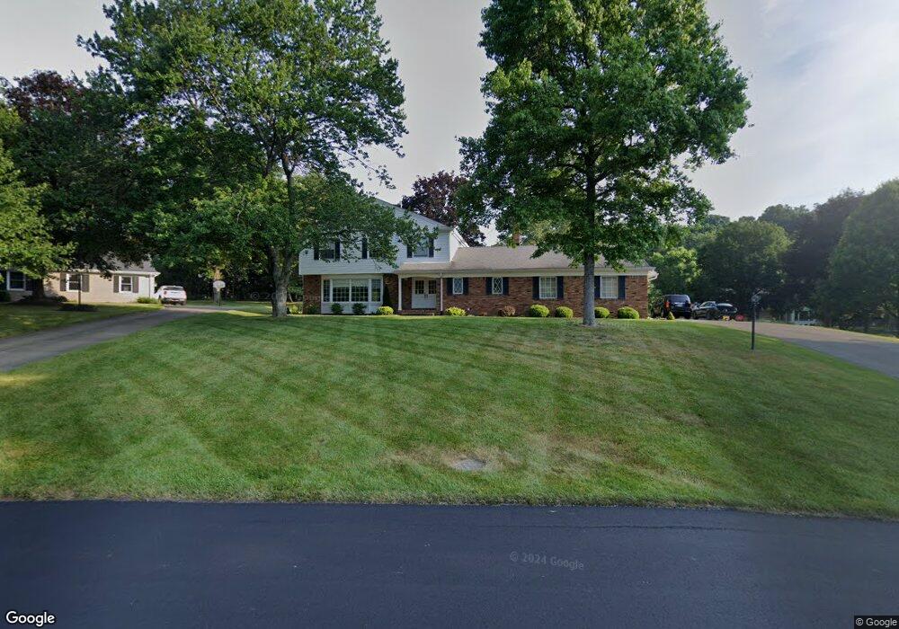
5327 Saint Andrews St NW Canton, OH 44708
Estimated Value: $353,000 - $412,000
4
Beds
3
Baths
2,676
Sq Ft
$145/Sq Ft
Est. Value
About This Home
This home is located at 5327 Saint Andrews St NW, Canton, OH 44708 and is currently estimated at $388,874, approximately $145 per square foot. 5327 Saint Andrews St NW is a home located in Stark County with nearby schools including Lake Cable Elementary School, Jackson Memorial Middle School, and Jackson High School.
Ownership History
Date
Name
Owned For
Owner Type
Purchase Details
Closed on
May 24, 2004
Sold by
Truman Norrine
Bought by
Soehnlen Emil A and Soehnlen Tamara K
Current Estimated Value
Home Financials for this Owner
Home Financials are based on the most recent Mortgage that was taken out on this home.
Original Mortgage
$166,000
Interest Rate
5.85%
Mortgage Type
Balloon
Create a Home Valuation Report for This Property
The Home Valuation Report is an in-depth analysis detailing your home's value as well as a comparison with similar homes in the area
Home Values in the Area
Average Home Value in this Area
Purchase History
| Date | Buyer | Sale Price | Title Company |
|---|---|---|---|
| Soehnlen Emil A | $226,000 | -- |
Source: Public Records
Mortgage History
| Date | Status | Borrower | Loan Amount |
|---|---|---|---|
| Closed | Soehnlen Emil A | $166,000 |
Source: Public Records
Tax History Compared to Growth
Tax History
| Year | Tax Paid | Tax Assessment Tax Assessment Total Assessment is a certain percentage of the fair market value that is determined by local assessors to be the total taxable value of land and additions on the property. | Land | Improvement |
|---|---|---|---|---|
| 2025 | -- | $130,840 | $46,240 | $84,600 |
| 2024 | -- | $130,840 | $46,240 | $84,600 |
| 2023 | $5,053 | $101,540 | $39,030 | $62,510 |
| 2022 | $2,514 | $101,540 | $39,030 | $62,510 |
| 2021 | $5,047 | $101,540 | $39,030 | $62,510 |
| 2020 | $4,697 | $86,840 | $33,670 | $53,170 |
| 2019 | $4,524 | $86,840 | $33,670 | $53,170 |
| 2018 | $4,547 | $86,840 | $33,670 | $53,170 |
| 2017 | $4,338 | $78,820 | $25,760 | $53,060 |
| 2016 | $4,696 | $78,820 | $25,760 | $53,060 |
| 2015 | $4,420 | $78,820 | $25,760 | $53,060 |
| 2014 | $302 | $73,370 | $23,980 | $49,390 |
| 2013 | $2,117 | $73,370 | $23,980 | $49,390 |
Source: Public Records
Map
Nearby Homes
- 5179 Birkdale St NW
- 2421 Brentwood Rd NW
- 0 Birkdale St NW Unit 5122150
- 0 Dunkeith Dr NW Unit 5083845
- 2742 Dunkeith Dr NW
- 3273 Dellwood Ave NW
- 5851 Hawks Nest Cir NW
- 0 Hills And Dales Rd NW Unit 5138797
- 5853 Hawks Nest Cir NW
- 5845 Hawks Nest Cir NW
- 2622 Glenmont Rd NW
- 5843 Hawks Nest Cir NW
- 5867 Hawks Nest Cir NW
- 1805 Dunkeith Dr NW
- 5848 Hawks Nest Cir NW
- 5869 Hawks Nest Cir NW
- 5846 Hawks Nest Cir NW
- 5875 Hawks Nest Cir NW
- 5877 Hawks Nest Cir NW
- 5879 Hawks Nest Cir NW
- 5333 Saint Andrews St NW
- 5291 Saint Andrews St NW
- 5330 Fitzjames Dr NW
- 3200 Dunbarton Ave NW
- 5339 Saint Andrews St NW
- 5340 Saint Andrews St NW
- 5352 Fitzjames Dr NW
- Lot #2 Fitzjames Dr NW
- 5282 Saint Andrews St NW
- 5345 Saint Andrews St NW
- 2868 Dunbarton Ave NW
- 2890 Dunbarton Ave NW
- 2910 Dunbarton Ave NW
- 3201 Dunbarton Ave NW
- 5333 Fitzjames Dr NW
- 5224 Saint Andrews St NW
- 5350 Saint Andrews St NW
- 2838 Dunbarton Ave NW
- 5351 Saint Andrews St NW
- 5355 Fitzjames Dr NW