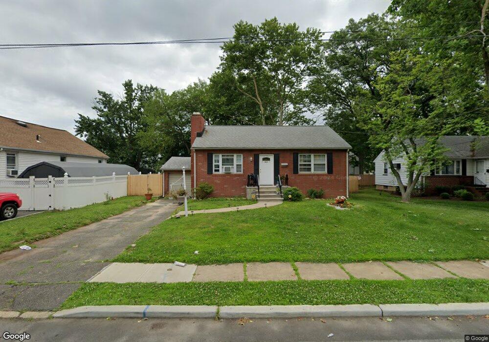
533 2nd Ave North Brunswick, NJ 08902
Estimated Value: $419,504 - $481,000
--
Bed
--
Bath
924
Sq Ft
$485/Sq Ft
Est. Value
About This Home
This home is located at 533 2nd Ave, North Brunswick, NJ 08902 and is currently estimated at $448,376, approximately $485 per square foot. 533 2nd Ave is a home located in Middlesex County with nearby schools including Parsons Elementary School, Linwood Middle School, and North Brunswick Twp High School.
Ownership History
Date
Name
Owned For
Owner Type
Purchase Details
Closed on
Jun 29, 2016
Sold by
Albert Robert and Albert Eileen
Bought by
Camamis Peter Michael
Current Estimated Value
Purchase Details
Closed on
Jan 28, 1992
Bought by
Albert Robert and Albert Eileen
Create a Home Valuation Report for This Property
The Home Valuation Report is an in-depth analysis detailing your home's value as well as a comparison with similar homes in the area
Home Values in the Area
Average Home Value in this Area
Purchase History
| Date | Buyer | Sale Price | Title Company |
|---|---|---|---|
| Camamis Peter Michael | $134,180 | None Available | |
| Albert Robert | -- | -- |
Source: Public Records
Tax History Compared to Growth
Tax History
| Year | Tax Paid | Tax Assessment Tax Assessment Total Assessment is a certain percentage of the fair market value that is determined by local assessors to be the total taxable value of land and additions on the property. | Land | Improvement |
|---|---|---|---|---|
| 2025 | $8,110 | $128,000 | $59,000 | $69,000 |
| 2024 | $7,964 | $128,000 | $59,000 | $69,000 |
| 2023 | $7,964 | $128,000 | $59,000 | $69,000 |
| 2022 | $7,693 | $128,000 | $59,000 | $69,000 |
| 2021 | $5,605 | $128,000 | $59,000 | $69,000 |
| 2020 | $7,406 | $128,000 | $59,000 | $69,000 |
| 2019 | $7,255 | $128,000 | $59,000 | $69,000 |
| 2018 | $7,012 | $126,300 | $59,000 | $67,300 |
| 2017 | $6,888 | $126,300 | $59,000 | $67,300 |
| 2016 | $6,744 | $126,300 | $59,000 | $67,300 |
| 2015 | $6,629 | $126,300 | $59,000 | $67,300 |
| 2014 | $6,555 | $126,300 | $59,000 | $67,300 |
Source: Public Records
Map
Nearby Homes
- 803 Nassau St
- 50 Columbia Ave
- 44 S Ward St
- 80A Larch Ave
- 80 Larch Ave
- 37 Hazelhurst St
- 82 S Ward St
- 1224 Dogwood Ct
- 18 N Talmadge St
- 15 N Talmadge St
- 790 Cranbury Cross Rd
- 79 Booream Ave
- 147 Rutgers St
- 7 Oakwood Place
- 122 Lawrence St Unit 26
- 4 Graulich Dr
- 640 Livingston Ave
- 855 Newton St
- 721 Livingston Ave
- 988 Elmer Place