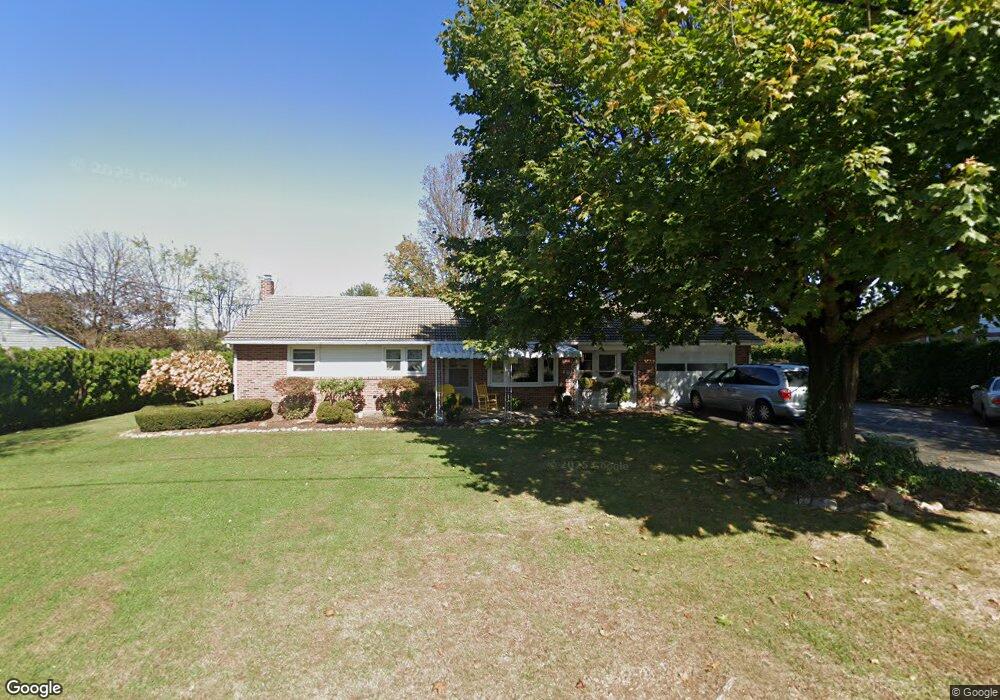
533 Butter Ln Leesport, PA 19533
Bern NeighborhoodEstimated Value: $242,727 - $293,000
3
Beds
2
Baths
1,124
Sq Ft
$235/Sq Ft
Est. Value
About This Home
This home is located at 533 Butter Ln, Leesport, PA 19533 and is currently estimated at $264,432, approximately $235 per square foot. 533 Butter Ln is a home located in Berks County with nearby schools including Schuylkill Valley Elementary School, Schuylkill Valley Middle School, and Schuylkill Valley High School.
Ownership History
Date
Name
Owned For
Owner Type
Purchase Details
Closed on
Jul 11, 2014
Sold by
Worrell Mathew L and Worrell Renee C
Bought by
Worrell Mathew L and Worrell Renee C
Current Estimated Value
Home Financials for this Owner
Home Financials are based on the most recent Mortgage that was taken out on this home.
Original Mortgage
$69,000
Outstanding Balance
$20,922
Interest Rate
3.23%
Mortgage Type
New Conventional
Estimated Equity
$243,510
Purchase Details
Closed on
Apr 13, 1995
Bought by
Worrell Mathew L and Grim Renee C
Create a Home Valuation Report for This Property
The Home Valuation Report is an in-depth analysis detailing your home's value as well as a comparison with similar homes in the area
Home Values in the Area
Average Home Value in this Area
Purchase History
| Date | Buyer | Sale Price | Title Company |
|---|---|---|---|
| Worrell Mathew L | -- | None Available | |
| Worrell Mathew L | $104,000 | -- |
Source: Public Records
Mortgage History
| Date | Status | Borrower | Loan Amount |
|---|---|---|---|
| Open | Worrell Mathew L | $69,000 |
Source: Public Records
Tax History Compared to Growth
Tax History
| Year | Tax Paid | Tax Assessment Tax Assessment Total Assessment is a certain percentage of the fair market value that is determined by local assessors to be the total taxable value of land and additions on the property. | Land | Improvement |
|---|---|---|---|---|
| 2025 | $1,102 | $70,300 | $22,800 | $47,500 |
| 2024 | $2,863 | $70,300 | $22,800 | $47,500 |
| 2023 | $2,788 | $70,300 | $22,800 | $47,500 |
| 2022 | $2,788 | $70,300 | $22,800 | $47,500 |
| 2021 | $2,788 | $70,300 | $22,800 | $47,500 |
| 2020 | $2,788 | $70,300 | $22,800 | $47,500 |
| 2019 | $2,718 | $70,300 | $22,800 | $47,500 |
| 2018 | $2,718 | $70,300 | $22,800 | $47,500 |
| 2017 | $2,698 | $70,300 | $22,800 | $47,500 |
| 2016 | $774 | $70,300 | $22,800 | $47,500 |
| 2015 | $774 | $70,300 | $22,800 | $47,500 |
| 2014 | $774 | $70,300 | $22,800 | $47,500 |
Source: Public Records
Map
Nearby Homes
- 1030 Chestnut St
- 731 W Main St
- 678 Schuylkill Hill Rd
- 482 Data Rd
- 0 Woodland Dr
- 32 Canal St
- 70 N Centre Ave
- 405 Indian Manor Dr
- 1064 Mahlon Dr
- 0 Mahlon Dr
- 1645 Fairview Dr
- 332 Kindt Corner Rd
- 195 Sunglo Dr Unit (LOT 125)
- 739 Boar Rd
- 188 Ida Red Dr
- 180 Ida Red Dr
- 186 Ida Red Dr
- 182 Ida Red Dr Unit (LOT 154)
- 168 Ida Red Dr Unit (LOT 160)
- 190 Ida Red Dr Unit (LOT 150)