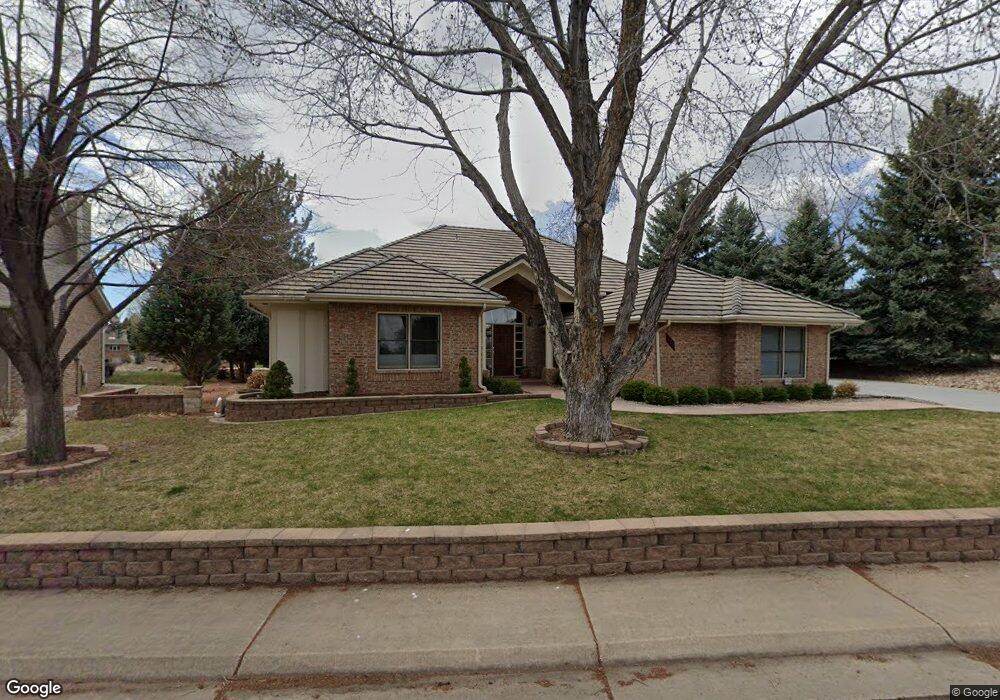
533 Coal Creek Ln Louisville, CO 80027
Estimated Value: $1,199,000 - $1,230,000
3
Beds
3
Baths
2,435
Sq Ft
$501/Sq Ft
Est. Value
About This Home
This home is located at 533 Coal Creek Ln, Louisville, CO 80027 and is currently estimated at $1,218,764, approximately $500 per square foot. 533 Coal Creek Ln is a home located in Boulder County with nearby schools including Monarch K-8 School, Monarch High School, and The Goddard School - Louisville.
Ownership History
Date
Name
Owned For
Owner Type
Purchase Details
Closed on
Jun 7, 2011
Sold by
Becker Bruce R and Becker Patricia D
Bought by
Becker Bruce R
Current Estimated Value
Purchase Details
Closed on
Apr 7, 2011
Sold by
The Bruce R Becker Trust
Bought by
Becker Bruce R
Purchase Details
Closed on
Nov 13, 1996
Sold by
Patricia D Becker Trust
Bought by
The Bruce R Becker Trust
Purchase Details
Closed on
Jul 13, 1992
Bought by
Becker Bruce R
Purchase Details
Closed on
Feb 13, 1992
Bought by
Becker Bruce R
Purchase Details
Closed on
Apr 30, 1990
Bought by
Becker Bruce R
Create a Home Valuation Report for This Property
The Home Valuation Report is an in-depth analysis detailing your home's value as well as a comparison with similar homes in the area
Home Values in the Area
Average Home Value in this Area
Purchase History
| Date | Buyer | Sale Price | Title Company |
|---|---|---|---|
| Becker Bruce R | -- | None Available | |
| Becker Bruce R | -- | None Available | |
| The Bruce R Becker Trust | -- | -- | |
| Becker Bruce R | $265,000 | -- | |
| Becker Bruce R | -- | -- | |
| Becker Bruce R | $245,000 | -- |
Source: Public Records
Tax History Compared to Growth
Tax History
| Year | Tax Paid | Tax Assessment Tax Assessment Total Assessment is a certain percentage of the fair market value that is determined by local assessors to be the total taxable value of land and additions on the property. | Land | Improvement |
|---|---|---|---|---|
| 2025 | $6,524 | $78,306 | $45,356 | $32,950 |
| 2024 | $6,524 | $78,306 | $45,356 | $32,950 |
| 2023 | $6,414 | $79,288 | $46,712 | $36,260 |
| 2022 | $5,436 | $63,440 | $35,014 | $28,426 |
| 2021 | $5,505 | $66,595 | $36,758 | $29,837 |
| 2020 | $4,887 | $59,367 | $32,962 | $26,405 |
| 2019 | $4,817 | $59,367 | $32,962 | $26,405 |
| 2018 | $4,469 | $57,226 | $21,312 | $35,914 |
| 2017 | $4,380 | $63,266 | $23,562 | $39,704 |
| 2016 | $4,079 | $54,327 | $23,562 | $30,765 |
| 2015 | $3,866 | $48,261 | $14,487 | $33,774 |
| 2014 | $3,522 | $48,261 | $14,487 | $33,774 |
Source: Public Records
Map
Nearby Homes
- 539 Coal Creek Ln
- 567 Manorwood Ln
- 203 Springs Dr
- 362 S Taft Ct Unit 108
- 284 S Taft Ct Unit 76
- 749 Apple Ct
- 641 W Dahlia St
- 323 S Taft Ct Unit 26
- 305 S Taft Ct Unit 33
- 279 S Taft Ct Unit 53
- 159 S Polk Ave
- 546 Ridgeview Dr
- 716 Club Cir
- 572 Ridgeview Dr
- 620 Ridgeview Dr
- 499 Muirfield Cir
- 497 Muirfield Cir
- 118 S Tanager Ct
- 730 Copper Ln Unit 106
- 494 Muirfield Cir
- 530 Fairfield Ln
- 535 Fairfield Ln
- 550 Fairfield Ln
- 541 Fairfield Ln
- 562 Fairfield Ln
- 553 Fairfield Ln
- 450 Fairfield Ln
- 426 Fairfield Ln
- 424 Fairfield Ln
- 578 Fairfield Ln
- 567 Fairfield Ln
- 422 Fairfield Ln
- 428 Fairfield Ln
- 129 Doudy Ct
- 406 Fairfield Ln
- 579 Fairfield Ln
- 420 Fairfield Ln
- 533 Manorwood Ln
- 580 Fairfield Ln
- 527 Manorwood Ln