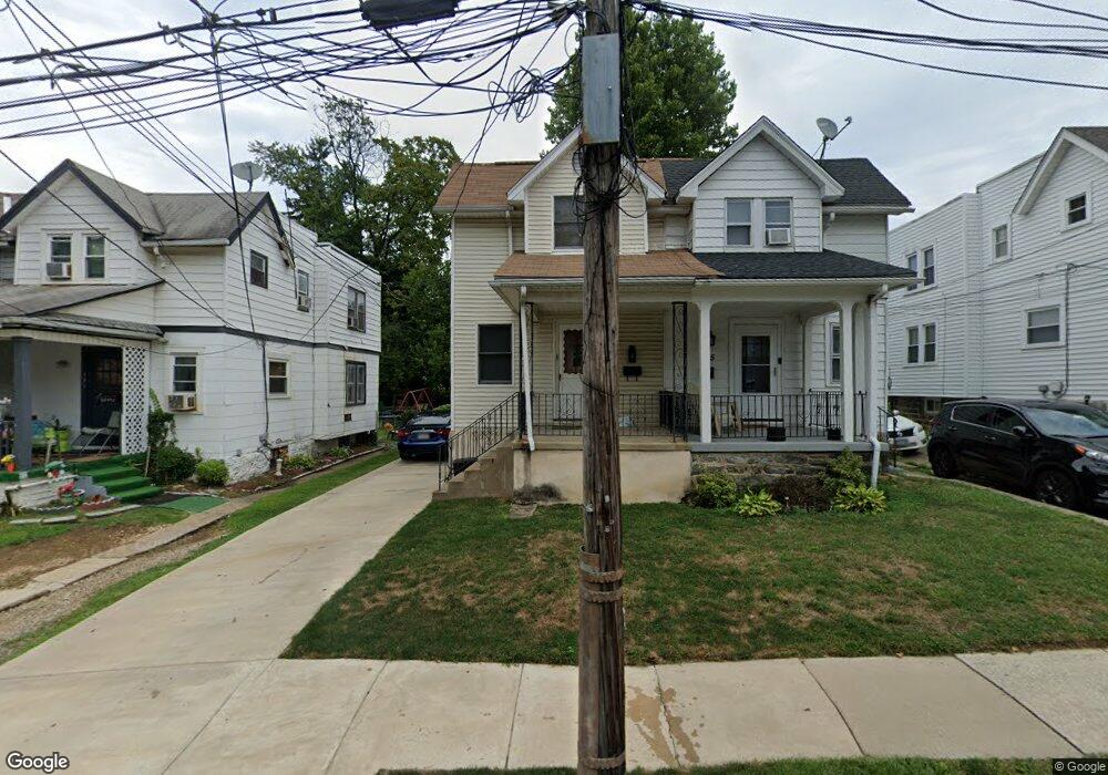
533 Cypress St Lansdowne, PA 19050
Estimated Value: $209,145 - $228,000
3
Beds
1
Bath
1,158
Sq Ft
$192/Sq Ft
Est. Value
About This Home
This home is located at 533 Cypress St, Lansdowne, PA 19050 and is currently estimated at $222,036, approximately $191 per square foot. 533 Cypress St is a home located in Delaware County with nearby schools including Evans Elementary School, Penn Wood Middle School, and Penn Wood High School - Cypress Street Campus.
Ownership History
Date
Name
Owned For
Owner Type
Purchase Details
Closed on
Nov 30, 1995
Sold by
Gilhool Thomas Michael and Gilhool Emma R
Bought by
Maloney William
Current Estimated Value
Home Financials for this Owner
Home Financials are based on the most recent Mortgage that was taken out on this home.
Original Mortgage
$71,963
Outstanding Balance
$1,472
Interest Rate
7.37%
Mortgage Type
FHA
Estimated Equity
$220,564
Create a Home Valuation Report for This Property
The Home Valuation Report is an in-depth analysis detailing your home's value as well as a comparison with similar homes in the area
Home Values in the Area
Average Home Value in this Area
Purchase History
| Date | Buyer | Sale Price | Title Company |
|---|---|---|---|
| Maloney William | $72,000 | T A Title Insurance Company |
Source: Public Records
Mortgage History
| Date | Status | Borrower | Loan Amount |
|---|---|---|---|
| Open | Maloney William | $71,963 |
Source: Public Records
Tax History Compared to Growth
Tax History
| Year | Tax Paid | Tax Assessment Tax Assessment Total Assessment is a certain percentage of the fair market value that is determined by local assessors to be the total taxable value of land and additions on the property. | Land | Improvement |
|---|---|---|---|---|
| 2025 | $4,127 | $96,650 | $33,280 | $63,370 |
| 2024 | $4,127 | $96,650 | $33,280 | $63,370 |
| 2023 | $3,748 | $96,650 | $33,280 | $63,370 |
| 2022 | $3,574 | $96,650 | $33,280 | $63,370 |
| 2021 | $5,405 | $96,650 | $33,280 | $63,370 |
| 2020 | $3,425 | $54,850 | $19,200 | $35,650 |
| 2019 | $3,365 | $54,850 | $19,200 | $35,650 |
| 2018 | $3,318 | $54,850 | $0 | $0 |
| 2017 | $3,249 | $54,850 | $0 | $0 |
| 2016 | $301 | $54,850 | $0 | $0 |
| 2015 | $301 | $54,850 | $0 | $0 |
| 2014 | $301 | $54,850 | $0 | $0 |
Source: Public Records
Map
Nearby Homes
- 536 Cypress St
- 407 Church Ln
- 503 Bonsall Ave
- 435 Bonsall Ave
- 537 Orchard Ave
- 1016 Whitby Ave
- 530 Orchard Ave
- 702 Cedar Ave
- 603 Penn St
- 1104 Baily Rd
- 711 Yeadon Ave Unit 1
- 740 Church Ln
- 1212 S Millick St
- 722 Yeadon Ave
- 6013 Baltimore Ave
- 1201 S Millick St
- 6030 Cedarhurst St
- 7026 Atlantic Ave
- 1214 S 60th St
- 6026 Baltimore Ave