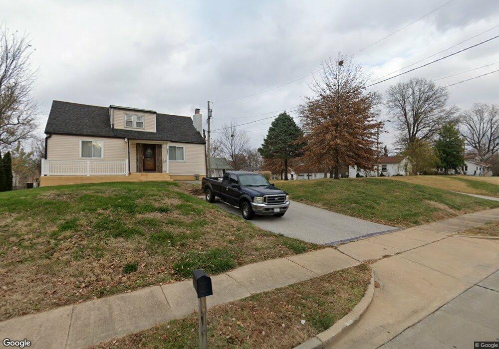
533 Forder Rd Saint Louis, MO 63129
Mehlville NeighborhoodEstimated Value: $236,000 - $287,000
2
Beds
1
Bath
1,202
Sq Ft
$211/Sq Ft
Est. Value
About This Home
This home is located at 533 Forder Rd, Saint Louis, MO 63129 and is currently estimated at $253,403, approximately $210 per square foot. 533 Forder Rd is a home located in St. Louis County with nearby schools including Oakville Elementary School, Bernard Middle School, and Oakville Senior High School.
Ownership History
Date
Name
Owned For
Owner Type
Purchase Details
Closed on
Jan 18, 2022
Sold by
Dooley Judith F
Bought by
Dooley Thomas B and Dooley Kathryn A
Current Estimated Value
Home Financials for this Owner
Home Financials are based on the most recent Mortgage that was taken out on this home.
Original Mortgage
$160,000
Outstanding Balance
$125,885
Interest Rate
2.33%
Mortgage Type
New Conventional
Estimated Equity
$127,518
Purchase Details
Closed on
May 22, 2002
Sold by
Dooley Judith F
Bought by
Dooley Thomas Bernard
Create a Home Valuation Report for This Property
The Home Valuation Report is an in-depth analysis detailing your home's value as well as a comparison with similar homes in the area
Home Values in the Area
Average Home Value in this Area
Purchase History
| Date | Buyer | Sale Price | Title Company |
|---|---|---|---|
| Dooley Thomas B | -- | Freedom Title | |
| Dooley Thomas Bernard | -- | -- |
Source: Public Records
Mortgage History
| Date | Status | Borrower | Loan Amount |
|---|---|---|---|
| Open | Dooley Thomas B | $160,000 |
Source: Public Records
Tax History Compared to Growth
Tax History
| Year | Tax Paid | Tax Assessment Tax Assessment Total Assessment is a certain percentage of the fair market value that is determined by local assessors to be the total taxable value of land and additions on the property. | Land | Improvement |
|---|---|---|---|---|
| 2025 | $2,338 | $39,540 | $29,870 | $9,670 |
| 2024 | $2,338 | $34,640 | $12,810 | $21,830 |
| 2023 | $2,308 | $34,640 | $12,810 | $21,830 |
| 2022 | $1,892 | $28,480 | $13,890 | $14,590 |
| 2021 | $1,832 | $28,480 | $13,890 | $14,590 |
| 2020 | $1,789 | $26,450 | $11,020 | $15,430 |
| 2019 | $1,784 | $26,450 | $11,020 | $15,430 |
| 2018 | $1,645 | $21,990 | $9,770 | $12,220 |
| 2017 | $1,642 | $21,990 | $9,770 | $12,220 |
| 2016 | $1,238 | $15,810 | $7,200 | $8,610 |
| 2015 | $1,138 | $15,810 | $7,200 | $8,610 |
| 2014 | $1,723 | $23,910 | $6,370 | $17,540 |
Source: Public Records
Map
Nearby Homes
- 4301 Heinle Dr
- 525 Fairwick Dr
- 643 Tanya Court Dr
- 5126 Firelight Ct
- 517 Aqua Ridge Dr
- 2838 Flintwood Dr
- 337 Saddle Back Dr
- 4061 Morningview Ct
- 5228 Kings Park Dr
- 4101 Forder Circle Dr
- 4130 Saddle Back Ct
- 5046 Lomar Ln
- 4322 Martyridge Dr
- 826 Crosswood Ct
- 4460 Telegraph Rd
- 2675 Victron Dr
- 141 Stallard Ln
- 4812 Idecker Ridge
- 144 Martigney Dr
- 4555 Burncoate Dr