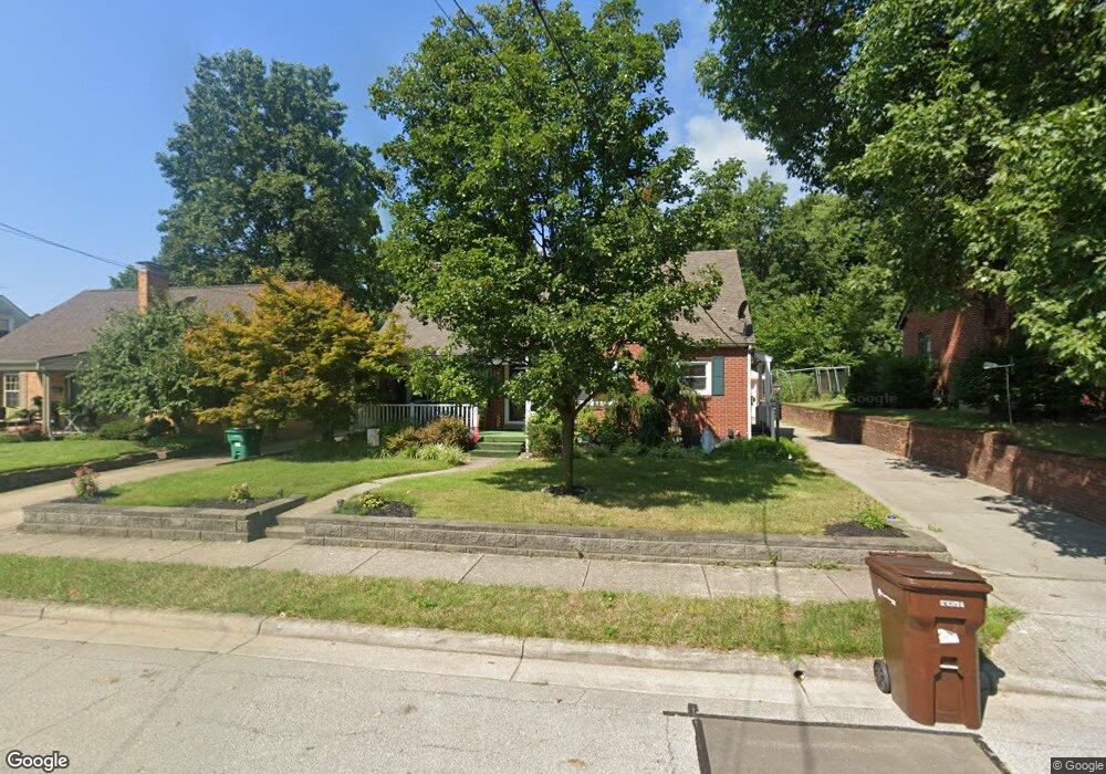
533 Hayes St Greendale, IN 47025
Estimated Value: $226,000 - $250,000
2
Beds
2
Baths
1,033
Sq Ft
$231/Sq Ft
Est. Value
About This Home
This home is located at 533 Hayes St, Greendale, IN 47025 and is currently estimated at $238,705, approximately $231 per square foot. 533 Hayes St is a home located in Dearborn County with nearby schools including Lawrenceburg Primary School, Central Elementary School, and Greendale Middle School.
Ownership History
Date
Name
Owned For
Owner Type
Purchase Details
Closed on
Sep 5, 2018
Sold by
Messer James B
Bought by
Tsuleff Steven C and Tsuleff Kar A
Current Estimated Value
Home Financials for this Owner
Home Financials are based on the most recent Mortgage that was taken out on this home.
Original Mortgage
$173,850
Outstanding Balance
$126,630
Interest Rate
4.5%
Mortgage Type
New Conventional
Estimated Equity
$112,075
Purchase Details
Closed on
Feb 1, 2012
Sold by
Messer Katherine A and Messer Kathy
Bought by
Messer James B and Messer Katherine A
Create a Home Valuation Report for This Property
The Home Valuation Report is an in-depth analysis detailing your home's value as well as a comparison with similar homes in the area
Home Values in the Area
Average Home Value in this Area
Purchase History
| Date | Buyer | Sale Price | Title Company |
|---|---|---|---|
| Tsuleff Steven C | $183,000 | Weiler Law Offices, Inc | |
| Messer James B | -- | -- |
Source: Public Records
Mortgage History
| Date | Status | Borrower | Loan Amount |
|---|---|---|---|
| Open | Tsuleff Steven C | $173,850 |
Source: Public Records
Tax History
| Year | Tax Paid | Tax Assessment Tax Assessment Total Assessment is a certain percentage of the fair market value that is determined by local assessors to be the total taxable value of land and additions on the property. | Land | Improvement |
|---|---|---|---|---|
| 2025 | $2,118 | $214,200 | $24,500 | $189,700 |
| 2024 | $2,118 | $211,800 | $24,500 | $187,300 |
| 2023 | $1,947 | $194,700 | $24,500 | $170,200 |
| 2022 | $1,823 | $182,300 | $24,500 | $157,800 |
| 2021 | $1,750 | $175,000 | $24,500 | $150,500 |
| 2020 | $1,740 | $174,000 | $24,500 | $149,500 |
| 2019 | $1,740 | $174,000 | $24,500 | $149,500 |
| 2018 | $1,473 | $147,300 | $24,500 | $122,800 |
| 2017 | $1,295 | $129,500 | $24,500 | $105,000 |
| 2016 | $1,295 | $129,500 | $24,500 | $105,000 |
| 2014 | $1,261 | $126,100 | $24,500 | $101,600 |
Source: Public Records
Map
Nearby Homes
- 537 Hayes St
- 315 Diehl Dr
- 408 Sheldon St
- 237 Cook Ave
- 51 Billups Dr
- 151 Brown St
- 0 Sunset Dr Unit 204596
- 0 Sunset Dr Unit 206904
- 130 Parkside Ave
- 10 Dearborn Ct
- 100 Catalpa Ave
- 613 River Ridge
- 606 River Ridge
- 614 River Ridge
- 204 E Wind Ln
- 1005 Nowlin Ave
- 1009 Nowlin Ave
- 537 Front St
- 307 Westwind Ln
- 213 Westwind Ln
Your Personal Tour Guide
Ask me questions while you tour the home.