Estimated Value: $257,771 - $341,000
Studio
--
Bath
2,497
Sq Ft
$122/Sq Ft
Est. Value
About This Home
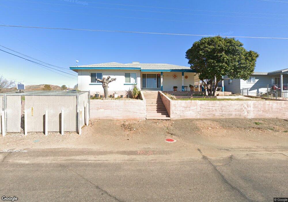
This home is located at 533 N High St, Globe, AZ 85501 and is currently estimated at $304,443, approximately $121 per square foot. 533 N High St is a home with nearby schools including Copper Rim Elementary School, High Desert Middle School, and Globe High School.
Ownership History
Date
Name
Owned For
Owner Type
Purchase Details
Closed on
May 18, 2012
Sold by
Fitzgerald Jack D and Fitzgerald Lanita M
Bought by
Guerrero Michael R
Current Estimated Value
Home Financials for this Owner
Home Financials are based on the most recent Mortgage that was taken out on this home.
Original Mortgage
$123,226
Outstanding Balance
$81,977
Interest Rate
3.37%
Mortgage Type
FHA
Estimated Equity
$222,466
Purchase Details
Closed on
Mar 13, 2012
Sold by
Fitzgerald Jack D and Fitzgerald Lanita M
Bought by
Fitzgerald Jack D and Fitzgerald Lanita M
Create a Home Valuation Report for This Property
The Home Valuation Report is an in-depth analysis detailing your home's value as well as a comparison with similar homes in the area
Home Values in the Area
Average Home Value in this Area
Purchase History
| Date | Buyer | Sale Price | Title Company |
|---|---|---|---|
| Guerrero Michael R | $125,500 | Pioneer Title Agency | |
| Fitzgerald Jack D | -- | None Available |
Source: Public Records
Mortgage History
| Date | Status | Borrower | Loan Amount |
|---|---|---|---|
| Open | Guerrero Michael R | $123,226 |
Source: Public Records
Tax History
| Year | Tax Paid | Tax Assessment Tax Assessment Total Assessment is a certain percentage of the fair market value that is determined by local assessors to be the total taxable value of land and additions on the property. | Land | Improvement |
|---|---|---|---|---|
| 2026 | $1,958 | $31,169 | $1,082 | $30,087 |
| 2025 | $1,958 | -- | -- | -- |
| 2024 | $1,821 | $25,281 | $913 | $24,368 |
| 2023 | $1,821 | $18,775 | $753 | $18,022 |
| 2022 | $1,786 | $16,187 | $753 | $15,434 |
| 2021 | $1,823 | $16,187 | $753 | $15,434 |
| 2020 | $1,706 | $0 | $0 | $0 |
| 2019 | $1,682 | $0 | $0 | $0 |
| 2018 | $1,623 | $0 | $0 | $0 |
| 2017 | $1,577 | $0 | $0 | $0 |
| 2016 | $1,408 | $0 | $0 | $0 |
| 2015 | $1,308 | $0 | $0 | $0 |
Source: Public Records
Map
Nearby Homes
- 601 N Sutherland St
- 339 N Devereaux St
- 523 E Copper Hills Rd
- 501 E Mesquite St
- 840 N Devereaux St
- 415 N Hill St
- 247 N Devereaux St
- 1021 High
- 1069 N Devereaux St
- 595 N Fourth St
- 610 N Broad St
- 300 N Broad St
- 425 E North St
- 254 N Broad St
- 267 E North St
- 372 N Fifth St
- 877 E Sycamore St
- 227 S First St
- 258 S Sutherland St
- 350 E Cottonwood St
- xxx N High St Unit 1
- 531 N High St
- 478 E Apache St
- 543 N High St
- 507 E Apache St
- 578 E Apache St
- 529 N High St
- 475 E Apache St
- 663 N High St
- 588 E Apache St
- 547 E Kline St
- 453 E Kline St
- 519 N High St
- 647 N High St
- 408 E Apache St
- 585 E Kline St
- 459 E Apache St
- 673 N High St
- 519 N Devereaux St
- 405 E Apache St
Your Personal Tour Guide
Ask me questions while you tour the home.