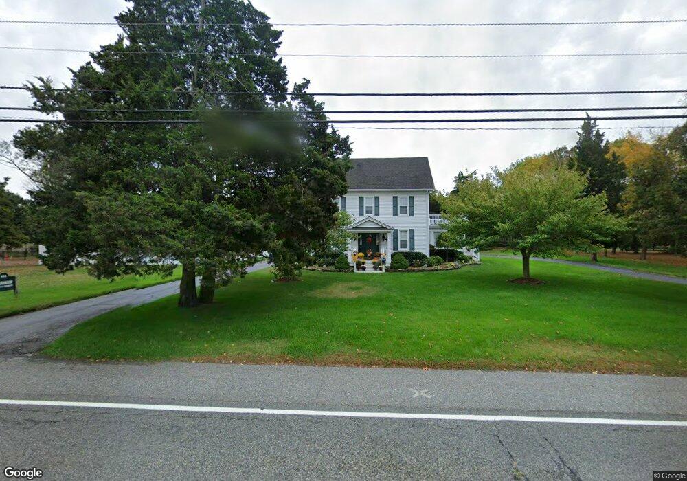
533 Route Us 9 N Marmora, NJ 08223
Estimated Value: $577,552 - $733,000
--
Bed
--
Bath
2,688
Sq Ft
$247/Sq Ft
Est. Value
About This Home
This home is located at 533 Route Us 9 N, Marmora, NJ 08223 and is currently estimated at $662,888, approximately $246 per square foot. 533 Route Us 9 N is a home located in Cape May County with nearby schools including Upper Township Primary School, Upper Township Elementary School, and Upper Township Middle School.
Ownership History
Date
Name
Owned For
Owner Type
Purchase Details
Closed on
Sep 15, 2025
Sold by
Johnson Judi G
Bought by
Johnson Judi G
Current Estimated Value
Purchase Details
Closed on
Apr 25, 2016
Sold by
Johnson Samuel L and Johnson Judi G
Bought by
Johnson Samuel L and Johnson Judi G
Purchase Details
Closed on
May 4, 1990
Sold by
Beyel Daniel and Cheryl Et Als
Bought by
Atlantic City Electric Co
Purchase Details
Closed on
Apr 2, 1990
Sold by
Morris Morris W and Morris C
Bought by
Johnson Samuel and Johnson Patricia
Purchase Details
Closed on
Nov 6, 1989
Sold by
Moyer Helen By Attn Novickiv
Bought by
Beyel Daniel and Beyel Cheryl
Create a Home Valuation Report for This Property
The Home Valuation Report is an in-depth analysis detailing your home's value as well as a comparison with similar homes in the area
Home Values in the Area
Average Home Value in this Area
Purchase History
| Date | Buyer | Sale Price | Title Company |
|---|---|---|---|
| Johnson Judi G | -- | None Listed On Document | |
| Johnson Samuel L | -- | None Available | |
| Atlantic City Electric Co | -- | -- | |
| Johnson Samuel | $167,500 | -- | |
| Beyel Daniel | $180,000 | -- |
Source: Public Records
Tax History Compared to Growth
Tax History
| Year | Tax Paid | Tax Assessment Tax Assessment Total Assessment is a certain percentage of the fair market value that is determined by local assessors to be the total taxable value of land and additions on the property. | Land | Improvement |
|---|---|---|---|---|
| 2025 | $7,603 | $331,300 | $155,200 | $176,100 |
| 2024 | $7,603 | $331,300 | $155,200 | $176,100 |
| 2023 | $7,229 | $331,300 | $155,200 | $176,100 |
| 2022 | $6,964 | $331,300 | $155,200 | $176,100 |
| 2021 | $4,970 | $331,300 | $155,200 | $176,100 |
| 2020 | $6,457 | $331,300 | $155,200 | $176,100 |
| 2019 | $6,285 | $331,300 | $155,200 | $176,100 |
| 2018 | $6,119 | $331,300 | $155,200 | $176,100 |
| 2017 | $6,043 | $331,300 | $155,200 | $176,100 |
| 2016 | $6,146 | $331,300 | $155,200 | $176,100 |
| 2015 | $5,980 | $331,300 | $155,200 | $176,100 |
| 2014 | $6,135 | $416,800 | $225,500 | $191,300 |
Source: Public Records
Map
Nearby Homes
- 1 Cedar Hollow Ct Unit 1-B
- 1 Cedar Hollow Ct
- 529 Route Us 9 N
- 3 Cedar Hollow Ct
- 530 Route Us 9 N
- 532 Route Us 9 N
- 5 Cedar Hollow Ct
- 527 Route Us 9 N
- 3 Dirt Rd
- 520 Route Us 9 N
- 544 Route Us 9 S
- 9 Wilkie Blvd
- 544 Route Us 9 N
- 516 Route 9 N-51
- 516 N Shore Rd
- 536 Route Us 9 N
- 10 Wilkie Blvd
- 520 1st Ave
- 516 Route Us 9 N
- 5 Dirt Rd