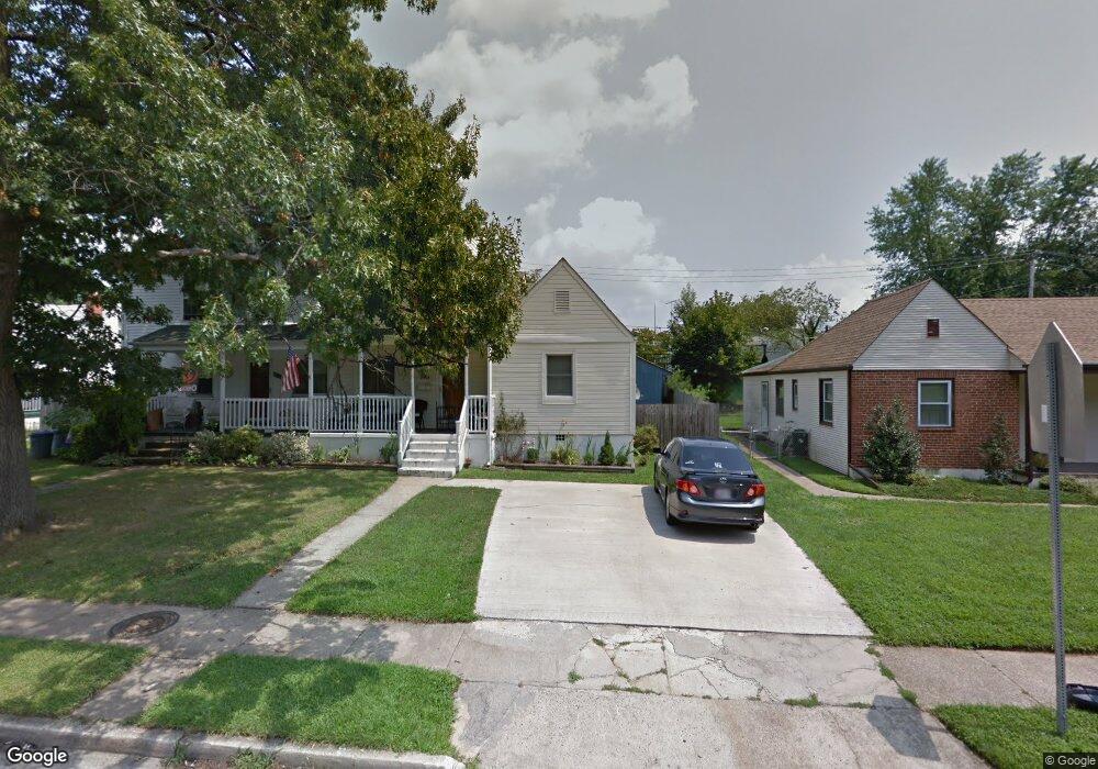
533 Saint Patrick Rd Baltimore, MD 21206
Estimated Value: $183,000 - $232,000
Studio
1
Bath
1,075
Sq Ft
$194/Sq Ft
Est. Value
About This Home
This home is located at 533 Saint Patrick Rd, Baltimore, MD 21206 and is currently estimated at $208,236, approximately $193 per square foot. 533 Saint Patrick Rd is a home located in Baltimore County with nearby schools including Elmwood Elementary School, Parkville Middle & Center of Technology, and Overlea High School.
Ownership History
Date
Name
Owned For
Owner Type
Purchase Details
Closed on
Jun 26, 2006
Sold by
Theis Jean D
Bought by
Nelson Chantell
Current Estimated Value
Home Financials for this Owner
Home Financials are based on the most recent Mortgage that was taken out on this home.
Original Mortgage
$26,600
Outstanding Balance
$15,300
Interest Rate
6.28%
Mortgage Type
Purchase Money Mortgage
Estimated Equity
$192,936
Purchase Details
Closed on
Dec 21, 2005
Sold by
Theis Jean D
Bought by
Nelson Chantell
Home Financials for this Owner
Home Financials are based on the most recent Mortgage that was taken out on this home.
Original Mortgage
$106,400
Interest Rate
7.95%
Mortgage Type
Purchase Money Mortgage
Create a Home Valuation Report for This Property
The Home Valuation Report is an in-depth analysis detailing your home's value as well as a comparison with similar homes in the area
Home Values in the Area
Average Home Value in this Area
Purchase History
| Date | Buyer | Sale Price | Title Company |
|---|---|---|---|
| Nelson Chantell | $133,000 | -- | |
| Nelson Chantell | $133,000 | -- |
Source: Public Records
Mortgage History
| Date | Status | Borrower | Loan Amount |
|---|---|---|---|
| Open | Nelson Chantell | $26,600 | |
| Open | Nelson Chantell | $106,400 | |
| Closed | Nelson Chantell | $26,600 | |
| Previous Owner | Nelson Chantell | $106,400 |
Source: Public Records
Tax History
| Year | Tax Paid | Tax Assessment Tax Assessment Total Assessment is a certain percentage of the fair market value that is determined by local assessors to be the total taxable value of land and additions on the property. | Land | Improvement |
|---|---|---|---|---|
| 2025 | $2,130 | $128,900 | -- | -- |
| 2024 | $2,130 | $120,400 | -- | -- |
| 2023 | $1,132 | $111,900 | $50,000 | $61,900 |
| 2022 | $2,127 | $110,800 | $0 | $0 |
| 2021 | $1,939 | $109,700 | $0 | $0 |
| 2020 | $1,316 | $108,600 | $50,000 | $58,600 |
| 2019 | $1,292 | $106,567 | $0 | $0 |
| 2018 | $1,933 | $104,533 | $0 | $0 |
| 2017 | $1,777 | $102,500 | $0 | $0 |
| 2016 | $1,899 | $102,500 | $0 | $0 |
| 2015 | $1,899 | $102,500 | $0 | $0 |
| 2014 | $1,899 | $107,600 | $0 | $0 |
Source: Public Records
Map
Nearby Homes
- 417 Meadow Rd
- 6121 Marglenn Ave
- 5944 Clayton Ave
- 5943 Clayton Ave
- 9 Glenmore Ave
- 4510 Forest View Ave
- 3 Morning Star Ct
- 6809 Linden Ave
- 4422 Forest View Ave
- 5819 Westwood Ave
- 4412 Springwood Ave
- 7127 Willowdale Ave
- 5010 Kenwood Ave
- 4 Elinor Ave
- 19 Lyndale Ave
- 5522 Mccormick Ave
- 4416 Fullerton Ave
- 4006 Fleetwood Ave
- 5727 Utrecht Rd
- 4103 Glenmore Ave
- 531 Saint Patrick Rd
- 535 Saint Patrick Rd
- 537 Saint Patrick Rd
- 529 Saint Patrick Rd
- 528 Dale Ave
- 526 Dale Ave
- 530 Dale Ave
- 527 Saint Patrick Rd
- 532 Dale Ave
- 524 Dale Ave
- 539 Saint Patrick Rd
- 525 Saint Patrick Rd
- 534 Dale Ave
- 522 Dale Ave
- 541 Saint Patrick Rd
- 520 Dale Ave
- 523 Saint Patrick Rd
- 536 Dale Ave
- 543 Saint Patrick Rd
- 518 Dale Ave
Your Personal Tour Guide
Ask me questions while you tour the home.