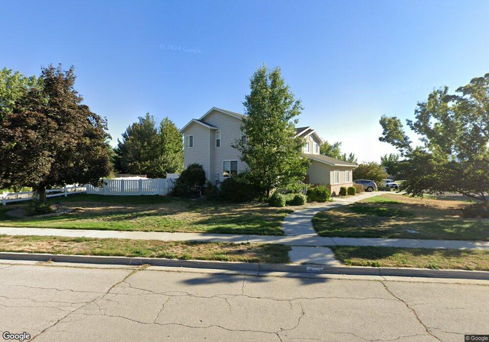
533 W 860 N American Fork, UT 84003
Estimated Value: $629,000 - $715,000
5
Beds
4
Baths
2,961
Sq Ft
$226/Sq Ft
Est. Value
About This Home
This home is located at 533 W 860 N, American Fork, UT 84003 and is currently estimated at $668,602, approximately $225 per square foot. 533 W 860 N is a home located in Utah County with nearby schools including Shelley Elementary School, American Fork Junior High School, and American Fork High School.
Ownership History
Date
Name
Owned For
Owner Type
Purchase Details
Closed on
Oct 11, 2024
Sold by
Rorke Stacia
Bought by
Stacia Rorke Revocable Trust and Rorke
Current Estimated Value
Purchase Details
Closed on
Jan 22, 2013
Sold by
Butterfly Mango Llc
Bought by
Rorke Stacia
Home Financials for this Owner
Home Financials are based on the most recent Mortgage that was taken out on this home.
Original Mortgage
$255,781
Interest Rate
3.5%
Mortgage Type
FHA
Purchase Details
Closed on
Feb 27, 2012
Sold by
Geertsen Jau Gordon
Bought by
Butterfly Mango Llc
Purchase Details
Closed on
Oct 29, 2009
Sold by
Geertsen Jay Gordon and Geertsen Patricia Lynn
Bought by
Geertsen Jay Gordon and Geertsen Patricia Lynn
Create a Home Valuation Report for This Property
The Home Valuation Report is an in-depth analysis detailing your home's value as well as a comparison with similar homes in the area
Home Values in the Area
Average Home Value in this Area
Purchase History
| Date | Buyer | Sale Price | Title Company |
|---|---|---|---|
| Stacia Rorke Revocable Trust | -- | None Listed On Document | |
| Rorke Stacia | -- | Integrated Title Insurance S | |
| Butterfly Mango Llc | -- | None Available | |
| Geertsen Jay Gordon | -- | Accommodation |
Source: Public Records
Mortgage History
| Date | Status | Borrower | Loan Amount |
|---|---|---|---|
| Previous Owner | Rorke Stacia | $255,781 |
Source: Public Records
Tax History Compared to Growth
Tax History
| Year | Tax Paid | Tax Assessment Tax Assessment Total Assessment is a certain percentage of the fair market value that is determined by local assessors to be the total taxable value of land and additions on the property. | Land | Improvement |
|---|---|---|---|---|
| 2025 | $2,687 | $315,480 | $231,200 | $342,400 |
| 2024 | $2,687 | $298,595 | $0 | $0 |
| 2023 | $2,565 | $302,115 | $0 | $0 |
| 2022 | $2,658 | $309,045 | $0 | $0 |
| 2021 | $2,278 | $413,700 | $165,900 | $247,800 |
| 2020 | $2,132 | $375,400 | $148,100 | $227,300 |
| 2019 | $1,991 | $362,700 | $137,000 | $225,700 |
| 2018 | $1,923 | $334,900 | $129,600 | $205,300 |
| 2017 | $1,851 | $174,020 | $0 | $0 |
| 2016 | $1,774 | $154,880 | $0 | $0 |
| 2015 | $1,787 | $148,115 | $0 | $0 |
| 2014 | $1,684 | $137,665 | $0 | $0 |
Source: Public Records
Map
Nearby Homes
- 602 W 860 N
- 914 N 400 W Unit A
- 987 N 410 W
- 3889 W 950 Cir N Unit 366
- 471 W 1040 N
- 641 N 420 W
- 984 N 300 W
- 962 N 780 St W Unit 508
- 974 N 780 St W Unit 509
- 916 N 780 St W Unit 501
- 822 W 800 St N Unit LOT319
- 425 W 1120 N
- 822 N 860 W Unit 317
- 344 W 1080 N
- 796 N 200 W
- 782 N 200 W
- 3935 W 1000 N Unit 438
- 3983 W 1000 N Unit 442
- 4007 W 1000 N
- 3947 W 1000 N Unit 439