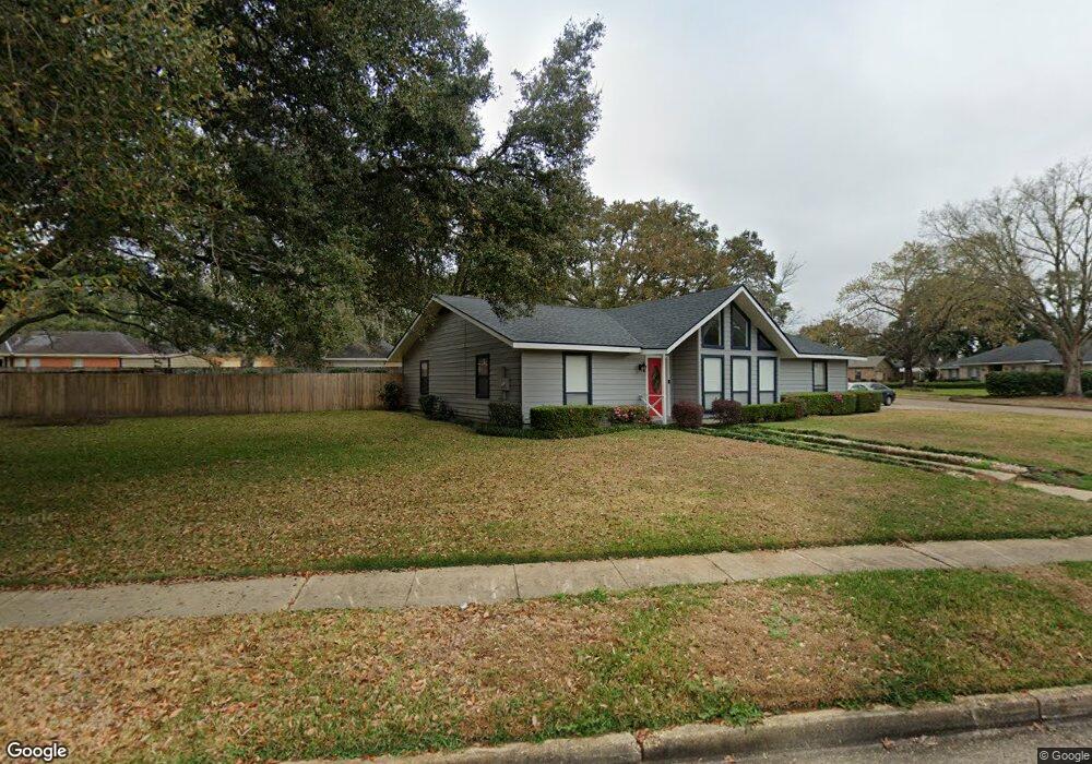
5331 Longridge Dr N Unit 2 Mobile, AL 36693
Canterbury NeighborhoodEstimated Value: $192,000 - $304,000
3
Beds
2
Baths
1,906
Sq Ft
$124/Sq Ft
Est. Value
About This Home
This home is located at 5331 Longridge Dr N Unit 2, Mobile, AL 36693 and is currently estimated at $237,244, approximately $124 per square foot. 5331 Longridge Dr N Unit 2 is a home located in Mobile County with nearby schools including Kate Shepard Elementary School, Burns Middle School, and Murphy High School.
Ownership History
Date
Name
Owned For
Owner Type
Purchase Details
Closed on
Oct 8, 2020
Sold by
Bickford Elgia H
Bought by
Perryman Shemekia C
Current Estimated Value
Home Financials for this Owner
Home Financials are based on the most recent Mortgage that was taken out on this home.
Original Mortgage
$147,283
Outstanding Balance
$130,109
Interest Rate
2.9%
Mortgage Type
FHA
Estimated Equity
$107,135
Purchase Details
Closed on
Sep 16, 2002
Sold by
Bickford William John and Bickford Elgia H
Bought by
Bickford Elgia H
Create a Home Valuation Report for This Property
The Home Valuation Report is an in-depth analysis detailing your home's value as well as a comparison with similar homes in the area
Home Values in the Area
Average Home Value in this Area
Purchase History
| Date | Buyer | Sale Price | Title Company |
|---|---|---|---|
| Perryman Shemekia C | $150,000 | Dst | |
| Bickford Elgia H | $46,000 | -- |
Source: Public Records
Mortgage History
| Date | Status | Borrower | Loan Amount |
|---|---|---|---|
| Open | Perryman Shemekia C | $147,283 |
Source: Public Records
Tax History
| Year | Tax Paid | Tax Assessment Tax Assessment Total Assessment is a certain percentage of the fair market value that is determined by local assessors to be the total taxable value of land and additions on the property. | Land | Improvement |
|---|---|---|---|---|
| 2025 | $1,146 | $18,930 | $3,000 | $15,930 |
| 2024 | $1,146 | $18,540 | $3,000 | $15,540 |
| 2023 | $1,120 | $15,000 | $2,550 | $12,450 |
| 2022 | $888 | $15,020 | $2,550 | $12,470 |
| 2021 | $874 | $14,800 | $2,550 | $12,250 |
| 2020 | $0 | $11,770 | $2,550 | $9,220 |
| 2019 | $0 | $11,040 | $2,550 | $8,490 |
| 2018 | $0 | $11,060 | $0 | $0 |
| 2017 | $0 | $11,300 | $0 | $0 |
| 2016 | -- | $12,540 | $0 | $0 |
| 2013 | -- | $12,880 | $0 | $0 |
Source: Public Records
Map
Nearby Homes
- 3701 Arrington Dr
- 5321 Longridge Dr N
- 5413 Myrick Ct
- 0 Girby Rd
- 3613 Vista Ridge Dr
- 5213 Drexel Dr
- 5024 Government Blvd
- 5544 Candia Ct
- 3109 Grishilde Dr
- 3447 Rue Royal
- 3549 Rue Royal
- 5505 White Pine Dr
- 3075 Longleaf Dr
- 5508 White Pine Dr
- 5114 Geoffrey Dr
- 5771 Rue Conti
- 3150 Maudelayne Dr E
- 5600 James Madison Dr S
- 5623 James Monroe Ct
- 4371 Antares Ln
- 5331 Longridge Dr N
- 3654 Wenlock Ct
- 5339 Longridge Dr N
- 3663 Surrey Ct
- 5332 Longridge Dr N
- 5336 Longridge Dr N
- 5328 Longridge Dr N
- 3655 Wenlock Ct
- 3701 Norton Dr
- 3652 Wenlock Ct
- 3659 Surrey Ct
- 5324 Longridge Dr N
- 3651 Wenlock Ct
- 3650 Wenlock Ct
- 3700 Robertson Ct
- 3705 Norton Dr
- 5325 Longridge Dr N
- 3653 Surrey Ct
- 3662 Surrey Ct
- 3701 Robertson Ct
Your Personal Tour Guide
Ask me questions while you tour the home.