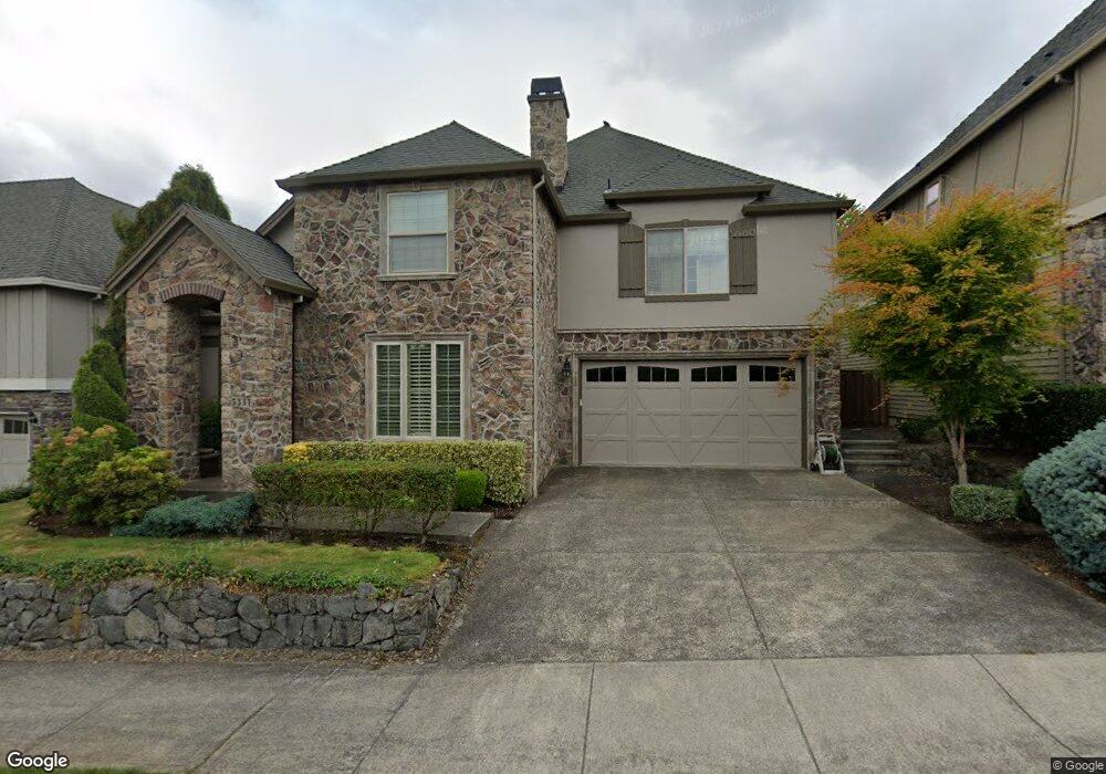
5331 NW 133rd Ave Portland, OR 97229
Estimated Value: $1,064,182 - $1,094,000
4
Beds
4
Baths
3,904
Sq Ft
$277/Sq Ft
Est. Value
About This Home
This home is located at 5331 NW 133rd Ave, Portland, OR 97229 and is currently estimated at $1,079,546, approximately $276 per square foot. 5331 NW 133rd Ave is a home located in Washington County with nearby schools including Jacob Wismer Elementary School, Stoller Middle School, and Sunset High School.
Ownership History
Date
Name
Owned For
Owner Type
Purchase Details
Closed on
Feb 8, 2023
Sold by
Sczyrba Meg
Bought by
Sczyrba Revocable Trust
Current Estimated Value
Purchase Details
Closed on
Dec 27, 2011
Sold by
Arbor Heights Llc
Bought by
Sczyrba Meg
Home Financials for this Owner
Home Financials are based on the most recent Mortgage that was taken out on this home.
Original Mortgage
$417,000
Interest Rate
3.94%
Mortgage Type
New Conventional
Create a Home Valuation Report for This Property
The Home Valuation Report is an in-depth analysis detailing your home's value as well as a comparison with similar homes in the area
Home Values in the Area
Average Home Value in this Area
Purchase History
| Date | Buyer | Sale Price | Title Company |
|---|---|---|---|
| Sczyrba Revocable Trust | -- | -- | |
| Sczyrba Meg | $750,000 | Chicago Title Ins Co Of Or |
Source: Public Records
Mortgage History
| Date | Status | Borrower | Loan Amount |
|---|---|---|---|
| Previous Owner | Sczyrba Meg | $417,000 |
Source: Public Records
Tax History Compared to Growth
Tax History
| Year | Tax Paid | Tax Assessment Tax Assessment Total Assessment is a certain percentage of the fair market value that is determined by local assessors to be the total taxable value of land and additions on the property. | Land | Improvement |
|---|---|---|---|---|
| 2025 | $13,322 | $729,500 | -- | -- |
| 2024 | $12,513 | $708,260 | -- | -- |
| 2023 | $12,513 | $687,640 | $0 | $0 |
| 2022 | $12,099 | $687,640 | $0 | $0 |
| 2021 | $11,662 | $648,180 | $0 | $0 |
| 2020 | $11,309 | $629,310 | $0 | $0 |
| 2019 | $10,914 | $610,990 | $0 | $0 |
| 2018 | $10,559 | $593,200 | $0 | $0 |
| 2017 | $10,178 | $575,930 | $0 | $0 |
| 2016 | $9,814 | $559,160 | $0 | $0 |
| 2015 | $9,448 | $542,880 | $0 | $0 |
| 2014 | $9,252 | $527,070 | $0 | $0 |
Source: Public Records
Map
Nearby Homes
- 5598 NW 135th Ave
- 12985 NW Kyla Ln
- 12988 NW Tigon Ln
- 12974 NW Ramona Ln Unit LOT A26
- 12971 NW Ramona Ln Unit DA1
- 12955 NW Ramona Ln Unit LOT A2
- 12949 NW Ramona Ln Unit A3
- 12937 NW Ramona Ln Unit LOT A4
- 5325 NW 137th Ave
- 0 NW Laidlaw Rd
- 13053 NW Lombardy Dr
- 13191 NW Findley St
- 5000 NW 140th Ave
- 5024 NW 140th Ave
- 5802 NW Bannister Dr
- 14017 NW Greenwood Dr
- 5728 NW Skycrest Pkwy
- 12606 NW Larry Ct
- 4556 NW Oakpoint Way
- 4473 NW Oxbridge Dr
- 5309 NW 133rd Ave
- 5353 NW 133rd Ave
- 5328 NW 134th Ave
- 5354 NW 134th Ave
- 5300 NW 134th Ave
- 5375 NW 133rd Ave
- 5376 NW 134th Ave
- 5368 NW 133rd Ave
- 5397 NW 133rd Ave
- 13316 NW Manzoni St
- 13350 NW Manzoni St
- 5277 NW 133rd Ave
- 5390 NW 134th Ave
- 13384 NW Manzoni St
- 5333 NW 134th Ave
- 5359 NW 134th Ave
- 5305 NW 134th Ave
- 5425 NW 133rd Ave
- 5359 NW 134th (103) Ave
- 13410 NW Manzoni St