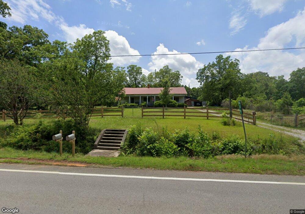
5331 Union Point Hwy Union Point, GA 30669
Estimated Value: $236,000 - $293,000
3
Beds
1
Bath
2,778
Sq Ft
$94/Sq Ft
Est. Value
About This Home
This home is located at 5331 Union Point Hwy, Union Point, GA 30669 and is currently estimated at $262,216, approximately $94 per square foot. 5331 Union Point Hwy is a home located in Greene County with nearby schools including Greene County High School.
Ownership History
Date
Name
Owned For
Owner Type
Purchase Details
Closed on
Sep 16, 2009
Sold by
Godbee Todd and Buford Sandra L
Bought by
Godbee Todd and Godbee Sandra L
Current Estimated Value
Purchase Details
Closed on
Aug 16, 2000
Sold by
Sherrer Edith D
Bought by
Godbee Todd and Buford Sandra L
Purchase Details
Closed on
Feb 23, 1990
Sold by
Sherrer Hinton
Bought by
Sherrer Edith D
Purchase Details
Closed on
Jan 1, 1964
Sold by
Sherrer Hinton
Bought by
Sherrer Hinton
Purchase Details
Closed on
Jan 1, 1953
Bought by
Sherrer Hinton
Create a Home Valuation Report for This Property
The Home Valuation Report is an in-depth analysis detailing your home's value as well as a comparison with similar homes in the area
Purchase History
| Date | Buyer | Sale Price | Title Company |
|---|---|---|---|
| Godbee Todd | -- | -- | |
| Godbee Todd | $45,000 | -- | |
| Sherrer Edith D | -- | -- | |
| Sherrer Hinton | -- | -- | |
| Sherrer Hinton | -- | -- |
Source: Public Records
Tax History
| Year | Tax Paid | Tax Assessment Tax Assessment Total Assessment is a certain percentage of the fair market value that is determined by local assessors to be the total taxable value of land and additions on the property. | Land | Improvement |
|---|---|---|---|---|
| 2025 | $667 | $88,480 | $19,920 | $68,560 |
| 2024 | $704 | $83,040 | $19,920 | $63,120 |
| 2023 | $419 | $76,040 | $15,080 | $60,960 |
| 2022 | $678 | $50,720 | $14,480 | $36,240 |
| 2021 | $708 | $46,920 | $14,480 | $32,440 |
| 2020 | $575 | $21,264 | $8,200 | $13,064 |
| 2019 | $588 | $21,264 | $8,200 | $13,064 |
| 2018 | $566 | $21,264 | $8,200 | $13,064 |
| 2017 | $539 | $21,337 | $8,222 | $13,115 |
| 2016 | $540 | $21,384 | $8,222 | $13,162 |
| 2015 | $514 | $21,384 | $8,222 | $13,162 |
| 2014 | $501 | $20,243 | $8,222 | $12,021 |
Source: Public Records
Map
Nearby Homes
- 5401 Union Point Hwy
- 1201 Buffalo Lick Rd
- 0 Buffalo Lick Rd Unit 10551234
- 0 Buffalo Lick Rd Unit 10551325
- 509 Carlton Ave
- 405 Crawfordville Rd
- 1160 Moody St
- 202 Veazey St
- 0 Woodland Ct Unit 10543600
- 1241 Old Siloam Rd
- 324 N Rhodes St
- 1581 Highway 77 S
- 1581 Highway 77 S Hwy
- 215 Hunter St
- 1071 Alexander St
- 000 Washington Hwy
- 0 Washington Hwy Unit 10686255
- 1251 Brick House Rd
- 1251 Brickhouse Rd
- 1251 Adams Rd
- 0 Lamb Ave Unit 10351579
- 5341 Union Point Hwy
- 4804 Lamb Ave Unit &503
- 101 Spruce St
- 5281 Union Point Hwy
- 100 Spruce St
- 101 Pine Dr
- 105 Pine Dr
- 5391 Union Point Hwy
- 5141 Lamb Ave
- 104 Pine Dr
- 101 Mckinley St
- 107 Mckinley St
- 5111 Lamb Ave
- 109 Mckinley St
- 1 Union Point Hwy
- 0 Mckinley St Unit 7521139
- 102 Mckinley St
- 104 Mckinley St
- 106 Mckinley St
Your Personal Tour Guide
Ask me questions while you tour the home.