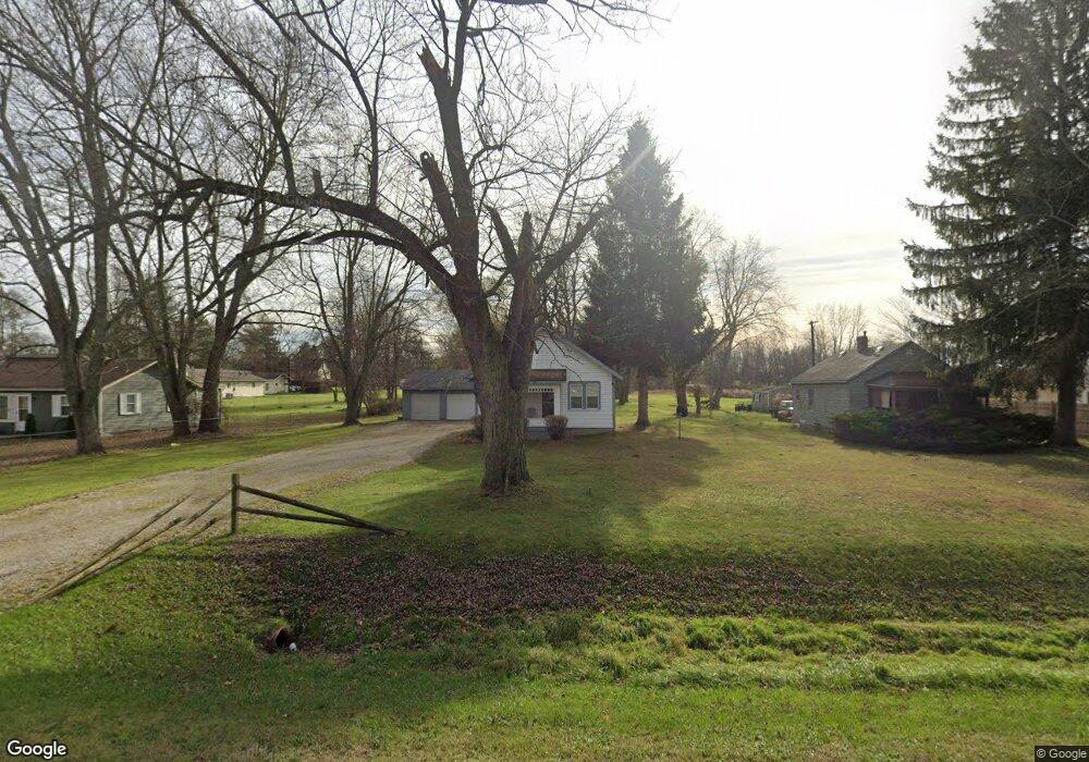
5335 Griswold Rd Kimball, MI 48074
Estimated Value: $68,000 - $228,000
3
Beds
1
Bath
1,172
Sq Ft
$134/Sq Ft
Est. Value
About This Home
This home is located at 5335 Griswold Rd, Kimball, MI 48074 and is currently estimated at $157,105, approximately $134 per square foot. 5335 Griswold Rd is a home located in St. Clair County with nearby schools including Kimball Elementary School, Central Middle School, and Port Huron High School.
Ownership History
Date
Name
Owned For
Owner Type
Purchase Details
Closed on
Jun 28, 2006
Sold by
Swain Edward C
Bought by
Cook Anne M
Current Estimated Value
Home Financials for this Owner
Home Financials are based on the most recent Mortgage that was taken out on this home.
Original Mortgage
$92,700
Outstanding Balance
$55,276
Interest Rate
6.73%
Mortgage Type
New Conventional
Estimated Equity
$101,829
Create a Home Valuation Report for This Property
The Home Valuation Report is an in-depth analysis detailing your home's value as well as a comparison with similar homes in the area
Home Values in the Area
Average Home Value in this Area
Purchase History
| Date | Buyer | Sale Price | Title Company |
|---|---|---|---|
| Cook Anne M | $92,700 | Landameria Lawyers Title |
Source: Public Records
Mortgage History
| Date | Status | Borrower | Loan Amount |
|---|---|---|---|
| Open | Cook Anne M | $92,700 |
Source: Public Records
Tax History Compared to Growth
Tax History
| Year | Tax Paid | Tax Assessment Tax Assessment Total Assessment is a certain percentage of the fair market value that is determined by local assessors to be the total taxable value of land and additions on the property. | Land | Improvement |
|---|---|---|---|---|
| 2025 | $1,117 | $64,200 | $0 | $0 |
| 2024 | $611 | $59,500 | $0 | $0 |
| 2023 | $560 | $56,700 | $0 | $0 |
| 2022 | $1,003 | $48,800 | $0 | $0 |
| 2021 | $922 | $45,200 | $0 | $0 |
| 2020 | $922 | $40,500 | $40,500 | $0 |
| 2019 | $890 | $36,700 | $0 | $0 |
| 2018 | $870 | $35,000 | $0 | $0 |
| 2017 | $860 | $37,900 | $0 | $0 |
| 2016 | $457 | $37,900 | $0 | $0 |
| 2015 | -- | $36,800 | $36,800 | $0 |
| 2014 | -- | $32,100 | $32,100 | $0 |
| 2013 | -- | $34,300 | $0 | $0 |
Source: Public Records
Map
Nearby Homes
- 5510 Griswold Rd
- 1876 Morningstar Ave
- 1979 Allen Rd
- V/L Allen
- 1701 Allen Rd
- 2007 Edward Ln E
- 0 Allen Rd Unit 20250008597
- 0 Allen Rd Unit 20250008612
- 2022 Edward Ln W
- 2047 Edward Ln E
- 1604 Allen Rd
- 2019 Edward Ln E
- 0 Wadhams Rd Unit 50155021
- 00 Howard Rd
- 00 Griswold Rd
- 4632 Cloverdale Ln
- 4595 Griswold Rd
- 0000 Range Rd
- 0 Lapeer Rd Unit 50137357
- 599 Trout Lake Ct
- 5339 Griswold Rd
- 5327 Griswold Rd
- 5343 Griswold Rd
- 5351 Griswold Rd
- 5332 Griswold Rd
- 5319 Griswold Rd
- 5361 Griswold Rd
- 5318 Griswold Rd
- 5305 Griswold Rd
- 5310 Griswold Rd
- 5364 Griswold Rd
- 1971 Hickory Rd Unit Bldg-Unit
- 1971 Hickory Rd
- 5302 Griswold Rd
- 5295 Griswold Rd
- 5374 Griswold Rd
- 1978 Hickory Rd
- 5376 Griswold Rd
- 1959 Hickory Rd
- 5287 Griswold Rd