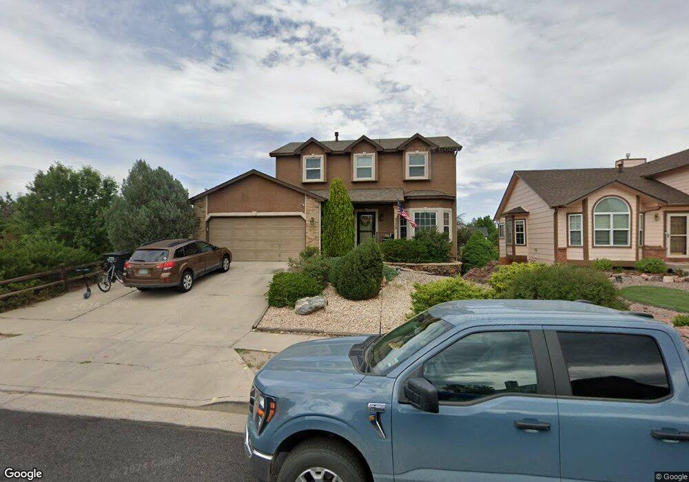
5335 Plumstead Dr Colorado Springs, CO 80920
Briargate NeighborhoodEstimated Value: $424,000
5
Beds
4
Baths
2,642
Sq Ft
$160/Sq Ft
Est. Value
About This Home
This home is located at 5335 Plumstead Dr, Colorado Springs, CO 80920 and is currently priced at $424,000, approximately $160 per square foot. 5335 Plumstead Dr is a home located in El Paso County with nearby schools including Prairie Hills Elementary School, Timberview Middle School, and Liberty High School.
Ownership History
Date
Name
Owned For
Owner Type
Purchase Details
Closed on
Jun 17, 2016
Sold by
Maseda Preston J and Maseda Lorie J
Bought by
Slagle Corby L and Slagle Heather
Current Estimated Value
Home Financials for this Owner
Home Financials are based on the most recent Mortgage that was taken out on this home.
Original Mortgage
$272,650
Outstanding Balance
$217,282
Interest Rate
3.61%
Mortgage Type
New Conventional
Purchase Details
Closed on
Jan 18, 1995
Sold by
Campbell Corp
Bought by
Maseda Preston J and Maseda Lorie J
Home Financials for this Owner
Home Financials are based on the most recent Mortgage that was taken out on this home.
Original Mortgage
$134,250
Interest Rate
7.5%
Mortgage Type
VA
Purchase Details
Closed on
Oct 31, 1994
Sold by
Colrad Development Corp
Bought by
Campbell Corp
Create a Home Valuation Report for This Property
The Home Valuation Report is an in-depth analysis detailing your home's value as well as a comparison with similar homes in the area
Home Values in the Area
Average Home Value in this Area
Purchase History
| Date | Buyer | Sale Price | Title Company |
|---|---|---|---|
| Slagle Corby L | $287,000 | Empire Title Of Colarado Spr | |
| Maseda Preston J | $141,343 | -- | |
| Campbell Corp | -- | -- | |
| Campbell Corp | -- | -- |
Source: Public Records
Mortgage History
| Date | Status | Borrower | Loan Amount |
|---|---|---|---|
| Open | Slagle Corby L | $272,650 | |
| Previous Owner | Maseda Preston J | $134,250 |
Source: Public Records
Tax History Compared to Growth
Tax History
| Year | Tax Paid | Tax Assessment Tax Assessment Total Assessment is a certain percentage of the fair market value that is determined by local assessors to be the total taxable value of land and additions on the property. | Land | Improvement |
|---|---|---|---|---|
| 2022 | $1,741 | $24,670 | $4,340 | $20,330 |
| 2021 | $1,925 | $25,370 | $4,460 | $20,910 |
| 2020 | $1,915 | $23,530 | $3,720 | $19,810 |
| 2019 | $1,896 | $23,530 | $3,720 | $19,810 |
| 2018 | $1,551 | $18,930 | $2,880 | $16,050 |
| 2017 | $1,545 | $18,930 | $2,880 | $16,050 |
| 2016 | $1,558 | $19,060 | $2,930 | $16,130 |
| 2015 | $1,555 | $19,060 | $2,930 | $16,130 |
| 2014 | $1,482 | $18,150 | $2,930 | $15,220 |
Source: Public Records
Map
Nearby Homes
- 5305 Plumstead Dr
- 7543 Potomac Dr
- 8405 Andrus Dr
- 8313 Scarborough Dr
- 5050 Plumstead Dr
- 8017 Radcliff Dr
- 5026 Plumstead Dr
- 8372 Wilmington Dr
- 7820 Swiftrun Rd
- 5109 Oyster Bay Dr
- 8352 James Creek Dr
- 5408 Cushing Grove
- 5414 Cushing Grove
- 5426 Cushing Grove
- 8688 Eckberg Heights
- 8728 Eckberg Heights
- 8760 Eckberg Heights
- 5537 Cross Creek Dr
- 8387 Snow Cap View
- 7985 Interlaken Dr
- 5325 Plumstead Dr
- 5355 Plumstead Dr
- 5315 Plumstead Dr
- 8190 Ferncliff Dr
- 5365 Plumstead Dr
- 8182 Ferncliff Dr
- 5375 Plumstead Dr
- 5402 Plumstead Dr
- 5290 Plumstead Dr
- 5285 Plumstead Dr
- 8166 Lockport Dr
- 5385 Plumstead Dr
- 8172 Radcliff Dr
- 8166 Ferncliff Dr
- 8180 Radcliff Dr
- 5408 Plumstead Dr
- 8188 Radcliff Dr
- 8158 Lockport Dr
- 5280 Plumstead Dr
- 8055 Lorton Dr