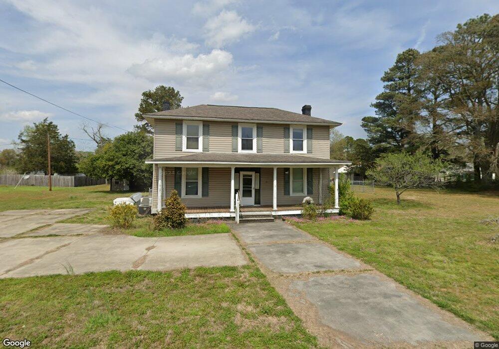
5335 Zuni Cir Zuni, VA 23898
Southern Isle of Wight NeighborhoodEstimated Value: $229,000 - $354,000
3
Beds
2
Baths
1,861
Sq Ft
$152/Sq Ft
Est. Value
About This Home
This home is located at 5335 Zuni Cir, Zuni, VA 23898 and is currently estimated at $283,635, approximately $152 per square foot. 5335 Zuni Cir is a home located in Isle of Wight County with nearby schools including Windsor Elementary School, Georgie D. Tyler Middle School, and Windsor High School.
Ownership History
Date
Name
Owned For
Owner Type
Purchase Details
Closed on
Nov 21, 2023
Sold by
Seasoned Credit Risk Transfer Trust
Bought by
Rowett Johnathan
Current Estimated Value
Home Financials for this Owner
Home Financials are based on the most recent Mortgage that was taken out on this home.
Original Mortgage
$168,000
Outstanding Balance
$165,108
Interest Rate
7.57%
Mortgage Type
New Conventional
Estimated Equity
$118,527
Purchase Details
Closed on
Nov 1, 2023
Sold by
Seasoned Credit Risk Transfer Trust
Bought by
Rowett Johnathan
Home Financials for this Owner
Home Financials are based on the most recent Mortgage that was taken out on this home.
Original Mortgage
$168,000
Outstanding Balance
$165,108
Interest Rate
7.57%
Mortgage Type
New Conventional
Estimated Equity
$118,527
Purchase Details
Closed on
Jun 2, 2023
Sold by
Equity Trustees Llc
Bought by
Seasoned Cr Risk Transfer Tr and Federal Home Loan Mtg Corp
Purchase Details
Closed on
Nov 10, 2009
Sold by
Burger Mark and Burger Carrie
Purchase Details
Closed on
Dec 29, 2006
Purchase Details
Closed on
Aug 26, 2002
Purchase Details
Closed on
Jul 1, 1999
Create a Home Valuation Report for This Property
The Home Valuation Report is an in-depth analysis detailing your home's value as well as a comparison with similar homes in the area
Home Values in the Area
Average Home Value in this Area
Purchase History
| Date | Buyer | Sale Price | Title Company |
|---|---|---|---|
| Rowett Johnathan | $180,000 | Service Link | |
| Rowett Johnathan | $180,000 | Service Link | |
| Seasoned Cr Risk Transfer Tr | $136,491 | None Listed On Document | |
| -- | $178,000 | -- | |
| -- | $155,000 | -- | |
| -- | -- | -- | |
| -- | $18,000 | -- |
Source: Public Records
Mortgage History
| Date | Status | Borrower | Loan Amount |
|---|---|---|---|
| Open | Rowett Johnathan | $168,000 | |
| Closed | Rowett Johnathan | $168,000 |
Source: Public Records
Tax History Compared to Growth
Tax History
| Year | Tax Paid | Tax Assessment Tax Assessment Total Assessment is a certain percentage of the fair market value that is determined by local assessors to be the total taxable value of land and additions on the property. | Land | Improvement |
|---|---|---|---|---|
| 2025 | $1,801 | $232,400 | $27,000 | $205,400 |
| 2024 | $1,697 | $232,400 | $27,000 | $205,400 |
| 2023 | $1,704 | $232,400 | $27,000 | $205,400 |
| 2022 | $1,410 | $159,500 | $27,000 | $132,500 |
| 2021 | $1,410 | $159,500 | $27,000 | $132,500 |
| 2020 | $1,410 | $159,500 | $27,000 | $132,500 |
| 2019 | $1,410 | $159,500 | $27,000 | $132,500 |
| 2018 | $1,333 | $150,500 | $27,000 | $123,500 |
| 2016 | $1,351 | $150,500 | $27,000 | $123,500 |
| 2015 | $1,316 | $150,500 | $27,000 | $123,500 |
| 2014 | $1,316 | $146,300 | $27,000 | $119,300 |
| 2013 | -- | $146,300 | $27,000 | $119,300 |
Source: Public Records
Map
Nearby Homes
- 5217 Blackie Ln
- 20460 Sand Pit Rd
- 11525 Tucker Swamp Rd
- 7496 Yellow Hammer Rd
- 36295 Seacock Chapel Rd
- 36093 Seacock Chapel Rd
- 18101 Foxfire Trail
- LOT 10 Strawberry Plains Rd
- 38556 Warrique Rd
- 51 Browns Ave
- 35258 Amanda Loop
- 35242 Amanda Loop
- 35250 Amanda Loop
- 4AC General Mahone Blvd
- 5+AC Ivor Rd
- 61+AC Ivor Rd
- 5 AC Ivor Rd
- 15241 Strawberry Plains Rd
- 42 AC Strawberry Plains Rd
- 7b Strawberry Plains Rd
- 5313 Zuni Cir
- 5358 Zuni Cir
- 5351 Zuni Cir
- 5316 Windsor Blvd
- 5292 Windsor Blvd
- 5359 Zuni Cir
- 5301 Zuni Cir
- 5299 Zuni Cir
- 5328 Windsor Blvd
- 5367 Zuni Cir
- 5309 Windsor Blvd
- 5291 Zuni Cir
- 5315 Windsor Blvd
- 5374 Zuni Cir
- 5379 Zuni Cir
- 5380 Zuni Cir
- 5344 Windsor Blvd
- 5325 Windsor Blvd
- 5227 Peggy Lou Ln
- 5387 Zuni Cir