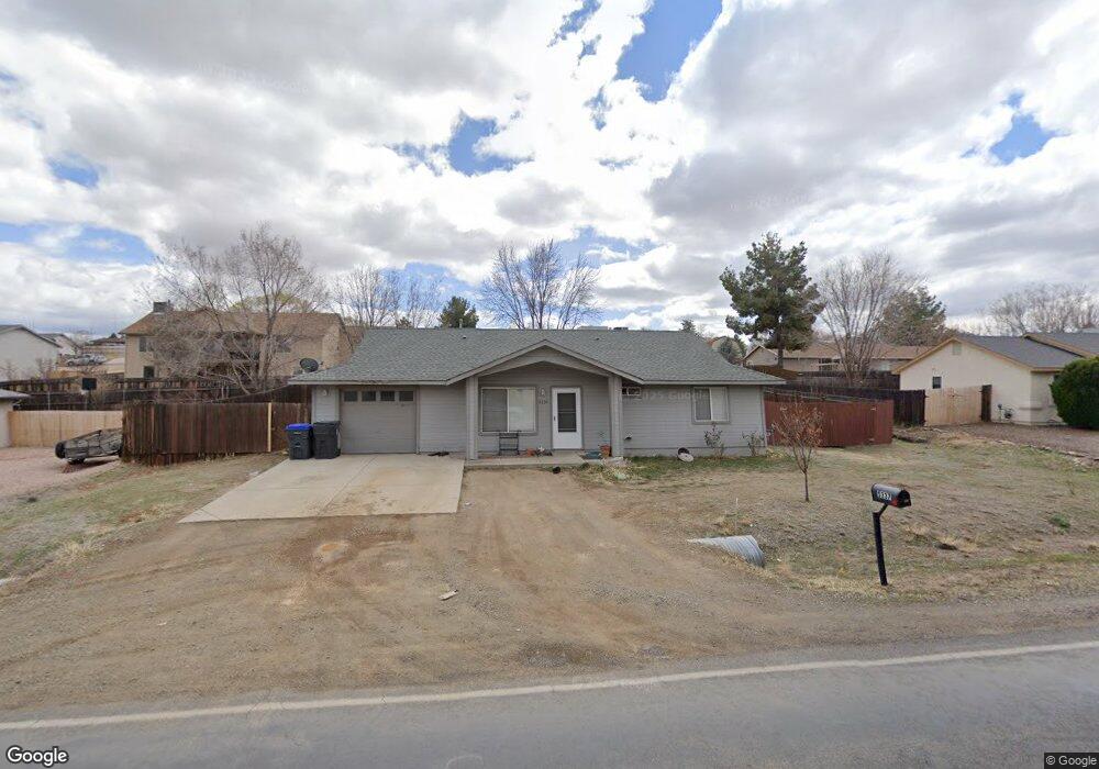
5337 N Robert Rd Unit 15 Prescott Valley, AZ 86314
Estimated Value: $352,000 - $392,000
3
Beds
2
Baths
1,230
Sq Ft
$296/Sq Ft
Est. Value
About This Home
This home is located at 5337 N Robert Rd Unit 15, Prescott Valley, AZ 86314 and is currently estimated at $363,794, approximately $295 per square foot. 5337 N Robert Rd Unit 15 is a home located in Yavapai County with nearby schools including Coyote Springs Elementary School, Glassford Hill Middle School, and Bradshaw Mountain High School.
Ownership History
Date
Name
Owned For
Owner Type
Purchase Details
Closed on
Dec 20, 2024
Sold by
Peapenburg Mark and Peapenburg Christine M
Bought by
Peapenburg Mark Albert and Peapenburg Christine Margaret
Current Estimated Value
Purchase Details
Closed on
Jun 29, 2015
Sold by
Zepeda Nino L
Bought by
Peapenburg Mark and Peapenburg Christine M
Home Financials for this Owner
Home Financials are based on the most recent Mortgage that was taken out on this home.
Original Mortgage
$82,500
Interest Rate
3.81%
Mortgage Type
Trade
Purchase Details
Closed on
Mar 19, 2013
Sold by
Federel National Mortgage Association
Bought by
Zepeda Nino L
Home Financials for this Owner
Home Financials are based on the most recent Mortgage that was taken out on this home.
Original Mortgage
$107,142
Interest Rate
3.6%
Mortgage Type
New Conventional
Purchase Details
Closed on
Dec 26, 2012
Sold by
Kowalski Adam John
Bought by
Federal National Mortgage Association
Purchase Details
Closed on
Jan 19, 2007
Sold by
Kowalski Adam John
Bought by
Kowalski Adam John and Collacott Cathleen A
Purchase Details
Closed on
Apr 29, 2004
Sold by
Harwood Anthony G and Harwood Viola L
Bought by
Enriquez Luis and Enriquez Trina
Home Financials for this Owner
Home Financials are based on the most recent Mortgage that was taken out on this home.
Original Mortgage
$99,000
Interest Rate
5.77%
Mortgage Type
New Conventional
Purchase Details
Closed on
May 13, 1998
Sold by
Oursland Jeffrey Alan
Bought by
Harwood Anthony G and Harwood Viola L
Home Financials for this Owner
Home Financials are based on the most recent Mortgage that was taken out on this home.
Original Mortgage
$9,750
Interest Rate
7.13%
Mortgage Type
Seller Take Back
Purchase Details
Closed on
Apr 6, 1998
Sold by
Bowers Diane
Bought by
Oursland Jeffrey Alan
Home Financials for this Owner
Home Financials are based on the most recent Mortgage that was taken out on this home.
Original Mortgage
$9,750
Interest Rate
7.13%
Mortgage Type
Seller Take Back
Create a Home Valuation Report for This Property
The Home Valuation Report is an in-depth analysis detailing your home's value as well as a comparison with similar homes in the area
Home Values in the Area
Average Home Value in this Area
Purchase History
| Date | Buyer | Sale Price | Title Company |
|---|---|---|---|
| Peapenburg Mark Albert | -- | Yavapai Title Agency | |
| Peapenburg Mark | $126,000 | Lawyers Title Yavapai Coconi | |
| Zepeda Nino L | $105,000 | Pioneer Title Agency Inc | |
| Federal National Mortgage Association | $93,150 | Accommodation | |
| Kowalski Adam John | -- | Yavapai Title Agency Inc | |
| Kowalski Adam John | $194,900 | Yavapai Title Agency Inc | |
| Enriquez Luis | $124,900 | Capital Title Agency | |
| Harwood Anthony G | $13,000 | Transnation Title Ins Co | |
| Oursland Jeffrey Alan | $5,000 | Chicago Title Insurance Co |
Source: Public Records
Mortgage History
| Date | Status | Borrower | Loan Amount |
|---|---|---|---|
| Previous Owner | Peapenburg Mark | $82,500 | |
| Previous Owner | Zepeda Nino L | $107,142 | |
| Previous Owner | Enriquez Luis | $99,000 | |
| Previous Owner | Harwood Anthony G | $9,750 | |
| Closed | Enriquez Luis | $24,400 |
Source: Public Records
Tax History Compared to Growth
Tax History
| Year | Tax Paid | Tax Assessment Tax Assessment Total Assessment is a certain percentage of the fair market value that is determined by local assessors to be the total taxable value of land and additions on the property. | Land | Improvement |
|---|---|---|---|---|
| 2026 | $1,326 | $28,977 | -- | -- |
| 2024 | $1,196 | $30,180 | -- | -- |
| 2023 | $1,216 | $24,931 | $0 | $0 |
| 2022 | $1,196 | $19,987 | $2,868 | $17,119 |
| 2021 | $1,249 | $18,511 | $2,883 | $15,628 |
| 2020 | $1,201 | $0 | $0 | $0 |
| 2019 | $1,386 | $0 | $0 | $0 |
| 2018 | $1,325 | $0 | $0 | $0 |
| 2017 | $1,299 | $0 | $0 | $0 |
| 2016 | $1,258 | $0 | $0 | $0 |
| 2015 | -- | $0 | $0 | $0 |
| 2014 | -- | $0 | $0 | $0 |
Source: Public Records
Map
Nearby Homes
- 5244 N Pinto Dr
- 5121 N Stetson Dr
- 5445 N Mesquite Dr
- 5088 N Desert Ln
- 5274 N Western Blvd
- 5035 N Robert Rd
- 5344 N Cord Dr
- 5601 N Robert Rd
- 5050 N Saddleback Dr
- 8428 E Manley Dr
- 5401 N Ramada Ln
- 5700 N Western Blvd Unit A
- 8061 E Dust Devil Dr Unit 5681
- 8061 E Dust Devil Dr
- 5285 N Hondo Dr
- 5551 N Ramada Ln
- 4895 N Arnold Dr
- 5575 E Magpie Dr
- 4870 N Meixner Rd Unit 4
- 8790 E Totem Cir
- 5337 N Robert Rd
- 5351 N Robert Rd Unit 15
- 5313 N Robert Rd
- 5313 N Robert Rd Unit 15
- 5300 N Stetson Dr
- 5312 N Stetson Dr
- 5312 N Stetson Dr Unit 15
- 5344 N Robert Rd
- 5288 N Stetson Dr
- 5367 N Robert Rd
- 5324 N Stetson Dr
- 5314 N Robert Rd Unit 15
- 5314 N Robert Rd Unit Road
- 5301 N Robert Rd
- 5274 N Stetson Dr Unit 15
- 5301 N Stetson Dr
- 5373 N Saddleback Dr
- 5361 N Saddleback Dr
- 5300 N Robert Rd
- 5385 N Saddleback Dr