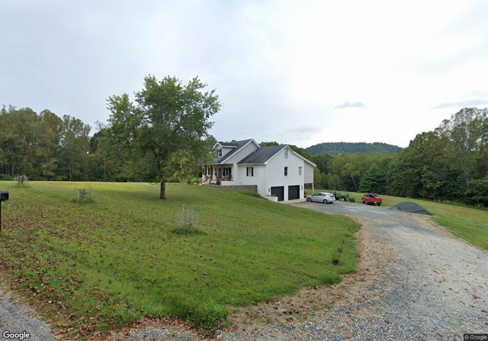
534 Muddy Branch Rd Amherst, VA 24521
Estimated Value: $453,000 - $573,000
3
Beds
3
Baths
1,713
Sq Ft
$296/Sq Ft
Est. Value
About This Home
This home is located at 534 Muddy Branch Rd, Amherst, VA 24521 and is currently estimated at $506,309, approximately $295 per square foot. 534 Muddy Branch Rd is a home located in Amherst County with nearby schools including Amherst Elementary School, Amherst Middle School, and Amherst County High School.
Ownership History
Date
Name
Owned For
Owner Type
Purchase Details
Closed on
Feb 20, 2023
Sold by
Becker Gary M
Bought by
Becker Gary M
Current Estimated Value
Home Financials for this Owner
Home Financials are based on the most recent Mortgage that was taken out on this home.
Original Mortgage
$400,000
Outstanding Balance
$351,458
Interest Rate
5.25%
Mortgage Type
New Conventional
Estimated Equity
$154,851
Purchase Details
Closed on
Aug 14, 2008
Sold by
Fitzpatrick Carolyn P
Bought by
Becker Gary M and Becker Jerilyn N
Create a Home Valuation Report for This Property
The Home Valuation Report is an in-depth analysis detailing your home's value as well as a comparison with similar homes in the area
Home Values in the Area
Average Home Value in this Area
Purchase History
| Date | Buyer | Sale Price | Title Company |
|---|---|---|---|
| Becker Gary M | -- | -- | |
| Becker Gary M | -- | None Available |
Source: Public Records
Mortgage History
| Date | Status | Borrower | Loan Amount |
|---|---|---|---|
| Open | Becker Gary M | $400,000 |
Source: Public Records
Tax History Compared to Growth
Tax History
| Year | Tax Paid | Tax Assessment Tax Assessment Total Assessment is a certain percentage of the fair market value that is determined by local assessors to be the total taxable value of land and additions on the property. | Land | Improvement |
|---|---|---|---|---|
| 2025 | $2,090 | $342,600 | $50,700 | $291,900 |
| 2024 | $2,090 | $342,600 | $50,700 | $291,900 |
| 2023 | $2,090 | $394,700 | $80,300 | $314,400 |
| 2022 | $2,408 | $394,700 | $80,300 | $314,400 |
| 2021 | $2,408 | $394,700 | $80,300 | $314,400 |
| 2020 | $2,408 | $404,700 | $80,300 | $324,400 |
| 2019 | $2,142 | $351,100 | $86,300 | $264,800 |
| 2018 | $2,142 | $351,100 | $86,300 | $264,800 |
| 2017 | $928 | $351,100 | $86,300 | $264,800 |
| 2016 | $2,142 | $351,100 | $86,300 | $264,800 |
| 2015 | $1,703 | $351,100 | $86,300 | $264,800 |
| 2014 | $1,703 | $351,100 | $86,300 | $264,800 |
Source: Public Records
Map
Nearby Homes
- 929 Poor House Farm Rd
- 243 Huff Creek Trail
- 0 Turkey Mountain Rd
- 2 Turkey Mountain Rd
- 0 Huff Creek Trail
- 181 Mobley Mountain Rd
- 181 Mobley Mtn Rd
- 2288 Lexington Turnpike
- 0.50ac Lexington Turnpike
- 102 Fawn Ct
- 176 N Main St
- 120 N Main St
- 260 N Main St
- 1192 N Amherst Hwy
- 0 Lavender Ln
- 65-Acres Lavender Ln
- 206 Glenway Dr
- 577 Muddy Branch Rd
- 481 Muddy Branch Rd
- 569 Muddy Branch Rd
- 610 Muddy Branch Rd
- 462 Cherry Hill Rd
- 405 Cherry Hill Rd
- 528 Cherry Hill Rd
- 563 Muddy Branch Rd
- 627 Cherry Hill Rd
- 592 Cherry Hill Rd
- 566 Cherry Hill Rd
- 561 Muddy Branch Rd
- 570 Cherry Hill Rd
- 657 Cherry Hill Rd
- 336 Cherry Hill Rd
- 661 Cherry Hill Rd
- 324 Cherry Hill Rd
- 0 Dreaming Creek Hollow Rd Unit 341375
- 53 Forest Canopy Dr
- 0 Lot 31 Banks Mountain Unit 332680