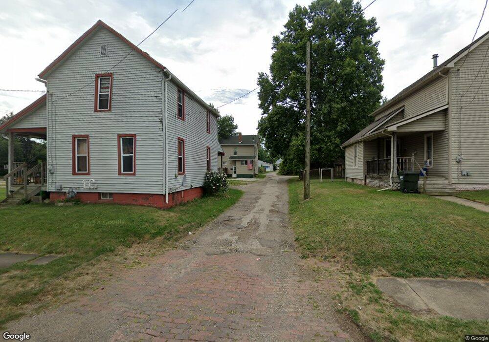
534 N Union Ave Alliance, OH 44601
Estimated Value: $83,000 - $97,000
2
Beds
1
Bath
996
Sq Ft
$90/Sq Ft
Est. Value
About This Home
This home is located at 534 N Union Ave, Alliance, OH 44601 and is currently estimated at $89,303, approximately $89 per square foot. 534 N Union Ave is a home located in Stark County with nearby schools including Alliance Early Learning School, Alliance Intermediate School at Northside, and Alliance Middle School.
Ownership History
Date
Name
Owned For
Owner Type
Purchase Details
Closed on
Sep 29, 2000
Sold by
Zeno Michele Trustee
Bought by
French Richard C and French Mary T
Current Estimated Value
Home Financials for this Owner
Home Financials are based on the most recent Mortgage that was taken out on this home.
Original Mortgage
$43,021
Outstanding Balance
$15,757
Interest Rate
7.98%
Mortgage Type
FHA
Estimated Equity
$73,546
Purchase Details
Closed on
May 6, 1999
Sold by
Salaski Tricia L and Salaski Darrell
Bought by
Rent To Own Leasing Co Inc
Purchase Details
Closed on
Jan 19, 1999
Sold by
Scott James P and Scott James T
Bought by
Anderson Tricia L
Purchase Details
Closed on
Aug 6, 1991
Create a Home Valuation Report for This Property
The Home Valuation Report is an in-depth analysis detailing your home's value as well as a comparison with similar homes in the area
Home Values in the Area
Average Home Value in this Area
Purchase History
| Date | Buyer | Sale Price | Title Company |
|---|---|---|---|
| French Richard C | $43,500 | Americas Choice Title Agency | |
| Rent To Own Leasing Co Inc | $16,500 | Colonial Title Agency Inc | |
| Zeno Michele | -- | Colonial Title Agency Inc | |
| Anderson Tricia L | $10,000 | -- | |
| -- | $3,000 | -- |
Source: Public Records
Mortgage History
| Date | Status | Borrower | Loan Amount |
|---|---|---|---|
| Open | French Richard C | $43,021 | |
| Closed | French Richard C | $2,500 |
Source: Public Records
Tax History Compared to Growth
Tax History
| Year | Tax Paid | Tax Assessment Tax Assessment Total Assessment is a certain percentage of the fair market value that is determined by local assessors to be the total taxable value of land and additions on the property. | Land | Improvement |
|---|---|---|---|---|
| 2025 | -- | $23,700 | $2,000 | $21,700 |
| 2024 | -- | $23,700 | $2,000 | $21,700 |
| 2023 | $619 | $15,050 | $1,960 | $13,090 |
| 2022 | $312 | $15,050 | $1,960 | $13,090 |
| 2021 | $625 | $15,050 | $1,960 | $13,090 |
| 2020 | $525 | $11,800 | $1,720 | $10,080 |
| 2019 | $518 | $11,800 | $1,720 | $10,080 |
| 2018 | $520 | $11,800 | $1,720 | $10,080 |
| 2017 | $398 | $8,860 | $1,160 | $7,700 |
| 2016 | $401 | $8,860 | $1,160 | $7,700 |
| 2015 | $382 | $8,370 | $1,160 | $7,210 |
| 2014 | $428 | $8,930 | $1,230 | $7,700 |
| 2013 | $214 | $8,930 | $1,230 | $7,700 |
Source: Public Records
Map
Nearby Homes
- 124 E Wayne St
- 710 N Freedom Ave
- 511 W Ely St
- 163 W Market St
- 329 1/2 W Main St
- 132 S Haines Ave
- 361 E Main St
- 345 W Market St
- 652 N Webb Ave
- 356 E Broadway St
- 11344 Walnut Ave NE
- 427 S Union Ave
- 142 S Seneca Ave
- V/L S Fredeom Ave
- 263 Franklin Ave
- 432 S Linden Ave
- 000 Meadowbrook Ave
- 0 Meadowbrook Ave
- 11310 Webb Ave NE
- 432 Johnson Ave
- 540 N Union Ave
- 512 N Union Ave
- 12 W Wayne St
- 35 W Washington St
- 44 W Wayne St
- 34 W Wayne St
- 45 W Washington St
- 54 W Wayne St
- 55 W Washington St
- 64 W Wayne St
- 539 N Union Ave
- 65 W Washington St
- 553 N Union Ave
- 434 N Union Ave
- 525 N Union Ave
- 519 N Union Ave
- 74 W Wayne St
- 505 N Union Ave
- 515 N Union Ave
- 75 W Washington St