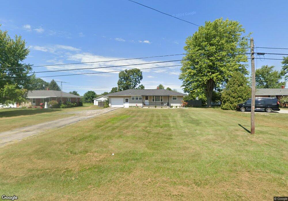
534 State Route 725 W Camden, OH 45311
Estimated Value: $167,056 - $202,000
3
Beds
1
Bath
1,040
Sq Ft
$177/Sq Ft
Est. Value
About This Home
This home is located at 534 State Route 725 W, Camden, OH 45311 and is currently estimated at $184,014, approximately $176 per square foot. 534 State Route 725 W is a home located in Preble County with nearby schools including Preble Shawnee Elementary School, West Elkton Intermediate School, and Preble Shawnee Junior/Senior High School.
Ownership History
Date
Name
Owned For
Owner Type
Purchase Details
Closed on
Dec 13, 2023
Sold by
Ballard Jonna
Bought by
Ballard Jonna and Ballard Nathaniel
Current Estimated Value
Purchase Details
Closed on
Jan 6, 2000
Sold by
Crawford Midred
Bought by
Ballard Jonna
Home Financials for this Owner
Home Financials are based on the most recent Mortgage that was taken out on this home.
Original Mortgage
$85,400
Interest Rate
7.76%
Mortgage Type
New Conventional
Create a Home Valuation Report for This Property
The Home Valuation Report is an in-depth analysis detailing your home's value as well as a comparison with similar homes in the area
Home Values in the Area
Average Home Value in this Area
Purchase History
| Date | Buyer | Sale Price | Title Company |
|---|---|---|---|
| Ballard Jonna | -- | None Listed On Document | |
| Ballard Jonna | $89,900 | -- |
Source: Public Records
Mortgage History
| Date | Status | Borrower | Loan Amount |
|---|---|---|---|
| Previous Owner | Ballard Jonna | $85,400 |
Source: Public Records
Tax History Compared to Growth
Tax History
| Year | Tax Paid | Tax Assessment Tax Assessment Total Assessment is a certain percentage of the fair market value that is determined by local assessors to be the total taxable value of land and additions on the property. | Land | Improvement |
|---|---|---|---|---|
| 2024 | $1,441 | $36,510 | $7,670 | $28,840 |
| 2023 | $1,441 | $36,510 | $7,670 | $28,840 |
| 2022 | $1,364 | $32,870 | $6,930 | $25,940 |
| 2021 | $1,512 | $32,870 | $6,930 | $25,940 |
| 2020 | $1,457 | $32,870 | $6,930 | $25,940 |
| 2019 | $1,278 | $27,480 | $6,020 | $21,460 |
| 2018 | $1,315 | $27,480 | $6,020 | $21,460 |
| 2017 | $1,216 | $27,480 | $6,020 | $21,460 |
| 2016 | $1,242 | $28,010 | $5,850 | $22,160 |
| 2014 | $1,291 | $27,620 | $5,850 | $21,770 |
| 2013 | $1,328 | $27,615 | $5,845 | $21,770 |
Source: Public Records
Map
Nearby Homes
- 407 W Central Ave
- 388 W Hendricks St
- 131 S Lafayette St
- 103 Katherine Ct
- 471 Camden West Elkton Rd
- 725 Sr
- 759 Barnetts Mill Rd
- 679 Oxford Germantown Rd
- 1246 Oxford Germantown Rd
- 314 Lakengren Dr
- 1222 Oxford Germantown Rd
- 0 Oxford Germantown Rd
- 820 Lars Cove
- 817 Old Norse Dr
- 0 Lars Cove Unit 1745954
- 805 Brande Dr
- 250 Lakengren Dr
- 0 Valhalla Cove Unit 941078
- 787 Baltic Dr
- 127 Voyage Dr
- 536 W Central Ave
- 532 State Route 725 W
- 532 W Central Ave
- 595 State Route 725 W
- 530 W Central Ave
- 540 State Route 725 W
- 530 State Route 725 W
- 533 State Route 725 W
- 531 State Route 725 W
- 537 State Route 725 W
- 542 State Route 725 W
- 496 State Route 725 W
- 496 W Central Ave
- 371 W Hendricks St
- 541 State Route 725 W
- 548 State Route 725 W
- 369 W Hendricks St
- 403 E Central Ave
- 406 State Route 725 W
- 401 E Central Ave