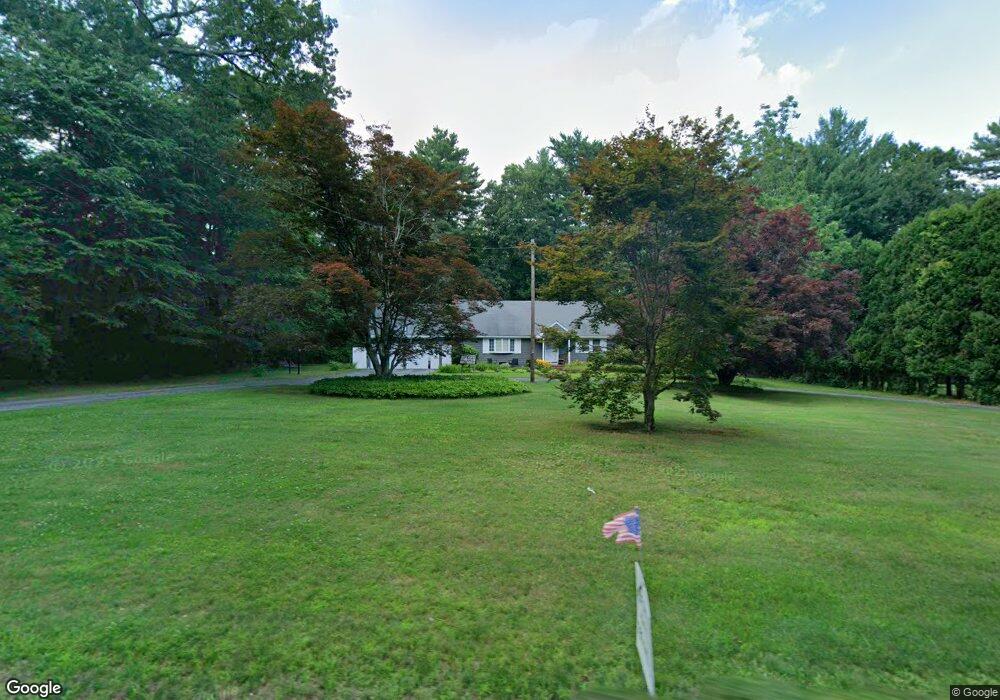
534 Whitman St Hanson, MA 02341
Estimated Value: $610,528 - $725,000
3
Beds
2
Baths
2,002
Sq Ft
$334/Sq Ft
Est. Value
About This Home
This home is located at 534 Whitman St, Hanson, MA 02341 and is currently estimated at $668,382, approximately $333 per square foot. 534 Whitman St is a home located in Plymouth County.
Ownership History
Date
Name
Owned For
Owner Type
Purchase Details
Closed on
May 31, 2007
Sold by
Mcclain Robert E
Bought by
Eaton Mark J and Eaton Susanne D
Current Estimated Value
Home Financials for this Owner
Home Financials are based on the most recent Mortgage that was taken out on this home.
Original Mortgage
$280,000
Interest Rate
6.24%
Purchase Details
Closed on
Mar 9, 2006
Sold by
Donovan Michael P and Donovan Nicole M
Bought by
Mcclain Robert E
Create a Home Valuation Report for This Property
The Home Valuation Report is an in-depth analysis detailing your home's value as well as a comparison with similar homes in the area
Home Values in the Area
Average Home Value in this Area
Purchase History
| Date | Buyer | Sale Price | Title Company |
|---|---|---|---|
| Eaton Mark J | $363,500 | -- | |
| Mcclain Robert E | $382,500 | -- |
Source: Public Records
Mortgage History
| Date | Status | Borrower | Loan Amount |
|---|---|---|---|
| Open | Mcclain Robert E | $307,200 | |
| Closed | Mcclain Robert E | $280,000 |
Source: Public Records
Tax History
| Year | Tax Paid | Tax Assessment Tax Assessment Total Assessment is a certain percentage of the fair market value that is determined by local assessors to be the total taxable value of land and additions on the property. | Land | Improvement |
|---|---|---|---|---|
| 2025 | $7,121 | $532,200 | $172,000 | $360,200 |
| 2024 | $6,291 | $470,200 | $167,000 | $303,200 |
| 2023 | $6,175 | $435,500 | $167,000 | $268,500 |
| 2022 | $6,039 | $400,200 | $151,800 | $248,400 |
| 2021 | $5,395 | $357,300 | $146,000 | $211,300 |
| 2020 | $5,323 | $348,600 | $141,000 | $207,600 |
| 2019 | $5,131 | $330,400 | $138,300 | $192,100 |
| 2018 | $5,031 | $317,800 | $133,000 | $184,800 |
| 2017 | $4,883 | $305,600 | $126,700 | $178,900 |
| 2016 | $4,975 | $300,600 | $126,700 | $173,900 |
| 2015 | $4,682 | $294,100 | $126,700 | $167,400 |
Source: Public Records
Map
Nearby Homes
- 724 Whitman St
- 100 Lexington St
- Lot 5 Princeton Way
- 353 Birchbark Dr
- 55 Plymouth St Unit G27
- 361 County Rd
- 254 Winter St
- 67 Gorwin Dr
- Lot 6 Way
- Lot 2 Harvard Rd
- 988 E Washington St
- 214 Winter St
- 700 High St
- 227 Winter St
- 127 King St
- 48 Big Rock Ln
- 5 Alpine St
- 126-130 Franklin St
- 26 Franklin St
- 113 Bradford Rd
- 12 Greenbrier Ln
- 524 Whitman St
- 24 Greenbrier Ln
- 24 Greenbrier Ln
- 42 Greenbrier Ln
- 15 Greenbrier Ln
- 25 Greenbrier Ln
- 0 Greenbrier Ln
- 00 Greenbrier Ln
- 479 Whitman St
- 60 Greenbrier Ln
- 18 Capt Nathaniel Dr
- 45 Greenbrier Ln
- 3 Capt Nathaniel Dr
- 22 Captain Nathaniel Dr
- 8 Capt Nathaniel Dr
- 586 Whitman St
- 57 Greenbrier Ln
- 40 Captain Nathaniel Dr
- 473 Whitman St
Your Personal Tour Guide
Ask me questions while you tour the home.