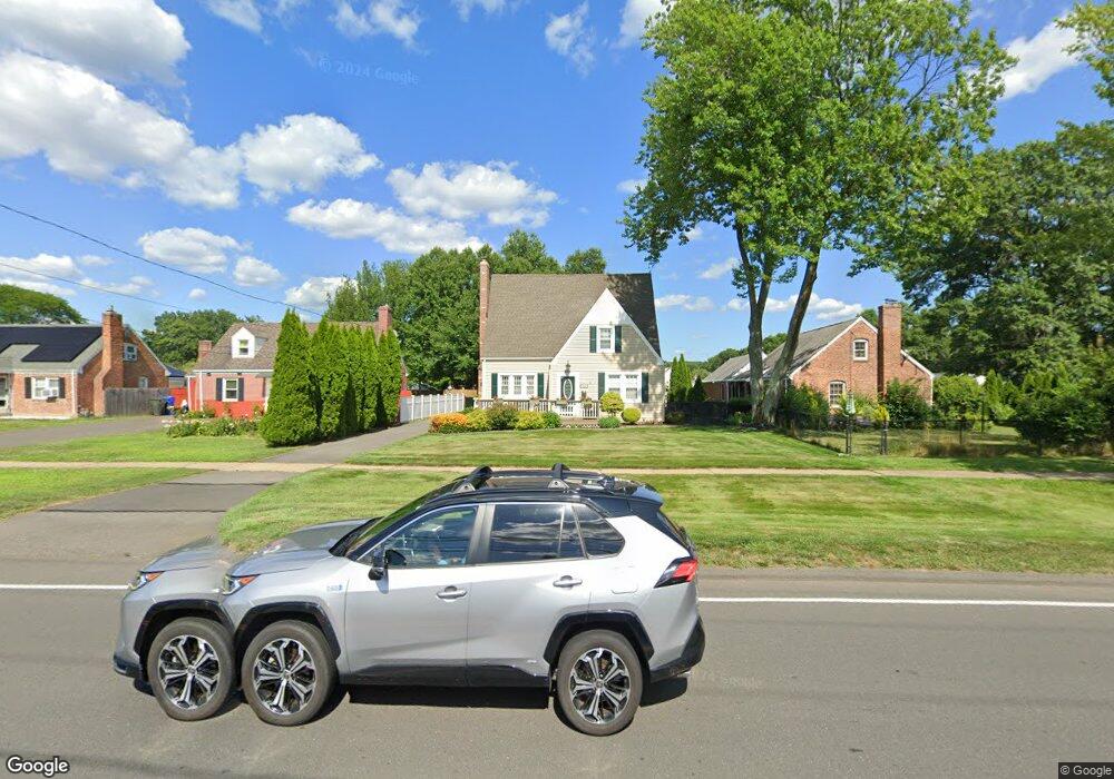
534 Willard Ave Newington, CT 06111
Estimated Value: $351,887 - $383,000
2
Beds
2
Baths
1,544
Sq Ft
$239/Sq Ft
Est. Value
About This Home
This home is located at 534 Willard Ave, Newington, CT 06111 and is currently estimated at $369,472, approximately $239 per square foot. 534 Willard Ave is a home located in Hartford County with nearby schools including Anna Reynolds School, Martin Kellogg Middle School, and Newington High School.
Ownership History
Date
Name
Owned For
Owner Type
Purchase Details
Closed on
Aug 3, 2007
Sold by
Stgermain Lisa A and Russo Richard A
Bought by
Karuoski Gina M
Current Estimated Value
Home Financials for this Owner
Home Financials are based on the most recent Mortgage that was taken out on this home.
Original Mortgage
$182,000
Outstanding Balance
$115,115
Interest Rate
6.73%
Estimated Equity
$254,357
Purchase Details
Closed on
Nov 7, 1995
Sold by
Powlishen Andrew H
Bought by
Russo Richard A and Russo Lisa A
Home Financials for this Owner
Home Financials are based on the most recent Mortgage that was taken out on this home.
Original Mortgage
$102,125
Interest Rate
7.58%
Mortgage Type
Unknown
Create a Home Valuation Report for This Property
The Home Valuation Report is an in-depth analysis detailing your home's value as well as a comparison with similar homes in the area
Home Values in the Area
Average Home Value in this Area
Purchase History
| Date | Buyer | Sale Price | Title Company |
|---|---|---|---|
| Karuoski Gina M | $227,500 | -- | |
| Russo Richard A | $107,500 | -- |
Source: Public Records
Mortgage History
| Date | Status | Borrower | Loan Amount |
|---|---|---|---|
| Open | Russo Richard A | $182,000 | |
| Closed | Russo Richard A | $22,700 | |
| Previous Owner | Russo Richard A | $148,700 | |
| Previous Owner | Russo Richard A | $102,125 |
Source: Public Records
Tax History Compared to Growth
Tax History
| Year | Tax Paid | Tax Assessment Tax Assessment Total Assessment is a certain percentage of the fair market value that is determined by local assessors to be the total taxable value of land and additions on the property. | Land | Improvement |
|---|---|---|---|---|
| 2025 | $5,626 | $140,710 | $50,920 | $89,790 |
| 2024 | $5,582 | $140,710 | $50,920 | $89,790 |
| 2023 | $5,398 | $140,710 | $50,920 | $89,790 |
| 2022 | $5,416 | $140,710 | $50,920 | $89,790 |
| 2021 | $5,461 | $140,710 | $50,920 | $89,790 |
| 2020 | $5,447 | $138,670 | $50,930 | $87,740 |
| 2019 | $5,471 | $138,670 | $50,930 | $87,740 |
| 2018 | $5,339 | $138,670 | $50,930 | $87,740 |
| 2017 | $5,074 | $138,670 | $50,930 | $87,740 |
| 2016 | $4,957 | $138,670 | $50,930 | $87,740 |
| 2014 | $4,821 | $138,640 | $51,560 | $87,080 |
Source: Public Records
Map
Nearby Homes
- 16 Michael Ln
- 70 Woodland St
- 73 Coolidge Ave
- 9 Old Farm Dr
- 7 Old Farm Dr
- 175 Old Farm Dr
- 27 Harding Ave
- 84 Connecticut Ave
- 236 Old Farm Dr
- 23 Dacosta Dr
- 82 Millbrook Ct
- 177 Moylan Ct Unit 177
- 131 Williamstown Ct Unit 131
- 33 Cedar Ridge Rd
- 160 Barkledge Dr
- 263 Williamstown Ct
- 79 Piper Brook Ave
- 305 Hampton Ct
- 282 Hillcrest Ave
- 21 Chestnut Rd