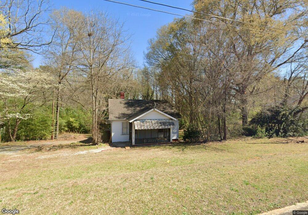
5341 Austell Rd Austell, GA 30106
Estimated Value: $208,000 - $238,970
3
Beds
1
Bath
1,029
Sq Ft
$212/Sq Ft
Est. Value
About This Home
This home is located at 5341 Austell Rd, Austell, GA 30106 and is currently estimated at $218,493, approximately $212 per square foot. 5341 Austell Rd is a home located in Cobb County with nearby schools including Austell Elementary School, Garrett Middle School, and South Cobb High School.
Ownership History
Date
Name
Owned For
Owner Type
Purchase Details
Closed on
Jun 20, 2024
Sold by
Pair & Associates Inc
Bought by
Yassa Medhat
Current Estimated Value
Home Financials for this Owner
Home Financials are based on the most recent Mortgage that was taken out on this home.
Original Mortgage
$300,000
Outstanding Balance
$283,370
Interest Rate
6.38%
Mortgage Type
New Conventional
Estimated Equity
-$64,877
Create a Home Valuation Report for This Property
The Home Valuation Report is an in-depth analysis detailing your home's value as well as a comparison with similar homes in the area
Home Values in the Area
Average Home Value in this Area
Purchase History
| Date | Buyer | Sale Price | Title Company |
|---|---|---|---|
| Yassa Medhat | $200,000 | None Listed On Document |
Source: Public Records
Mortgage History
| Date | Status | Borrower | Loan Amount |
|---|---|---|---|
| Open | Yassa Medhat | $300,000 |
Source: Public Records
Tax History
| Year | Tax Paid | Tax Assessment Tax Assessment Total Assessment is a certain percentage of the fair market value that is determined by local assessors to be the total taxable value of land and additions on the property. | Land | Improvement |
|---|---|---|---|---|
| 2025 | $2,356 | $78,184 | $45,600 | $32,584 |
| 2024 | $2,357 | $78,184 | $45,600 | $32,584 |
| 2023 | $2,182 | $72,364 | $45,600 | $26,764 |
| 2022 | $1,548 | $50,992 | $28,800 | $22,192 |
| 2021 | $1,323 | $43,604 | $24,960 | $18,644 |
| 2020 | $1,149 | $37,844 | $19,200 | $18,644 |
| 2019 | $1,149 | $37,844 | $19,200 | $18,644 |
| 2018 | $898 | $29,604 | $11,040 | $18,564 |
| 2017 | $615 | $21,384 | $7,200 | $14,184 |
| 2016 | $615 | $21,384 | $7,200 | $14,184 |
| 2015 | $585 | $19,860 | $4,800 | $15,060 |
| 2014 | $528 | $17,788 | $0 | $0 |
Source: Public Records
Map
Nearby Homes
- 2093 Gherry Dr
- 2136 Perkerson Mill Rd SW
- 1 Perkerson Mill Rd SW
- 5025 Bishops Row SW
- 1943 Arnold Dr
- 5164 Medford Ln
- 5472 June Dr SW
- 5267 Bullard Ln
- 5474 June Dr SW
- 2232 Warren Dr
- 1841 Mobley St
- 2179 Warren Dr
- 5466 Davis Dr
- 5069 Flint Hill Rd Unit AB
- 5410 Beth Dr
- 0 Clay Rd
- The Norwood II Plan at Sanders Park
- The Greenbrier II Plan at Sanders Park
- The Ellison II Plan at Sanders Park
- The Buford II Plan at Sanders Park
- 5329 Austell Rd
- 5360 Austell Rd
- 5373 Austell Rd
- 5350 Austell Rd
- 5289 Austell Rd
- 5296 Austell Rd
- 5379 Austell Rd
- 2070 Gherry Ct
- 5391 Austell Rd
- 5385 Austell Rd
- 2071 Gherry Ct
- 5388 Austell Rd
- 2060 Gherry Ct
- 2154 Sweetwater Ln
- 2050 Gherry Dr
- 2170 Sweetwater Ln
- 5405 Austell Rd
- 2061 Gherry Ct
- 5390 Austell Rd
- 5350 Birdsong Ln Unit 2