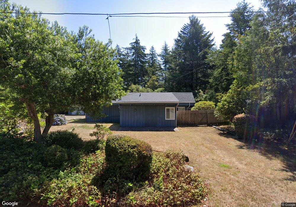
5342 Knoll Way Florence, OR 97439
Estimated Value: $294,000 - $347,000
3
Beds
1
Bath
940
Sq Ft
$341/Sq Ft
Est. Value
About This Home
This home is located at 5342 Knoll Way, Florence, OR 97439 and is currently estimated at $320,784, approximately $341 per square foot. 5342 Knoll Way is a home located in Lane County with nearby schools including Siuslaw Elementary School, Siuslaw Middle School, and Siuslaw High School.
Ownership History
Date
Name
Owned For
Owner Type
Purchase Details
Closed on
Nov 20, 2014
Sold by
Stark Brenda L and Stark Colton
Bought by
Seixas Thomas B
Current Estimated Value
Home Financials for this Owner
Home Financials are based on the most recent Mortgage that was taken out on this home.
Original Mortgage
$83,689
Outstanding Balance
$63,512
Interest Rate
3.75%
Mortgage Type
FHA
Estimated Equity
$257,272
Purchase Details
Closed on
May 12, 2014
Sold by
Harding Kerry J
Bought by
Stark Brenda L and Stark Colton
Create a Home Valuation Report for This Property
The Home Valuation Report is an in-depth analysis detailing your home's value as well as a comparison with similar homes in the area
Home Values in the Area
Average Home Value in this Area
Purchase History
| Date | Buyer | Sale Price | Title Company |
|---|---|---|---|
| Seixas Thomas B | $117,500 | Cascade Title Co | |
| Stark Brenda L | $75,000 | First American Title |
Source: Public Records
Mortgage History
| Date | Status | Borrower | Loan Amount |
|---|---|---|---|
| Open | Seixas Thomas B | $83,689 |
Source: Public Records
Tax History Compared to Growth
Tax History
| Year | Tax Paid | Tax Assessment Tax Assessment Total Assessment is a certain percentage of the fair market value that is determined by local assessors to be the total taxable value of land and additions on the property. | Land | Improvement |
|---|---|---|---|---|
| 2024 | $1,823 | $162,843 | -- | -- |
| 2023 | $1,823 | $158,100 | $0 | $0 |
| 2022 | $1,700 | $153,496 | $0 | $0 |
| 2021 | $1,654 | $149,026 | $0 | $0 |
| 2020 | $1,607 | $144,686 | $0 | $0 |
| 2019 | $1,545 | $140,472 | $0 | $0 |
| 2018 | $1,561 | $132,409 | $0 | $0 |
| 2017 | $1,504 | $132,409 | $0 | $0 |
| 2016 | $1,424 | $128,552 | $0 | $0 |
| 2015 | $1,436 | $124,808 | $0 | $0 |
| 2014 | $1,349 | $118,318 | $0 | $0 |
Source: Public Records
Map
Nearby Homes
- 0 Sand Dune Park Dr Unit TL 800 254608161
- 5509 Mercer Lake Rd
- 5590 S Shore Dr
- 89228 Shore Crest Dr
- 89298 Sutton Lake Dr
- 89311 Sutton Lake Dr
- 89319 Sutton Lake Dr
- 89159 Sutton Lake Rd
- 88921 Bayberry Ln
- 0 Levage Dr Unit 5600 24415074
- 88390 Bellevue Dr
- 89510 Highway 101 Unit 26
- 89510 Highway 101 Unit 20
- 89510 Highway 101 Unit 23
- 89492 Sutton Place
- 0 Bellevue Dr Unit 6 280264605
- 5603 Friendly Acres Rd
- 5938 View Loop
- 0 View Loop Unit 3 526137347
- 0 Tl5900 Bellevue Dr
- 5346 Knoll Way
- 5338 Knoll Way
- 0 Knoll Way
- 5350 Knoll Way
- 5350 Knoll Way Unit 1
- 5334 Knoll Way
- 5345 Knoll Way
- 5435 Bay Berry Dr
- 5337 Knoll Way
- 5349 Knoll Way
- 5381 Bay Berry Dr
- 5355 Knoll Way
- 5398 Sand Dune Park Dr
- 5359 Knoll Way
- 5388 Sand Dune Park Dr
- 5360 Sand Dune Park Dr
- 5439 Bay Berry Dr
- 0 Sand Dune Park Dr Unit 800 24125076
- 0 Sand Dune Park Dr Unit 23279725
- 0 Sand Dune Park Dr Unit TL800 14146144