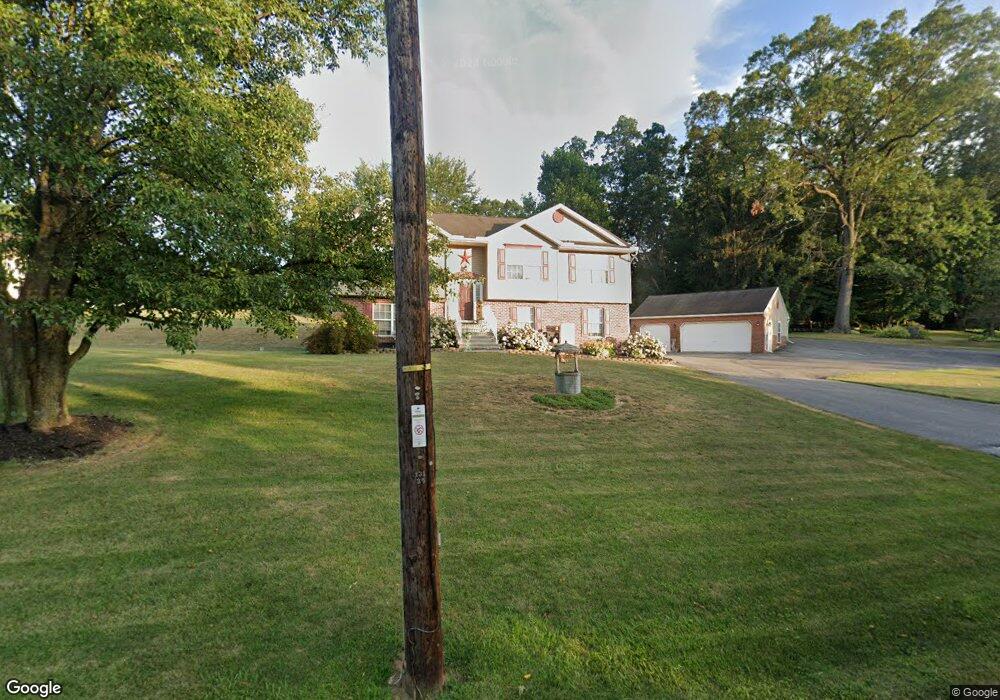
5342 Lehman Rd Spring Grove, PA 17362
Estimated Value: $341,000 - $429,000
3
Beds
3
Baths
2,045
Sq Ft
$186/Sq Ft
Est. Value
About This Home
This home is located at 5342 Lehman Rd, Spring Grove, PA 17362 and is currently estimated at $380,601, approximately $186 per square foot. 5342 Lehman Rd is a home located in York County with nearby schools including Spring Grove Area Middle School, Spring Grove Area High School, and Garbers Mennonite School.
Ownership History
Date
Name
Owned For
Owner Type
Purchase Details
Closed on
Oct 22, 2012
Sold by
Spangler Michael A and Spangler Wanda M
Bought by
Spangler Michael A
Current Estimated Value
Home Financials for this Owner
Home Financials are based on the most recent Mortgage that was taken out on this home.
Original Mortgage
$109,100
Outstanding Balance
$75,156
Interest Rate
3.4%
Mortgage Type
New Conventional
Estimated Equity
$305,445
Purchase Details
Closed on
Dec 2, 1998
Sold by
Stewartstown Cornerstone Development Inc
Bought by
Spangler Michael A and Spangler Wanda M
Home Financials for this Owner
Home Financials are based on the most recent Mortgage that was taken out on this home.
Original Mortgage
$149,700
Interest Rate
6.68%
Create a Home Valuation Report for This Property
The Home Valuation Report is an in-depth analysis detailing your home's value as well as a comparison with similar homes in the area
Home Values in the Area
Average Home Value in this Area
Purchase History
| Date | Buyer | Sale Price | Title Company |
|---|---|---|---|
| Spangler Michael A | -- | None Available | |
| Spangler Michael A | $157,600 | -- |
Source: Public Records
Mortgage History
| Date | Status | Borrower | Loan Amount |
|---|---|---|---|
| Open | Spangler Michael A | $109,100 | |
| Closed | Spangler Michael A | $149,700 |
Source: Public Records
Tax History Compared to Growth
Tax History
| Year | Tax Paid | Tax Assessment Tax Assessment Total Assessment is a certain percentage of the fair market value that is determined by local assessors to be the total taxable value of land and additions on the property. | Land | Improvement |
|---|---|---|---|---|
| 2025 | $5,583 | $167,400 | $31,440 | $135,960 |
| 2024 | $5,523 | $167,400 | $31,440 | $135,960 |
| 2023 | $5,523 | $167,400 | $31,440 | $135,960 |
| 2022 | $5,523 | $167,400 | $31,440 | $135,960 |
| 2021 | $5,284 | $167,400 | $31,440 | $135,960 |
| 2020 | $5,284 | $167,400 | $31,440 | $135,960 |
| 2019 | $5,246 | $167,400 | $31,440 | $135,960 |
| 2018 | $5,177 | $167,400 | $31,440 | $135,960 |
| 2017 | $5,059 | $167,400 | $31,440 | $135,960 |
| 2016 | $0 | $167,400 | $31,440 | $135,960 |
| 2015 | -- | $167,400 | $31,440 | $135,960 |
| 2014 | -- | $167,400 | $31,440 | $135,960 |
Source: Public Records
Map
Nearby Homes
- 1934 Forge Heights Ln
- 2405 Myers Rd
- 46 N Main St
- 1941 Cedar Dr
- 145 N Main St
- 4918 Greenwood Ln
- 156 N Walnut St
- 1495 Jefferson Rd
- Lot # 2 Midhill Rd
- Lot # 1 Midhill Rd
- Lot# 3 Midhill Rd
- 1709 Jefferson Rd
- 2029 Stoverstown Rd
- 540 Monocacy Trail
- St. Michaels Model 5 Monocacy Trail
- 214 Hauer Terrace
- 544 Monocacy Trail
- 568 Monocacy Trail
- 1982 Whyte Ln
- 562 Monocacy Trail
- 5356 Lehman Rd
- 5347 Field Pointe Dr
- 5339 Field Pointe Dr
- 5355 Field Pointe Dr
- 5335 Lehman Rd
- 5355 Lehman Rd
- 5362 Lehman Rd
- 5331 Field Pointe Dr
- 5361 Lehman Rd
- 5338 Field Pointe Dr
- 5330 Field Pointe Dr
- 5361 Field Pointe Dr
- 5344 Field Pointe Dr
- 5323 Lehman Rd
- 5350 Field Pointe Dr
- 5372 Lehman Rd
- 5323 Field Pointe Dr
- 5367 Lehman Rd
- 5356 Field Pointe Dr
- 5367 Field Pointe Dr