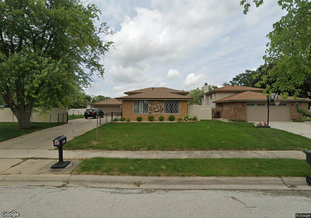
5344 La Palm Ct Oak Forest, IL 60452
Estimated Value: $332,000 - $381,000
4
Beds
2
Baths
1,267
Sq Ft
$277/Sq Ft
Est. Value
About This Home
This home is located at 5344 La Palm Ct, Oak Forest, IL 60452 and is currently estimated at $350,657, approximately $276 per square foot. 5344 La Palm Ct is a home located in Cook County with nearby schools including Kerkstra Elementary School, Jack Hille Middle School, and Oak Forest High School.
Ownership History
Date
Name
Owned For
Owner Type
Purchase Details
Closed on
Jun 23, 2017
Sold by
Kirschling Diane E and Kirschling James
Bought by
Hanna Brian and Hanna Lisa
Current Estimated Value
Home Financials for this Owner
Home Financials are based on the most recent Mortgage that was taken out on this home.
Original Mortgage
$170,400
Interest Rate
3.92%
Mortgage Type
New Conventional
Purchase Details
Closed on
Jul 28, 2014
Sold by
Worley Richard A
Bought by
Worley Diane E
Purchase Details
Closed on
Jan 25, 2007
Sold by
Worley Richard A and Worley Diane E
Bought by
Worley Richard A and Worley Diane E
Purchase Details
Closed on
May 3, 1999
Sold by
Prochnow Robert W and Prochnow Diana L
Bought by
Worley Richard A and Worley Diane E
Home Financials for this Owner
Home Financials are based on the most recent Mortgage that was taken out on this home.
Original Mortgage
$121,500
Interest Rate
7.04%
Create a Home Valuation Report for This Property
The Home Valuation Report is an in-depth analysis detailing your home's value as well as a comparison with similar homes in the area
Home Values in the Area
Average Home Value in this Area
Purchase History
| Date | Buyer | Sale Price | Title Company |
|---|---|---|---|
| Hanna Brian | $213,000 | Chicago Title | |
| Worley Diane E | -- | None Available | |
| Worley Richard A | -- | Ctic He | |
| Worley Richard A | $146,000 | -- |
Source: Public Records
Mortgage History
| Date | Status | Borrower | Loan Amount |
|---|---|---|---|
| Previous Owner | Hanna Brian | $170,400 | |
| Previous Owner | Worley Richard A | $121,500 |
Source: Public Records
Tax History Compared to Growth
Tax History
| Year | Tax Paid | Tax Assessment Tax Assessment Total Assessment is a certain percentage of the fair market value that is determined by local assessors to be the total taxable value of land and additions on the property. | Land | Improvement |
|---|---|---|---|---|
| 2024 | $6,966 | $25,580 | $4,915 | $20,665 |
| 2023 | $6,480 | $25,580 | $4,915 | $20,665 |
| 2022 | $6,480 | $18,855 | $4,369 | $14,486 |
| 2021 | $6,357 | $18,854 | $4,368 | $14,486 |
| 2020 | $6,202 | $18,854 | $4,368 | $14,486 |
| 2019 | $6,249 | $18,944 | $4,095 | $14,849 |
| 2018 | $6,141 | $18,944 | $4,095 | $14,849 |
| 2017 | $6,880 | $20,690 | $4,095 | $16,595 |
| 2016 | $5,422 | $15,694 | $3,822 | $11,872 |
| 2015 | $5,242 | $15,694 | $3,822 | $11,872 |
| 2014 | $5,111 | $15,694 | $3,822 | $11,872 |
| 2013 | $5,644 | $18,798 | $3,822 | $14,976 |
Source: Public Records
Map
Nearby Homes
- 15027 Park Ave
- 15001 Park Ave
- 15100 Crescent Green Dr
- 14825 Parkside Ave
- 5430 Grange Ave
- 5340 Crescent Ln Unit C
- 16207 Long Ave
- 5341 Crescent Ln Unit D
- 5556 Natalie Dr
- 14913 Sheila Ct
- 5218 Laramie Ct
- 5568 Natalie Dr
- 15143 Geoffrey Rd
- 14525 Walden Ct Unit PH4
- 14819 Anne Ct
- 14511 Central Ct Unit M2
- 14515 Central Ct Unit G3
- 14515 Central Ct Unit M3
- 5237 Diamond Dr Unit B
- 15201 Briar Ln
- 5338 La Palm Ct
- 14955 Mission Ave
- 14947 Mission Ave
- 5332 La Palm Ct
- 5337 La Palm Ct
- 14941 Mission Ave
- 15001 Mission Ave
- 5326 La Palm Ct
- 14935 Mission Ave
- 5333 La Palm Ct
- 15007 Mission Ave
- 5324 La Palm Ct
- 5329 La Palm Ct
- 14958 Mission Ave
- 14952 Mission Ave
- 14925 Mission Ave
- 15015 Mission Ave
- 14946 Mission Ave
- 15000 Mission Ave
- 5325 La Palm Ct