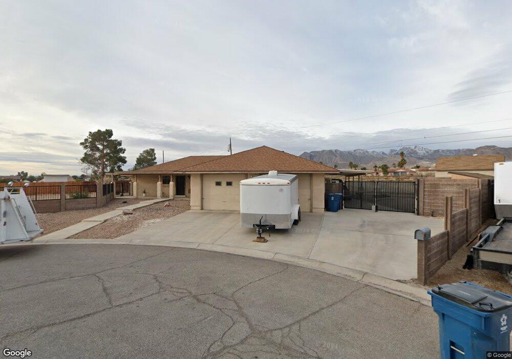
5345 N Fort Apache Rd Las Vegas, NV 89149
La Madre Foothills NeighborhoodEstimated Value: $703,000 - $753,000
3
Beds
2
Baths
2,280
Sq Ft
$317/Sq Ft
Est. Value
About This Home
This home is located at 5345 N Fort Apache Rd, Las Vegas, NV 89149 and is currently estimated at $723,749, approximately $317 per square foot. 5345 N Fort Apache Rd is a home located in Clark County with nearby schools including Dean Lamar Allen Elementary School, Justice Myron E Leavitt Middle School, and Centennial High School.
Ownership History
Date
Name
Owned For
Owner Type
Purchase Details
Closed on
Mar 16, 2004
Sold by
Hardy Charles H
Bought by
Sandager Jerry and Sandager Kathryn
Current Estimated Value
Home Financials for this Owner
Home Financials are based on the most recent Mortgage that was taken out on this home.
Original Mortgage
$180,000
Interest Rate
5.77%
Mortgage Type
Unknown
Create a Home Valuation Report for This Property
The Home Valuation Report is an in-depth analysis detailing your home's value as well as a comparison with similar homes in the area
Home Values in the Area
Average Home Value in this Area
Purchase History
| Date | Buyer | Sale Price | Title Company |
|---|---|---|---|
| Sandager Jerry | $360,000 | First American Title Co Of |
Source: Public Records
Mortgage History
| Date | Status | Borrower | Loan Amount |
|---|---|---|---|
| Previous Owner | Sandager Jerry | $180,000 | |
| Closed | Sandager Jerry | $108,000 |
Source: Public Records
Tax History Compared to Growth
Tax History
| Year | Tax Paid | Tax Assessment Tax Assessment Total Assessment is a certain percentage of the fair market value that is determined by local assessors to be the total taxable value of land and additions on the property. | Land | Improvement |
|---|---|---|---|---|
| 2025 | $3,022 | $170,930 | $105,000 | $65,930 |
| 2024 | $2,799 | $170,930 | $105,000 | $65,930 |
| 2023 | $2,799 | $149,204 | $85,750 | $63,454 |
| 2022 | $2,592 | $128,539 | $70,000 | $58,539 |
| 2021 | $2,400 | $117,404 | $61,250 | $56,154 |
| 2020 | $2,226 | $117,370 | $61,250 | $56,120 |
| 2019 | $2,086 | $116,898 | $61,250 | $55,648 |
| 2018 | $1,990 | $103,133 | $49,000 | $54,133 |
| 2017 | $2,655 | $97,395 | $42,000 | $55,395 |
| 2016 | $1,864 | $87,332 | $31,500 | $55,832 |
| 2015 | $1,860 | $72,925 | $17,500 | $55,425 |
| 2014 | $1,805 | $71,288 | $17,500 | $53,788 |
Source: Public Records
Map
Nearby Homes
- 5315 N Fort Apache Rd
- 0 Dapple Gray Rd
- 5309 N Chieftain St
- 9340 W Washburn Rd
- 9180 W Hammer Ln
- 3336 Plan at Homestead West
- 3704 Plan at Homestead West
- Primrose Plan at Crestwood Ranch
- Mesquite Plan at Crestwood Ranch
- 9428 New Discovery Ave
- Kathryn NextGen w/RV Plan at The Estates - Ann
- Leighton NextGen w/RV Plan at The Estates - El Capitan
- Ganon NextGen w/RV Plan at The Estates - Ann
- Ganon NextGen w/RV Plan at The Estates - El Capitan
- Leighton NextGen w/RV Plan at The Estates - Ann
- Kathryn NextGen w/RV Plan at The Estates - El Capitan
- 5515 N Campbell Rd
- 5630 Searching Bear Ct
- 11127 Rolling Vista Dr
- 5650 Searching Bear Ct
- 5335 N Fort Apache Rd
- 5355 N Fort Apache Rd
- 5365 N Fort Apache Rd
- 5385 N Fort Apache Rd
- 9180 W Fisher Ave
- 9540 Ponderay Ct
- 9520 Ponderay Ct
- 9585 Ponderay Ct
- 9560 Ponderay Ct
- 9580 Ponderay Ct
- 9525 N Park St
- 9545 Ponderay Ct
- 9190 W Fisher Ave
- 5280 N Chieftain St
- 0 W Fisher Ave
- 9170 W Fisher Ave
- 9315 W Hammer Ln
- 9160 W Fisher Ave
- 9185 W Fisher Ave
- 5266 N Chieftain St